Select units of measurement for the temperature and rainfall tables (metric or imperial).
Average weather, temperature, rainfall, sunshine
In Italy, a southern European country overlooking the Mediterranean Sea, there are
different types of climate, given the extension from north to south, the presence of mountain ranges, and the different slope exposure.
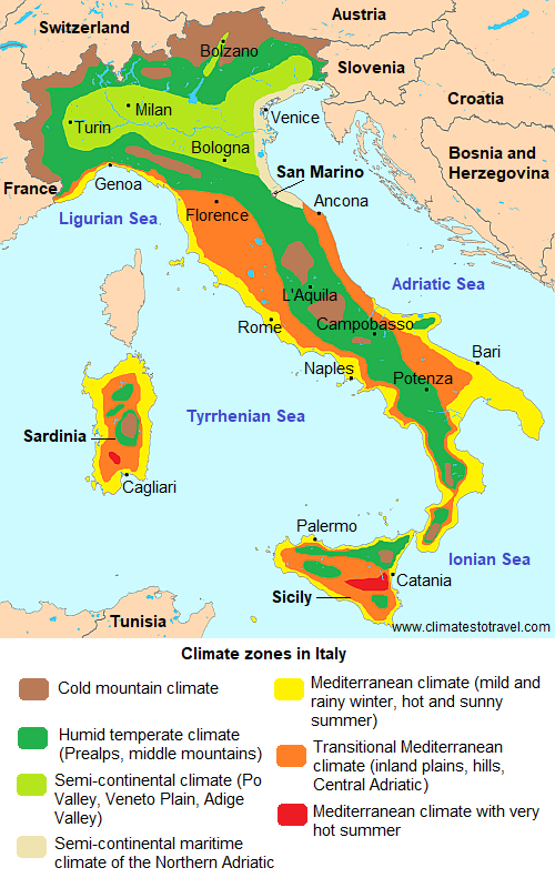
In short, in Italy there are the following climates:
-
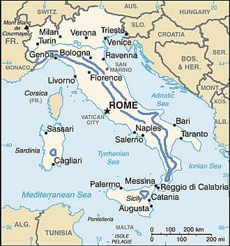
cold mountain climate in the Alps and the highest peaks of the Apennines,
-
humid temperate climate in the Prealps and the Apennines at intermediate altitudes,
-
moderately continental climate in the Po Valley and the Veneto Plain (with slightly attenuated characteristics on the coasts of the Northern Adriatic Sea),
-
Mediterranean climate, with mild, rainy winters and hot, sunny summers, on the coasts of Liguria, of the Tyrrhenian Sea, the islands and the southern Adriatic (similar but a little less mild in hilly areas, in the inland plains and on the coast of the central Adriatic, similar but with very hot summers in the inland plains of Sicily and Sardinia).
In the following map, we can see the
climate zones in Italy.
 Precipitation
 in Italy is generally moderate to relatively abundant, but there are also very rainy areas and quite arid ones. Typically, precipitation is between 650 and 1,300 millimeters (26 and 51 inches) per year in the central-northern plains, while in the south it ranges from 400 mm (15.5 in) per year in the driest areas of Sardinia and Puglia, to about 1,000 mm (40 in) on the western slopes of Campania and Calabria.
The mountainous areas are generally more humid, and in upper Tuscany and in the north-east it can exceed 2,500 mm (98 in) a year.
Autumn in Italy is the rainiest season, and floods can sometimes occur in October and November.
July and August are the warmest months, with daytime temperatures around 30/33 °C (86/91 °F) in the plains and along the coasts, and the weather is generally good, except in the Alps, where thunderstorms in the afternoon are quite frequent.
Italy is a
sunny country in the centre-south, where generally more than 2,500 hours of sunshine are recorded per year, while in the north, the amount of sunshine is moderate: there are around 1,800 hours of sunshine per year at the foot of the Alps, and about 2,000 hours in the Po valley.
Although the westerly currents generally prevail, in winter there can be
irruptions of cold air from Eastern Europe, with temperatures around freezing or even below, especially in the eastern part of the country.
In summer, in return, the hot wind from Africa can bring
very hot periods, with highs of 37/38 °C (99/100 °F) and more, especially in inland areas and in the south.
The climate in detail
Po Valley
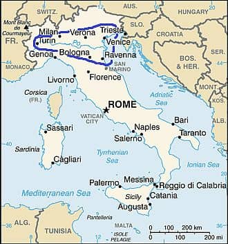
In northern Italy, the Po-Venetian plain has a
moderately continental climate. Winters, from December to February, are quite cold, the sky is often cloudy and sometimes fog can form, especially in the western part. Summers, from June to August, are hot and muggy, and sometimes thunderstorms can break out in the afternoon and in the evening, especially in the part to the north of the Po and closer to the Alps.
Relative
humidity is high throughout the year, and the wind is normally weak, especially in the west-central part: being closed on three sides, the Po valley is one of the least windy areas in the world.
Precipitation in the Po Valley is moderate, between 650 and 1,000 millimeters (25 to 40 inches) per year, typically, with two maxima in spring and autumn and two relative minima in winter and in summer.
The Alps protect northern Italy from
cold winds: the northerly wind can sweep away the blanket of mist and fog, but since it descends from mountain slopes, it is heated by compression and takes on the form of
Föhn, a dry and relatively warm wind, which blows even more often in the Alpine valleys. Therefore, cold waves in northern Italy come from eastern Europe. In these cases, sometimes it can even snow, especially in the western part and in Emilia-Romagna.
In
Milan, Lombardy, in the central-western part of the plain, the monthly average temperature ranges from 3.5 °C (38 °F) in January to 25 °C (77 °F) in July. In winter, the temperature is a bit milder than in the surrounding areas due to the city's heat island.
Milan is located in the rainiest part, i.e. the one north of the Po river and not far from the Alps, and receives 945 mm (37 in) of rain per year.

At the northern border of the plain and at the foot of the Pre-Alps, the shores of the
lakes (Maggiore, Como, and
Garda) are slightly milder and less foggy in winter, while in summer the heat is less intense and quite often broken by thunderstorms.
The amount of rainfall is high especially in the lakes of the north-west: in
Como, where the average in January is 4 °C (39 °F), 1,300 mm (51 in) of rain fall per year, with two maxima in May of 160 millimeters (6.3 in) and in August of 135 mm (5.3 in); autumn is rainy as well, and sometimes heavy rains can raise the level of the lake.
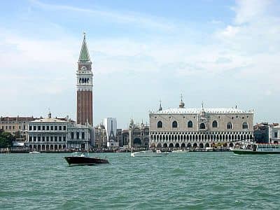
On the coast, in Veneto and Romagna, the climate is a little milder, but also windier, since both the cold wind from the north-east, the Bora, and the warm wind from the south- east, the Sirocco, can blow.
In
Venice, the temperature fluctuates between 4 °C (39 °F) in January and 24 °C (75 °F) in July. Rainfall is lower than in Milan, and amounts to 750 mm (29.5 in) per year.
In the Northern Adriatic
Sea, the water temperature becomes pleasantly warm for swimming in summer, especially in July and August, although being a small and shallow sea, it may experience remarkable changes depending on weather condition.
Alps and high mountains
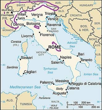
The Alpine Chain, which stretches from west to east separating Italy from central Europe, has a
mountain climate, cold and snowy in winter and mild in summer, when thunderstorms frequently break out. There are many winter sports resorts. In the highest peaks such as Mont Blanc, 4,810 meters (15,781 feet), Monte Rosa, and Matterhorn, there are also glaciers. In Italy, the
snowline is a bit higher than on the northern side of the Alps, and is around 3,000 meters (9,800 ft).
In general, the west-central part of the Alps, exposed to southern winds, receives the bulk of the snow in late autumn and early winter, while the eastern part is more exposed to northern currents, so it receives most of the snow in winter and early spring.
In the weather station of
Plateau Rosa, at 3,500 meters (11,500 ft), on the slopes of Monte Rosa, Aosta Valley, where you can do summer skiing, the average is between -11 °C (12 °F) in February and 3 °C (37.5 °F) in July.
In the mountain resorts, located above 1,000 metres (3,300 feet), winter is cold, while summer is very mild, with some hot days, and possible thunderstorms in the afternoon and in the evening.
In
Dobbiaco - Toblach (region of Alto Adige or Südtirol), located at 1,200 meters (3,900 feet) above sea level, in the Dolomites, the temperature fluctuates between -3.5 °C (25.5 °F) in January and 17 °C (62.5 °F) in July.
In valleys at the foot of the mountains, at low altitude (see
Aosta,
Trento,
Bolzano), the climate is moderately continental, with cold winters, with an average in January around freezing, and hot summers, when, however, there's a lower humidity compared with the Po valley, and nights are cool. In winter, it can snow, while from May to August, thunderstorms in the afternoon are fairly frequent.
Mediterranean climate
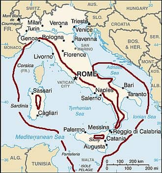
The climate for which Italy is famous, that is, mild and sunny, is actually found only in coastal and lowland areas of the center-south and on the coast of Liguria in the north-west. The Mediterranean climate is characterized by
mild, rainy winters and hot, sunny summers, a bit muggy but also tempered by the breeze. Autumn is often rainy, especially from late September or October onwards.
At a given latitude, the Tyrrhenian coast is slightly warmer than the Adriatic coast.
Ligurian Riviera
In the northwest, the
Ligurian Riviera has a mild climate, especially in the western part, although it is rainy in autumn and winter.
In
Sanremo, located on the western coast, the average goes from 10.5 °C (51 °F) in January to 24.5 °C (76 °F) in August.
In
Genoa, the temperature is similar in summer but it is a bit lower in winter, around 9 °C (48 °F) in January. Rainfall follows the Mediterranean pattern, with a maximum in autumn and winter and a minimum in summer. Throughout the year, 1,080 mm (42.5 in) of rain fall, with a maximum in autumn, of 170 mm (6.7 in) in October.
In the capital,
Rome, the average temperature ranges from 7.5 °C (44.5 °F) in January to 25.5 °C (78 °F) in August. Owing to the influence of the sea and the breezes that blow in the afternoon, the districts near the sea are a bit milder in winter and cooler in summer. The air is quite humid all year round.
In winter, rainy and cloudy days alternate with sunny days. The north wind, called
Tramontana, blows at times, bringing sunny days but also cold nights, with some slight frosts. Summer is hot and sunny, with occasional thunderstorms in the afternoon. Highs in July and August are around 30/32 °C (86/90 °F), but sometimes they can exceed 35 °C (95 °F). Owing to the urban heat island effect, during the summer months, the heat is more intense in the city center.
Throughout the year, about 750 mm (29.5 in) of rain fall; the wettest season is autumn, followed by winter. The first part of spring, until April or early May, may have moderate rains as well. In Rome, the summer drought is most evident than in the Ligurian Riviera.
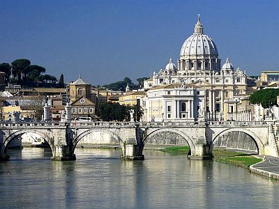
Southern Italy
In southern Italy, at low altitudes, the climate is generally even milder in winter, although there are differences depending on the exposure of the slopes.
Sardinia and the western part of
Sicily are exposed to the
Maestrale, a cool, dry northwest wind, which blows especially in winter and spring, and can cause sea storms.
In the east,
Apulia is exposed to
cold winds from the Balkan peninsula, although cold periods are becoming rarer due to global warming. In the southern part of Puglia we find the
Salento peninsula.
Precipitation is equal to or greater than 1,000 mm (40 in) per year on the coast of
Campania, while it is generally lower than 600 mm (23.5 in) per year elsewhere. Summer is the driest season, and it doesn't rain for long periods.
Southern Italy is sometimes affected by the
Scirocco, a dry and warm wind blowing from Africa, which can bring dust or even sand in the southernmost regions. When this wind is not too strong, it has the time to pick up moisture from the sea and to become quite humid. The Scirocco is more frequent in spring and autumn, but it may blow in all seasons, and can raise the temperature above 20 °C (68 °F) in winter in the south, while in late spring and summer, it brings heatwaves, with peaks of 40 °C (104 °F) and sometimes even above, especially in Sicily and Apulia.
In
Naples, the climate is similar to that of Rome, but given its position more to the south and directly on the coast, it is milder, and also a little more rainy in autumn and winter.
South of Naples, along the Tyrrhenian coast, the climate is typically Mediterranean, in fact the average in January exceeds 10 °C (50 °F).
In
Palermo, located on the north coast of Sicily, the average temperature ranges from 12.5 °C (54.5 °F) in January to 27 °C (80.5 °F) in August. The city is exposed not only to the warm southern wind called
Scirocco (Sirocco), which brings intense heat in late spring and summer, but also to the north-westerly wind called Maestrale, which brings cool weather and a bit of rain. In Palermo, as in the rest of the Sicilian coasts, frosts never occur.
Rainfall amounts to 600 mm (24 in) per year, with little or no rain in summer.
The temperature of the
sea in Sicily, as generally happens in southern Italy, is warm enough for swimming in summer, with a peak in August.
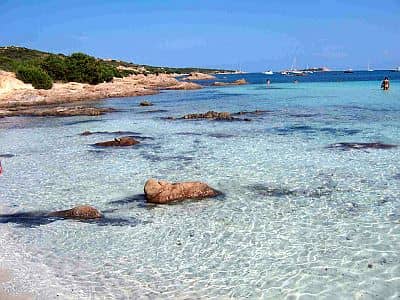
The southernmost islands (
Pantelleria,
Lampedusa) are very mild in winter, when it never freezes nor snows, but they are windy and sometimes rainy. Summer is hot and sunny, but tempered by sea breezes, and longer than elsewhere.
Central Italy

In central Italy, in Umbria, in the inland areas of Tuscany and Lazio, but also on the coast of Marche, the climate is transitional, a little too cold in winter to be considered as Mediterranean.
In
Florence, the average January temperature is 6.5 °C (43.5 °F), and sometimes at night it drops below freezing. Summer is hot, sometimes scorching during the day, when the temperature can sometimes reach 36/38 °C (97/100 °F), even though the air is not too humid and nights are usually cool.
The rainiest season is autumn, while summer is the driest season, as is often the case in Italy.
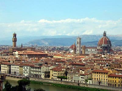
The other cities of
Tuscany have generally a mild climate; winters are a bit cold above 300 meters (1,000 feet), while summers are hot and sunny but tempered by the breeze, except in some sheltered valleys, which can be very hot. Snow, though rare, is not unheard of in winter, from December to February.
The region of
Marche is a bit milder than Tuscany in summer, while in winter it is exposed to cold air masses from the Balkan Peninsula, with possible snow on inland hills and sometimes even on the coast.
In
Umbria, the north wind (
Tramontana) often blows in winter.
Apennines
The Apennine Range is stretched along the Italian peninsula from Liguria, where it separates the mild Riviera from the more continental Po Valley, to the southern tip of Calabria.
In the cities located in the Apennines, in central and southern Italy, in the regions of Abruzzo, Molise, Campania, Basilicata and Calabria, the climate is
moderately continental, with cold winters, sometimes snowy, and warm and sunny summers, during which there's some chance of thunderstorms in the afternoon.
In
L'Aquila, in the central region of Abruzzo, 700 meters (2,300 feet) above sea level, the average temperature ranges from 3.5 °C (38 °F) in January to 22 °C (71.5 °F) in July. During winter, it can snow and freeze, and the temperature can drop to -10/-15 °C (5/14 °F), while in summer, the
Scirocco can sometimes raise the temperature up to 35 °C (95 °F).
Throughout the year, 700 mm (27.5 in) of rain fall, with a maximum in autumn and a minimum in summer.
Above 1,000 meters (3,300 feet), the climate gets colder, and during winter there can be heavy snowfalls. In Mount
Terminillo, located in the central Apennines, whose summit is at 2,217 meters (7,274 feet), though the weather station is located at 1,875 meters (6,150 feet), the temperature fluctuates between -1.5 °C (29 °F) in January and 15.5 °C (59.5 °F) in August.
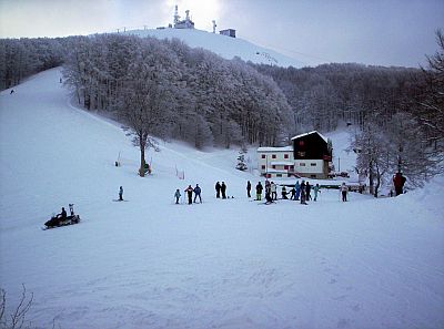
In Sardinia, in the massif of Gennargentu, at high altitudes the climate is similar to that of the Apennines as well.
In the mountains of Sicily, at equal altitude, the climate is milder. The cities located at 1,000 meters (3,300 feet) are a bit foggy and windy in winter (see Enna). However, on the highest peaks, such as Mount Etna, which is the highest volcano in Europe with its 3,343 meters (10,968 feet), snow often falls in winter.
When to go
The best time to visit the main Italian cities is the
spring: from mid-April to late May, temperatures are pleasant, the days are quite long, the sun often shines and nature is in bloom, though sometimes it can rain. In early spring, from March to mid-April, the weather can be sunny and mild, but also cold and wet: it's a fairly unstable period.
Another good period is
the beginning of autumn, in the first half of September. Between mid-September and mid-October, the temperatures are pleasantly warm, but it can rain, especially in the north and center of the country. November is typically a rainy month throughout Italy, even though the sun still shines quite often in the south.
Summer, from June to August, is often sunny, but it can be very hot, especially in July and August. However, visitors flock to cities like Rome and Florence even in this period. In any case, it is better to warn those who don't like the heat.
July and August are the best months for a
beach holiday in northern and central Italy, and also September in the south. In June, the weather is often nice and the days are the longest of the year, but as mentioned, the sea can still be a bit cool.
Summer is a good period to visit the
Alpine area and to go hiking in the mountains.
In February and the first half of March, there is almost always enough snow for a
ski holiday, and the days are longer than in December.
What to pack
In
winter: in Milan, the Po Valley and the Apennines: bring warm clothes, such as a sweater, a down jacket, a hat, gloves, a scarf, and a raincoat or umbrella. In the center, in Florence and Rome: bring warm clothes, such as a sweater, a coat, and a raincoat or umbrella. In Palermo and the Sicilian coast: clothes for spring and autumn, a sweater, a jacket and a raincoat. In the Alps: bring mountain clothing.
In
summer: in the north, Milan and Venice: bring light clothing, a T-shirt, a sweatshirt or sweater, a light jacket, and a raincoat or umbrella. In the center, in Florence and Rome: bring light clothing, a sun hat, a sweatshirt for cool evenings especially in June, and possibly an umbrella. In the south, light clothing, a sun hat, a sweatshirt for the evening especially in June.
In the mountains, bring a sweater, a jacket, hiking shoes, a raincoat, sunscreen and sunglasses.
Climate data - Italy
| Ancona |
|---|
Ancona, location on the map |
|---|
| Jan | Feb | Mar | Apr | May | Jun | Jul | Aug | Sep | Oct | Nov | Dec |
|---|
| Min temp. | 2 | 2 | 5 | 8 | 12 | 16 | 19 | 19 | 15 | 11 | 7 | 3 |
|---|
| Max temp. | 10 | 11 | 14 | 18 | 22 | 27 | 29 | 29 | 25 | 20 | 15 | 11 |
|---|
| Precip. | 45 | 50 | 55 | 60 | 55 | 60 | 45 | 75 | 75 | 75 | 85 | 60 |
|---|
| Prec. days | 7 | 7 | 8 | 8 | 7 | 6 | 4 | 5 | 7 | 8 | 9 | 7 |
|---|
| Humidity | 78% | 74% | 71% | 72% | 70% | 67% | 65% | 67% | 72% | 78% | 81% | 80% |
|---|
| Day length | 9 | 10 | 12 | 14 | 15 | 15 | 15 | 14 | 12 | 11 | 10 | 9 |
|---|
| Sun hours | 3 | 3 | 5 | 6 | 8 | 9 | 10 | 10 | 8 | 5 | 3 | 2 |
|---|
| Sea temp | 13 | 12 | 12 | 14 | 18 | 22 | 25 | 25 | 23 | 20 | 17 | 15 |
|---|
| Bari |
|---|
Bari, location on the map |
|---|
| Jan | Feb | Mar | Apr | May | Jun | Jul | Aug | Sep | Oct | Nov | Dec |
|---|
| Min temp. | 4 | 4 | 6 | 9 | 13 | 17 | 20 | 20 | 17 | 13 | 9 | 6 |
|---|
| Max temp. | 13 | 13 | 16 | 19 | 24 | 28 | 30 | 31 | 26 | 22 | 18 | 14 |
|---|
| Precip. | 55 | 65 | 40 | 40 | 35 | 25 | 25 | 30 | 60 | 60 | 75 | 55 |
|---|
| Prec. days | 7 | 8 | 7 | 6 | 5 | 4 | 3 | 4 | 5 | 6 | 8 | 7 |
|---|
| Humidity | 74% | 71% | 70% | 69% | 66% | 62% | 60% | 63% | 69% | 75% | 77% | 76% |
|---|
| Day length | 10 | 11 | 12 | 13 | 14 | 15 | 15 | 14 | 12 | 11 | 10 | 9 |
|---|
| Sun hours | 4 | 5 | 6 | 7 | 9 | 10 | 12 | 10 | 9 | 7 | 5 | 4 |
|---|
| Sea temp | 14 | 14 | 14 | 15 | 18 | 22 | 25 | 26 | 24 | 20 | 17 | 15 |
|---|
| Bologna |
|---|
Bologna, location on the map |
|---|
| Jan | Feb | Mar | Apr | May | Jun | Jul | Aug | Sep | Oct | Nov | Dec |
|---|
| Min temp. | 0 | 1 | 4 | 8 | 13 | 17 | 19 | 19 | 15 | 11 | 6 | 1 |
|---|
| Max temp. | 7 | 10 | 15 | 19 | 24 | 29 | 31 | 31 | 26 | 19 | 13 | 8 |
|---|
| Precip. | 35 | 45 | 55 | 75 | 60 | 55 | 40 | 50 | 65 | 70 | 70 | 50 |
|---|
| Prec. days | 6 | 6 | 7 | 8 | 8 | 6 | 4 | 5 | 5 | 7 | 6 | 6 |
|---|
| Humidity | 81% | 74% | 67% | 67% | 64% | 61% | 58% | 60% | 66% | 78% | 83% | 83% |
|---|
| Day length | 9 | 10 | 12 | 14 | 15 | 16 | 15 | 14 | 12 | 11 | 10 | 9 |
|---|
| Sun hours | 2 | 3 | 5 | 6 | 7 | 8 | 9 | 8 | 7 | 5 | 3 | 2 |
|---|
|
| Bolzano (250 meters) |
|---|
Bolzano, location on the map |
|---|
| Jan | Feb | Mar | Apr | May | Jun | Jul | Aug | Sep | Oct | Nov | Dec |
|---|
| Min temp. | -3 | -1 | 3 | 7 | 11 | 15 | 17 | 17 | 12 | 8 | 2 | -3 |
|---|
| Max temp. | 7 | 10 | 16 | 20 | 24 | 28 | 30 | 29 | 24 | 18 | 12 | 7 |
|---|
| Precip. | 25 | 25 | 35 | 50 | 75 | 85 | 90 | 85 | 70 | 85 | 50 | 35 |
|---|
| Prec. days | 4 | 3 | 5 | 7 | 9 | 9 | 9 | 8 | 7 | 7 | 5 | 4 |
|---|
| Humidity | 67% | 57% | 51% | 54% | 56% | 57% | 57% | 60% | 64% | 73% | 74% | 71% |
|---|
| Day length | 9 | 10 | 12 | 14 | 15 | 16 | 15 | 14 | 12 | 11 | 9 | 9 |
|---|
| Sun hours | 3 | 4 | 5 | 5 | 6 | 7 | 8 | 7 | 6 | 5 | 3 | 3 |
|---|
|
| Brindisi |
|---|
Brindisi, location on the map |
|---|
| Jan | Feb | Mar | Apr | May | Jun | Jul | Aug | Sep | Oct | Nov | Dec |
|---|
| Min temp. | 7 | 7 | 9 | 11 | 15 | 19 | 22 | 22 | 19 | 15 | 11 | 8 |
|---|
| Max temp. | 13 | 13 | 16 | 19 | 23 | 27 | 30 | 30 | 26 | 22 | 18 | 14 |
|---|
| Precip. | 65 | 60 | 65 | 50 | 25 | 15 | 10 | 20 | 60 | 75 | 80 | 80 |
|---|
| Prec. days | 8 | 7 | 7 | 6 | 4 | 2 | 1 | 2 | 5 | 6 | 7 | 9 |
|---|
| Humidity | 78% | 78% | 77% | 77% | 76% | 73% | 73% | 74% | 74% | 78% | 80% | 79% |
|---|
| Day length | 10 | 11 | 12 | 13 | 14 | 15 | 15 | 14 | 12 | 11 | 10 | 9 |
|---|
| Sun hours | 4 | 5 | 6 | 7 | 9 | 10 | 11 | 10 | 8 | 6 | 5 | 4 |
|---|
| Sea temp | 14 | 14 | 14 | 15 | 18 | 22 | 25 | 26 | 24 | 21 | 18 | 16 |
|---|
| Cagliari |
|---|
Cagliari, location on the map |
|---|
| Jan | Feb | Mar | Apr | May | Jun | Jul | Aug | Sep | Oct | Nov | Dec |
|---|
| Min temp. | 6 | 5 | 7 | 10 | 13 | 17 | 20 | 20 | 18 | 14 | 10 | 7 |
|---|
| Max temp. | 15 | 15 | 17 | 20 | 24 | 29 | 32 | 32 | 28 | 24 | 19 | 16 |
|---|
| Precip. | 45 | 55 | 45 | 35 | 25 | 10 | 5 | 10 | 30 | 55 | 55 | 55 |
|---|
| Prec. days | 8 | 8 | 7 | 6 | 4 | 2 | 1 | 1 | 4 | 6 | 8 | 8 |
|---|
| Humidity | 81% | 77% | 75% | 72% | 69% | 63% | 62% | 65% | 70% | 76% | 80% | 82% |
|---|
| Day length | 10 | 11 | 12 | 13 | 14 | 15 | 15 | 14 | 12 | 11 | 10 | 10 |
|---|
| Sun hours | 5 | 6 | 7 | 7 | 9 | 10 | 11 | 10 | 8 | 7 | 5 | 4 |
|---|
| Sea temp | 15 | 14 | 14 | 15 | 18 | 21 | 24 | 26 | 24 | 22 | 19 | 16 |
|---|
| Catania |
|---|
Catania, location on the map |
|---|
| Jan | Feb | Mar | Apr | May | Jun | Jul | Aug | Sep | Oct | Nov | Dec |
|---|
| Min temp. | 5 | 5 | 6 | 9 | 12 | 16 | 19 | 20 | 18 | 14 | 10 | 7 |
|---|
| Max temp. | 16 | 16 | 18 | 21 | 25 | 29 | 32 | 32 | 29 | 25 | 21 | 17 |
|---|
| Precip. | 75 | 55 | 45 | 35 | 20 | 5 | 5 | 10 | 45 | 105 | 65 | 85 |
|---|
| Prec. days | 8 | 7 | 6 | 5 | 3 | 1 | 1 | 2 | 3 | 7 | 5 | 8 |
|---|
| Humidity | 75% | 72% | 72% | 71% | 67% | 64% | 62% | 65% | 69% | 75% | 77% | 75% |
|---|
| Day length | 10 | 11 | 12 | 13 | 14 | 15 | 14 | 14 | 12 | 11 | 10 | 10 |
|---|
| Sun hours | 5 | 6 | 6 | 8 | 9 | 10 | 11 | 10 | 9 | 7 | 6 | 5 |
|---|
| Sea temp | 16 | 15 | 15 | 16 | 19 | 22 | 26 | 27 | 26 | 23 | 20 | 17 |
|---|
| Dobbiaco (1,200 meters) |
|---|
|
| Jan | Feb | Mar | Apr | May | Jun | Jul | Aug | Sep | Oct | Nov | Dec |
|---|
| Min temp. | -8 | -7 | -3 | 1 | 5 | 9 | 11 | 11 | 7 | 3 | -2 | -6 |
|---|
| Max temp. | 1 | 3 | 8 | 12 | 16 | 21 | 23 | 22 | 17 | 12 | 6 | 1 |
|---|
| Precip. | 25 | 20 | 35 | 55 | 75 | 100 | 120 | 115 | 80 | 80 | 75 | 40 |
|---|
| Prec. days | 4 | 4 | 5 | 8 | 11 | 12 | 12 | 12 | 8 | 8 | 7 | 5 |
|---|
|
|
| Sun hours | 4 | 5 | 5 | 5 | 6 | 6 | 7 | 7 | 6 | 6 | 4 | 4 |
|---|
|
| Florence |
|---|
Florence, location on the map |
|---|
| Jan | Feb | Mar | Apr | May | Jun | Jul | Aug | Sep | Oct | Nov | Dec |
|---|
| Min temp. | 2 | 3 | 5 | 8 | 12 | 16 | 19 | 19 | 15 | 11 | 7 | 3 |
|---|
| Max temp. | 11 | 13 | 16 | 20 | 25 | 29 | 32 | 33 | 27 | 22 | 16 | 11 |
|---|
| Precip. | 60 | 65 | 65 | 85 | 70 | 55 | 35 | 55 | 80 | 105 | 115 | 80 |
|---|
| Prec. days | 8 | 7 | 8 | 10 | 8 | 6 | 4 | 5 | 6 | 9 | 9 | 8 |
|---|
| Humidity | 73% | 67% | 64% | 64% | 63% | 60% | 56% | 57% | 63% | 72% | 77% | 76% |
|---|
| Day length | 9 | 10 | 12 | 14 | 15 | 15 | 15 | 14 | 12 | 11 | 10 | 9 |
|---|
| Sun hours | 4 | 5 | 5 | 7 | 8 | 10 | 11 | 10 | 7 | 6 | 3 | 3 |
|---|
|
| Genoa |
|---|
Genoa, location on the map |
|---|
| Jan | Feb | Mar | Apr | May | Jun | Jul | Aug | Sep | Oct | Nov | Dec |
|---|
| Min temp. | 6 | 7 | 9 | 11 | 15 | 19 | 22 | 22 | 18 | 15 | 10 | 7 |
|---|
| Max temp. | 12 | 13 | 15 | 18 | 22 | 25 | 28 | 28 | 25 | 21 | 16 | 13 |
|---|
| Precip. | 100 | 75 | 80 | 90 | 70 | 60 | 25 | 70 | 135 | 170 | 110 | 95 |
|---|
| Prec. days | 8 | 6 | 7 | 8 | 7 | 5 | 3 | 5 | 6 | 8 | 7 | 7 |
|---|
| Humidity | 63% | 62% | 65% | 69% | 71% | 73% | 71% | 71% | 67% | 69% | 67% | 62% |
|---|
| Day length | 9 | 10 | 12 | 14 | 15 | 16 | 15 | 14 | 12 | 11 | 10 | 9 |
|---|
| Sun hours | 4 | 4 | 5 | 6 | 7 | 8 | 10 | 9 | 7 | 6 | 4 | 4 |
|---|
| Sea temp | 13 | 13 | 13 | 15 | 18 | 21 | 24 | 25 | 22 | 20 | 17 | 15 |
|---|
| L Aquila (700 meters) |
|---|
L Aquila, location on the map |
|---|
| Jan | Feb | Mar | Apr | May | Jun | Jul | Aug | Sep | Oct | Nov | Dec |
|---|
| Min temp. | -1 | -1 | 2 | 4 | 8 | 12 | 14 | 14 | 10 | 7 | 3 | 0 |
|---|
| Max temp. | 8 | 10 | 14 | 17 | 22 | 27 | 30 | 30 | 24 | 19 | 13 | 8 |
|---|
| Precip. | 65 | 65 | 50 | 55 | 50 | 45 | 35 | 40 | 55 | 65 | 90 | 85 |
|---|
| Prec. days | 8 | 8 | 8 | 9 | 8 | 6 | 5 | 5 | 6 | 8 | 10 | 10 |
|---|
|
|
|
|
| Lampedusa |
|---|
Lampedusa, location on the map |
|---|
| Jan | Feb | Mar | Apr | May | Jun | Jul | Aug | Sep | Oct | Nov | Dec |
|---|
| Min temp. | 13 | 12 | 13 | 15 | 17 | 21 | 24 | 25 | 24 | 21 | 17 | 14 |
|---|
| Max temp. | 16 | 15 | 17 | 19 | 22 | 26 | 28 | 30 | 28 | 25 | 21 | 17 |
|---|
| Precip. | 45 | 30 | 25 | 20 | 5 | 0 | 0 | 5 | 15 | 60 | 70 | 50 |
|---|
| Prec. days | 7 | 5 | 4 | 3 | 1 | 1 | 0 | 0 | 2 | 6 | 6 | 7 |
|---|
| Humidity | 72% | 72% | 76% | 77% | 77% | 77% | 76% | 76% | 74% | 75% | 73% | 71% |
|---|
| Day length | 10 | 11 | 12 | 13 | 14 | 14 | 14 | 13 | 12 | 11 | 10 | 10 |
|---|
|
| Sea temp | 16 | 15 | 15 | 16 | 18 | 22 | 25 | 26 | 26 | 24 | 21 | 18 |
|---|
| Milan |
|---|
Milan, location on the map |
|---|
| Jan | Feb | Mar | Apr | May | Jun | Jul | Aug | Sep | Oct | Nov | Dec |
|---|
| Min temp. | 0 | 1 | 5 | 8 | 13 | 17 | 19 | 19 | 15 | 10 | 5 | 1 |
|---|
| Max temp. | 7 | 10 | 16 | 19 | 24 | 28 | 31 | 30 | 25 | 19 | 12 | 8 |
|---|
| Precip. | 65 | 65 | 80 | 80 | 95 | 65 | 70 | 95 | 70 | 100 | 100 | 60 |
|---|
| Prec. days | 7 | 7 | 8 | 8 | 8 | 8 | 6 | 7 | 5 | 7 | 9 | 6 |
|---|
| Humidity | 81% | 75% | 68% | 67% | 65% | 64% | 63% | 66% | 70% | 79% | 84% | 84% |
|---|
| Day length | 9 | 10 | 12 | 14 | 15 | 16 | 15 | 14 | 12 | 11 | 10 | 9 |
|---|
| Sun hours | 2 | 3 | 5 | 6 | 7 | 8 | 9 | 8 | 6 | 4 | 2 | 2 |
|---|
|
| Palermo |
|---|
Palermo, location on the map |
|---|
| Jan | Feb | Mar | Apr | May | Jun | Jul | Aug | Sep | Oct | Nov | Dec |
|---|
| Min temp. | 10 | 9 | 10 | 12 | 16 | 20 | 22 | 23 | 21 | 18 | 14 | 11 |
|---|
| Max temp. | 15 | 15 | 17 | 19 | 23 | 27 | 30 | 30 | 27 | 24 | 20 | 17 |
|---|
| Precip. | 90 | 70 | 60 | 45 | 25 | 10 | 5 | 10 | 40 | 80 | 85 | 95 |
|---|
| Prec. days | 12 | 9 | 9 | 7 | 4 | 2 | 1 | 1 | 5 | 8 | 10 | 12 |
|---|
| Humidity | 68% | 65% | 62% | 60% | 57% | 55% | 54% | 55% | 61% | 64% | 65% | 68% |
|---|
| Day length | 10 | 11 | 12 | 13 | 14 | 15 | 14 | 14 | 12 | 11 | 10 | 10 |
|---|
| Sun hours | 5 | 5 | 6 | 8 | 9 | 10 | 11 | 10 | 8 | 7 | 5 | 4 |
|---|
| Sea temp | 15 | 14 | 14 | 16 | 18 | 22 | 25 | 26 | 25 | 22 | 19 | 17 |
|---|
| Pescara |
|---|
Pescara, location on the map |
|---|
| Jan | Feb | Mar | Apr | May | Jun | Jul | Aug | Sep | Oct | Nov | Dec |
|---|
| Min temp. | 2 | 2 | 4 | 7 | 12 | 16 | 18 | 18 | 14 | 11 | 7 | 3 |
|---|
| Max temp. | 12 | 13 | 15 | 18 | 23 | 27 | 30 | 30 | 26 | 22 | 17 | 13 |
|---|
| Precip. | 50 | 50 | 55 | 55 | 30 | 45 | 35 | 55 | 60 | 70 | 80 | 65 |
|---|
| Prec. days | 6 | 7 | 7 | 6 | 5 | 5 | 4 | 5 | 6 | 7 | 8 | 7 |
|---|
| Humidity | 72% | 69% | 68% | 69% | 69% | 66% | 64% | 67% | 70% | 74% | 75% | 72% |
|---|
| Day length | 10 | 11 | 12 | 13 | 15 | 15 | 15 | 14 | 12 | 11 | 10 | 9 |
|---|
| Sun hours | 3 | 4 | 5 | 6 | 8 | 9 | 10 | 9 | 7 | 6 | 4 | 3 |
|---|
| Sea temp | 14 | 13 | 13 | 14 | 18 | 22 | 24 | 25 | 23 | 20 | 17 | 15 |
|---|
| Potenza (800 meters) |
|---|
Potenza, location on the map |
|---|
| Jan | Feb | Mar | Apr | May | Jun | Jul | Aug | Sep | Oct | Nov | Dec |
|---|
| Min temp. | 2 | 2 | 4 | 6 | 10 | 14 | 17 | 17 | 13 | 10 | 6 | 3 |
|---|
| Max temp. | 8 | 8 | 11 | 14 | 20 | 25 | 28 | 28 | 23 | 19 | 13 | 9 |
|---|
| Precip. | 55 | 65 | 50 | 65 | 45 | 30 | 25 | 35 | 45 | 60 | 75 | 65 |
|---|
| Prec. days | 8 | 9 | 9 | 9 | 6 | 4 | 3 | 4 | 5 | 8 | 9 | 8 |
|---|
|
|
|
|
| Rimini |
|---|
Rimini, location on the map |
|---|
| Jan | Feb | Mar | Apr | May | Jun | Jul | Aug | Sep | Oct | Nov | Dec |
|---|
| Min temp. | 1 | 1 | 4 | 8 | 12 | 17 | 19 | 19 | 15 | 11 | 7 | 2 |
|---|
| Max temp. | 8 | 10 | 14 | 17 | 22 | 27 | 29 | 29 | 25 | 20 | 14 | 9 |
|---|
| Precip. | 40 | 45 | 50 | 55 | 50 | 55 | 45 | 50 | 70 | 75 | 65 | 45 |
|---|
| Prec. days | 6 | 6 | 6 | 7 | 7 | 6 | 4 | 6 | 7 | 8 | 7 | 7 |
|---|
| Humidity | 86% | 81% | 79% | 79% | 77% | 74% | 73% | 76% | 79% | 85% | 87% | 86% |
|---|
| Day length | 9 | 10 | 12 | 14 | 15 | 15 | 15 | 14 | 12 | 11 | 10 | 9 |
|---|
| Sun hours | 3 | 4 | 5 | 6 | 8 | 9 | 11 | 10 | 8 | 6 | 3 | 3 |
|---|
| Sea temp | 12 | 11 | 11 | 14 | 18 | 22 | 26 | 26 | 23 | 20 | 17 | 14 |
|---|
| Rome |
|---|
Rome, location on the map |
|---|
| Jan | Feb | Mar | Apr | May | Jun | Jul | Aug | Sep | Oct | Nov | Dec |
|---|
| Min temp. | 4 | 4 | 6 | 9 | 13 | 17 | 19 | 20 | 16 | 13 | 9 | 5 |
|---|
| Max temp. | 12 | 13 | 16 | 19 | 23 | 28 | 31 | 31 | 27 | 22 | 17 | 13 |
|---|
| Precip. | 65 | 65 | 60 | 70 | 55 | 30 | 20 | 30 | 65 | 90 | 110 | 100 |
|---|
| Prec. days | 7 | 7 | 7 | 7 | 6 | 3 | 2 | 2 | 6 | 7 | 9 | 9 |
|---|
| Humidity | 78% | 74% | 73% | 72% | 69% | 64% | 61% | 63% | 71% | 78% | 81% | 80% |
|---|
| Day length | 10 | 11 | 12 | 13 | 15 | 15 | 15 | 14 | 12 | 11 | 10 | 9 |
|---|
| Sun hours | 4 | 5 | 6 | 7 | 9 | 10 | 11 | 10 | 8 | 6 | 5 | 4 |
|---|
| Sea temp | 15 | 14 | 14 | 16 | 18 | 22 | 25 | 26 | 24 | 22 | 19 | 16 |
|---|
| Sanremo |
|---|
Sanremo, location on the map |
|---|
| Jan | Feb | Mar | Apr | May | Jun | Jul | Aug | Sep | Oct | Nov | Dec |
|---|
| Min temp. | 8 | 8 | 9 | 12 | 15 | 19 | 22 | 22 | 19 | 16 | 12 | 9 |
|---|
| Max temp. | 13 | 13 | 15 | 18 | 21 | 24 | 27 | 27 | 25 | 21 | 17 | 15 |
|---|
| Precip. | 65 | 65 | 65 | 50 | 35 | 25 | 10 | 15 | 45 | 75 | 140 | 95 |
|---|
| Prec. days | 6 | 5 | 6 | 5 | 6 | 4 | 2 | 3 | 4 | 6 | 8 | 5 |
|---|
| Humidity | 66% | 66% | 66% | 69% | 71% | 76% | 75% | 72% | 67% | 69% | 67% | 66% |
|---|
| Day length | 9 | 10 | 12 | 14 | 15 | 15 | 15 | 14 | 12 | 11 | 10 | 9 |
|---|
| Sun hours | 4 | 5 | 6 | 7 | 8 | 10 | 10 | 9 | 8 | 6 | 5 | 4 |
|---|
| Sea temp | 14 | 13 | 14 | 15 | 18 | 21 | 24 | 25 | 22 | 20 | 17 | 15 |
|---|
| Terminillo (1,875 meters) |
|---|
Terminillo, location on the map |
|---|
| Jan | Feb | Mar | Apr | May | Jun | Jul | Aug | Sep | Oct | Nov | Dec |
|---|
| Min temp. | -4 | -4 | -2 | 0 | 4 | 8 | 12 | 12 | 8 | 5 | 0 | -3 |
|---|
| Max temp. | 1 | 1 | 3 | 6 | 11 | 14 | 18 | 18 | 13 | 10 | 5 | 1 |
|---|
|
|
|
|
|
| Turin (290 meters) |
|---|
Turin, location on the map |
|---|
| Jan | Feb | Mar | Apr | May | Jun | Jul | Aug | Sep | Oct | Nov | Dec |
|---|
| Min temp. | -2 | 0 | 4 | 7 | 12 | 16 | 17 | 17 | 13 | 9 | 4 | -1 |
|---|
| Max temp. | 8 | 10 | 15 | 18 | 22 | 26 | 29 | 29 | 24 | 18 | 12 | 8 |
|---|
| Precip. | 30 | 40 | 60 | 105 | 125 | 105 | 75 | 65 | 95 | 70 | 120 | 50 |
|---|
| Prec. days | 3 | 5 | 6 | 9 | 10 | 9 | 7 | 7 | 6 | 6 | 7 | 4 |
|---|
| Humidity | 74% | 69% | 63% | 66% | 68% | 69% | 66% | 68% | 71% | 77% | 77% | 76% |
|---|
| Day length | 9 | 10 | 12 | 14 | 15 | 16 | 15 | 14 | 12 | 11 | 10 | 9 |
|---|
| Sun hours | 4 | 4 | 5 | 6 | 6 | 7 | 8 | 7 | 6 | 5 | 4 | 4 |
|---|
|
| Venice |
|---|
Venice, location on the map |
|---|
| Jan | Feb | Mar | Apr | May | Jun | Jul | Aug | Sep | Oct | Nov | Dec |
|---|
| Min temp. | 0 | 1 | 5 | 9 | 14 | 17 | 19 | 19 | 15 | 11 | 6 | 1 |
|---|
| Max temp. | 8 | 9 | 13 | 18 | 22 | 26 | 29 | 29 | 24 | 19 | 13 | 8 |
|---|
| Precip. | 45 | 50 | 50 | 70 | 65 | 80 | 65 | 65 | 70 | 75 | 65 | 50 |
|---|
| Prec. days | 6 | 5 | 6 | 8 | 8 | 9 | 6 | 6 | 6 | 7 | 6 | 6 |
|---|
| Humidity | 78% | 75% | 73% | 72% | 71% | 70% | 68% | 70% | 73% | 78% | 79% | 78% |
|---|
| Day length | 9 | 10 | 12 | 14 | 15 | 16 | 15 | 14 | 12 | 11 | 10 | 9 |
|---|
| Sun hours | 3 | 4 | 5 | 6 | 7 | 8 | 9 | 8 | 7 | 5 | 3 | 2 |
|---|
| Sea temp | 12 | 10 | 11 | 14 | 18 | 23 | 25 | 26 | 23 | 20 | 16 | 14 |
|---|
See also the
temperatures month by month