Select units of measurement for the temperature and rainfall tables (metric or imperial).
Average weather, temperature, rainfall, sunshine
Despite being in the temperate zone, France, a Western European country overlooking the Atlantic Ocean and the Mediterranean Sea, has
different types of climates.
In short, in France we have the following climates:
- the oceanic climate, cool and rainy, of the northern coast, which becomes milder and sunnier along the western coast.
- the sub-oceanic climate of Paris and the north-central region, with quite cold winters and quite warm summers, which becomes milder in the southwest (see Bordeaux, Toulouse).
- the semi-continental climate of the eastern regions (see Strasbourg), with cold winters and quite warm summers.
- the Mediterranean climate of the southern coastal regions (see Marseille, Nice), with mild, rainy winters and hot, sunny summers.
- The cold climate of the mountainous regions (Alps, Pyrenees, Massif Central, etc.).
In the following map, we can see the
climate zones in France.
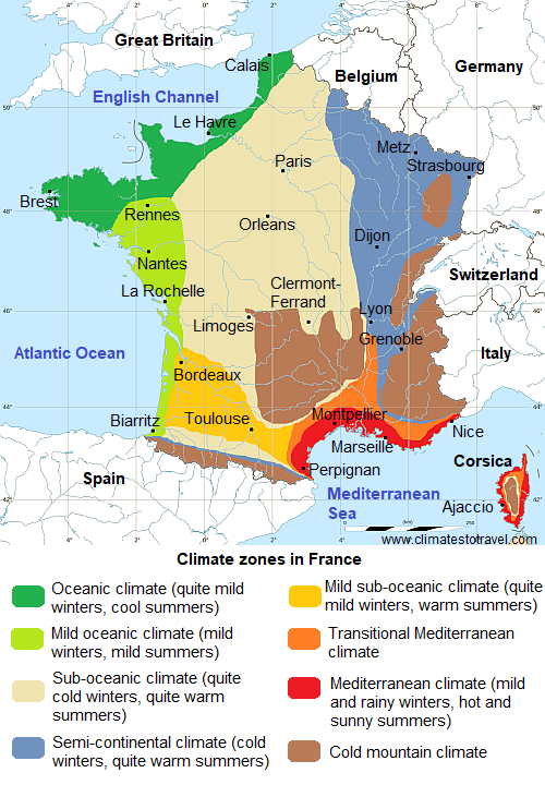
In the lowlands, the average
temperatures in January range from 2 °C (35.5 °F) in the north-east (Lorraine and Alsace), to 4.5 °C (40 °F) in Paris, to 7 °C (44.5 °F) in Bordeaux, to 9 °C (48 °F) in Corsica and the French Riviera.
The daily averages in July and August range from 17/18 °C (63/64 °F) along the English Channel coast, to 20 °C (68 °F) in Paris, to 24/25 °C (75/77 °F) along the Mediterranean coasts.
The amount of
sunshine also varies widely: the sun shines for less than 1,600 hours a year in Brittany and the far north, for 1,660 hours in Paris, for about 2,000 hours in the center-south, and for more than 2,500 hours along the Mediterranean coast.
Precipitation is quite abundant in the most exposed areas of Brittany and Normandy, and also at the foot of the mountains of the center-south, where it exceeds 1,000 millimeters (40 inches) per year, while it drops below 700 mm (27.5 in) per year in the interior of the center-north, in the plain to the east of the Vosges and in the area around the Gulf of Lion. In the mountains, on the other hand, it can even exceed 2,000 mm (80 in) per year.
In recent decades, France has been hit by
heat waves in summer, usually of short duration, during which the temperature can exceed 35 °C (95 °F), especially in inland areas.
Index
- North coast - Lille, Mont-Saint-Michel, Dunkirk, Le Havre, Brittany
- West coast - Rennes, Nantes, La Rochelle, Biarritz
- North-central - Paris
- The east - Lorraine and Alsace (Strasbourg), South-east (Lyon)
- The south - Mistral and Tramontane, Bordeaux, Toulouse, Marseille, Nice, Corsica
- Mountains
- When to go
- What to pack
- Climate data
North coast

On the northern coast of France, overlooking the English Channel, and up to a certain distance from the coast, the climate is
oceanic, cool and wet, rainy and windy all year round, but especially in autumn and winter.
In the far northeast, in the region on the border with Belgium (Nord-Pas de Calais), the climate is cool and humid: in
Lille, the average temperature ranges from 4 °C (39 °F) in January to 19 °C (66 °F) in July, and 745 mm (29 in) of rain fall each year.
In the north, the coast of the English Channel ("la Manche" in French) is generally colder than the western Atlantic coast. In these areas (Upper and Lower
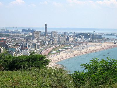
Normandy, see Le Havre,
Mont Saint-Michel), the weather is dull and wet, cold but not freezing in winter (except during cold air outbreaks from Eastern Europe) and cool in summer. The average temperature in
Dunkirk ranges from 5.5 °C (42 °F) in January to 19 °C (66 °F) in August.
In
Le Havre, Normandy, the average temperature ranges from 6 °C (42.5 °F) in February to 18.5 °C (65 °F) in August.
Precipitation amounts to 790 mm (31 in) per year. Summer is the least rainy season, but there are still 8 rainy days per month.
The sea remains very cool, if not cold, even in summer, however, it reaches 18 °C (64 °F) in August.
Further to the west, in
Brittany, the climate is influenced to an even higher degree by the Atlantic Ocean. In
Brest, the average temperature ranges from 7 °C (45 °F) in January and February to 17 °C (63 °F) in July and August, and an average of 1,200 mm (47 in) of rain falls per year, spread over 160 days.
The
islands of Brittany (Bréhat, Belle Île,
Ushant) have a very mild climate: the temperature almost never drops below freezing (0 °C or 32 °F), so that palm trees and tropical species can grow, while in summer, it almost never reaches 30 °C (86 °F). On the other hand, these islands are windy.
West coast

On the west coast of France, overlooking the Bay of Biscay, and up to a certain distance from the sea, the climate is still influenced by the Atlantic ocean, however, it is
milder than on the north coast: winter is still quite mild, while summer is a bit warmer and sunnier.
In the east of Brittany (see
Rennes), in the western part of the Pays de la Loire (see Nantes), and of New Aquitaine (see La Rochelle, Cap Ferret, Biarritz), the average temperatures in January range from 6 to 8 °C (43 to 46 °F), while in July and August, they range from 19 to 21 °C (66 to 70 °F).
In
Nantes, the average temperature ranges from 6.5 °C (43.5 °F) in January to 20 °C (68 °C) in August.
In
La Rochelle, 120 km (75 mi) south of Nantes and on the coast of the Charente-Maritime, the average ranges from 7 °C (44.5 °F) in January to 21 °C (69.5 °F) in August.
Rainfall amounts to 765 mm (30 in) per year, and the summer minimum, both in quantity and frequency, is quite evident.
On the west coast, the amount of sunshine is acceptable, as it exceeds 2,000 hours of sunshine per year, especially in the central part, where La Rochelle is located.
The
sea is decidedly less cool than on the northern coast, and reaches 20/21 °C (68/70 °F) from July to September.
In
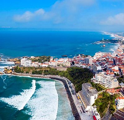
Biarritz, in the southernmost part of the coast, the average temperature ranges between 8.5 °C (47 °F) in January and 21 °C (70 °F) in August. However, the rains are more abundant due to the proximity of the Pyrenees. The sea temperature reaches 21 °C (70 °F) in July and 22 °C (72 °F) in August.
North-central

In the north-central part of France, the climate is
temperate, halfway between the cool one of the Atlantic coasts, and the more continental one of the east. In this area, in addition to the capital, there are also cities such as
Orléans,
Tours,
Auxerre,
Poitiers and
Le Mans, which hosts the famous car race of the "24 Hours".

In the region of
Paris (Île-de-France), the average temperatures are quite
cool: the daily average ranges from 4.5 °C (40 °F) in January to 20.5 °C (69 °F) in July. However, there can sometimes be
hot days in summer, with temperatures about 35 °C (95 °F) or above, while there may be some freezing or snowy days in winter, with night temperatures about -6/-8 °C (18/21 °F) or even below.
Anyway, the westerlies usually prevail, and in these cases the weather is unstable, with wet and rainy days, which are cool in summer and mild in winter. The most intense Atlantic low pressure areas can bring
strong winds from the ocean, especially in late autumn and winter.
Rainfall in Paris is lower than on the Atlantic coast, since it amounts to 640 mm (25 in) per year, although it is well distributed over the seasons.
The amount of sunshine in Paris is not very good, as it is lower than 1,700 hours per year.
East

The eastern regions of France have a
moderately continental climate, with a cold winter and a fairly warm summer, sometimes sultry and with possible thunderstorms. In this region, cold spells are possible in winter as well as heat waves in summer.
Lorraine and Alsace
Lorraine and Alsace, near the border with Germany, have a climate characterized by cold, gray winters, accompanied by frequent snowfalls, although generally not abundant, and warm summers, and with some chance of thunderstorms, and with some hot, sultry days.
In
Metz and in
Nancy, Lorraine, the average temperature ranges from a minimum of 2.5 °C (36.5 °F) in January to a maximum of 20 °C (68 °F) in July.
In
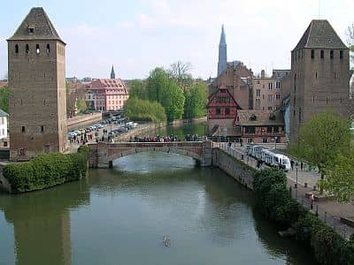
Strasbourg, Alsace, the daily average temperature ranges from 2.5 °C (36.5 °F) in January to 20.5 °C (69 °F) in July.
Precipitation amounts to 665 mm (26 in) per year. The rains are more abundant between May and September, due to the afternoon thunderstorms that can break out in the hot season.
In Strasbourg, too, the sun does not shine very often, and on average there are 1,700 hours of sunshine per year.
Further south, in
Colmar, which is sheltered from the moist westerlies by the Vosges Mountains, precipitation amounts to just 600 mm (24 in) per year.
In
Dijon, Burgundy, more to the south-west but at an altitude of 250 meters (820 ft), temperatures are very similar, the average ranging from 2.7 °C (37 °F) in January to 20.8 °C (69.4 °F) in July.
South-east
More to the south, in east-central France, to the east of the Massif Central, the difference between winter and summer is similar, so we can still speak of a semi-continental climate, but the temperatures are slightly higher and the sun is seen more often.
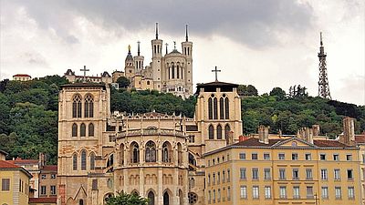
In
Lyon, the second largest French city, located between the Massif Central and the Alps, the average temperature ranges from 4 °C (39.5 °F) in January to 22.5 °C (72.5 °F) in July. Precipitation amounts to 830 millimeters (32.7 inches) per year, and it is less abundant in winter, but less frequent in summer, though slightly.
Southwest of Lyon,
Saint-Étienne, at 500 meters (1,650 ft) above sea level and to the east of the Massif Central, has a similar climate, although it snows more easily in winter due to the altitude.
East of Lyon, we find some cities that are located at the foot of the Alps and have a similar climate, albeit more rainy. In
Annecy, 450 meters (1,500 feet) above sea level and 30 km (18 mi) south of Geneva, and in
Chambéry (and in the neighboring town of Aix-les-Bains), 250 meters (800 ft) above sea level, more than 1,200 mm (47 in) of rain fall per year.
Grenoble, at 200 meters (650 ft), is in a particular situation, in a valley opened only on one side.
South

The south of France has a milder and sunnier climate, in fact it is often protected by the Azores Anticyclone, especially in the warm half of the year, when it is also prone to invasions of hot air masses from Spain.
In the southwest (see Bordeaux, Toulouse), the climate can be considered
mild sub-oceanic, while in the southeast, where the summer is warmer due to the greater distance from the ocean, the climate is
transitional Mediterranean at a certain distance from the sea, in the Rhone valley (see Valence,
Avignon), where the winter is relatively cold, while on the southern coast and Corsica, it is
Mediterranean, with mild, rainy winters and hot, dry summers.
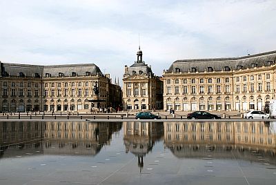
In
Bordeaux, Aquitaine, the average temperature ranges from 7 °C (45 °F) in January to 22 °C (71.5 °F) in August and August. During summer, this area can experience cool and rainy days caused by Atlantic fronts, but also hot and sunny days, with temperatures around 33/34 °C (91/93 °F). In autumn and winter, in addition to the rains, there can be strong winds from the ocean, but this region is also exposed to the cold wind from the north-east, the (
Bise).
The sea in Aquitaine does not get very warm, but it is certainly milder than on the north coast and in Brittany, in fact,
it reaches 21.5 °C (71 °F) in August.
Southeast of Bordeaux, in
Toulouse, the temperature is similar, ranging from 6 °C (43 °F) in January to 23 °C (73 °F) in August.
Mistral and Tramontane
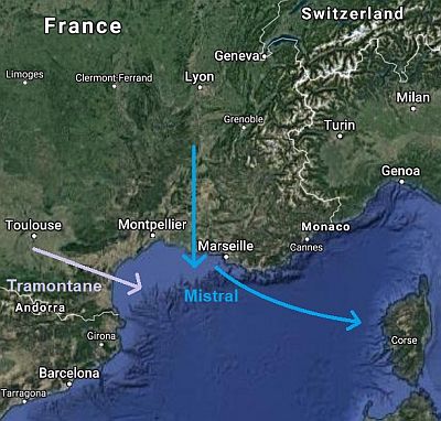
On the
Mediterranean coast and in the vicinity, the climate is even milder. However, on the Gulf of Lion, there are annoying winds, which often blow. The
Mistral blows in the Rhone Valley, starting from
Valence, while the western part (see Narbonne, Leucate,
Perpignan) is exposed to the north-west wind, the
Tramontane, which is channeled between the Pyrenees and the Massif Central, through the so-called gates of
Carcassonne.
These dry, cold winds blow about one hundred days a year, and can easily reach 80/100 kph (50/60 mph). So, cities like
Nîmes, Arles, Marseilles, in winter have an average temperature a bit lower than on the French Riviera, around 7/8 °C (45/46 °F) instead of 9/10 °C (48/50 °F); moreover, they are exposed to sudden drops in temperature, and even frosts during the cold season. However, summer is hot and sunny here as well because cold winds usually give a break in the warm season.
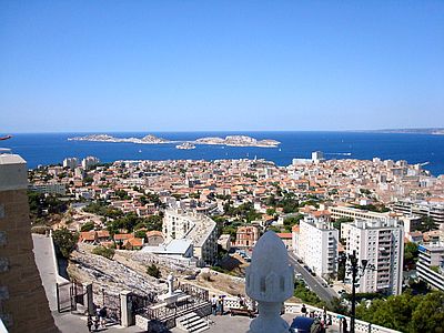 Marseilles
, the average temperature of the coldest month (January) is of 7.5 °C (46 °F), that of the warmest month (July) is of 25 °C (77 °F). In summer, the area of the Rhône delta heats up a lot, and Marseille is one of the few French cities where the maximum temperature in July and August reaches 30 °C (86 °F).
Because it receives the mistral wind many days a year, Marseille is one of the driest cities in France. In a year, just 515 mm (20 in) of rain fall, with a maximum, not too evident, in autumn. In summer, it rarely rains, as is typical of the Mediterranean climate.
A positive side of the dry north wind is that it cleans the air (and the sky). Marseille is one of the sunniest cities in Europe, and in fact, there are 2,850 hours of sunshine per year.
As the wind cools the sea surface and mixes the upper layers, the sea temperature in this part of the coast is slightly cooler than in the French Riviera (about 1/2 degrees Celsius).
Montpellier, which is halfway between the area affected by the Tramontane and the area affected by the Mistral, and is also protected by the mountains to the north, is the least windy city among those overlooking the Gulf of Lion.
French Riviera
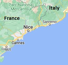 French Riviera, where is located
In the eastern part of the Mediterranean coast, towards the border with Italy, the
Côte d'Azur or French Riviera (see Saint Tropez, Fréjus,
Cannes,
Nice) is more sheltered from the Mistral, and has a particularly mild climate, similar to that of the Italian Riviera.
In
Nice, winter is mild, while summer is warm but without excess. The average temperature ranges from 9.5 °C (49 °F) in January to 24.5 °C (76 °F) in August.
On the French Riviera, the rains are a bit more abundant than in the Rhone delta, especially in autumn, due to the southerly winds.
As mentioned, the sea temperature on the Côte d'Azur is a little higher than in the Rhône delta area, and reaches 24 °C (75 °F) in August.
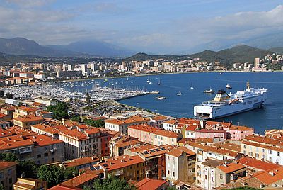 Corsica
 too has a Mediterranean climate, at least on the coasts, with mild, wet winters and warm to hot, sunny summers, although it is exposed to both
the Mistal and the west wind, which can be strong, especially in the western part of the island.
In the interior, there are steep mountains, where the weather becomes colder and wetter (and the landscape becomes greener) with increasing altitude, until at the highest altitudes, we find a typical mountain climate, where winters are characterized by abundant snowfalls.
In
Ajaccio, the largest city, located on the west coast, the temperature is similar to that of the French Riviera.
Corsica is the French region where the sea reaches its highest temperature, that is, 25 °C (77 °F) in August.
Mountains

In the mountainous regions of France, the climate varies mainly according to altitude and slope exposure, although it becomes obviously colder with increasing altitude. In summer, thunderstorms frequently erupt in the afternoon.
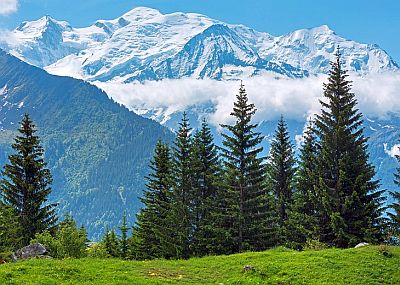
The highest peak of the
Alps and of France is Mont Blanc, on the border with Italy, whose height is 4,809 meters (15,777 ft).
The highest peak in the
French Pyrenees is Vignemale, 3,298 meters (10,820 ft) high, located 35 km (20 mi) south of Lourdes.
To the west of the Rhone valley, the
Massif Central reaches up to 1,886 meters (6,188 ft), in the Puy de Sancy.
The highest peak of the
Jura Massif, north of the Alps, is the Crêt de la Neige, 1,720 meters (5,643 ft) high and located a short distance from Geneva.
In the interior of Corsica, there are mountains as well, whose highest peak is
Monte Cinto, 2,706 meters (8,878 ft) high.
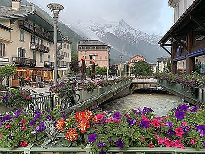
In
Chamonix (Haute-Savoie, north of Mont Blanc), located at 1,000 meters (3,300 feet) above sea level, the average temperature in January and July are respectively around -2 °C (28.5 °F) and 17 °C (62 °F).
In Chamonix, precipitation is more abundant than in the plains, and amounts to almost 1,300 millimetres (51 in). As usually happens in the mountains, summer is a rainy season because of afternoon thunderstorms.
Briançon is located in an alpine valley a short distance from the border with Italy, and despite being at 1,300 meters (4,300 feet), it has a relatively mild climate (the average in January is 0 °C or 32 °F).
When to go
It is difficult to find the best time to visit all of France, since in summer, which is the best season in the mountains and in the cooler areas of the north, it can get very hot, especially in the interior and in the south.
The best times to visit
Paris are late spring (mid-May to mid-June) and early autumn (the month of September). The summer (mid-June through August) is a good time as well, but sometimes it can get hot. The same can be said in general for all the inland areas of France.
If you want to visit
Brittany,
Normandy and the Atlantic coastal areas, the best time is the summer (June to August).
In the
Mediterranean regions, the best times are spring and autumn, especially the months of May and June and the first half of September (in the second half, the temperature is still pleasant, but the rains may become abundant, even with the risk of floods). In mid-summer (July-August), however, the heat is usually bearable because of the sea breezes, at least along the coasts.
If you want to go on a
beach holiday, the Mediterranean Sea (where the best months are July and August) is preferable to the Atlantic Ocean (especially the northern part, which is cooler) because both sea and air temperatures are higher, and sunshine is more frequent as well. On the Atlantic, however, the west coast is definitely preferable to the north coast, especially from La Rochelle to the south.
If you want to go on a
ski holiday, the months of February and March are the most recommended because the days are longer than in December and January. In some resorts at high altitudes, you can even ski in summer.
Summer is a good period to go
hiking in the mountains, although there may be some thunderstorms in the afternoon.
What to pack
In
winter: bring warm clothing, a sweater, a coat, a rain jacket or umbrella. A scarf, a hat and gloves for the north-central and eastern area and for the mountains.
In
summer: in Brittany and Normandy, bring clothes for spring and autumn, a T-shirt for warm days, but also a jacket, a raincoat or umbrella.
In the rest of the country, light clothing, but also long pants, a jacket and a sweater for the evening and cooler days; a raincoat or umbrella.
In the mountains, hiking shoes, sunscreen and sunglasses. A jacket for the evening.
Climate data - France
| Aix En Provence |
|---|
Aix En Provence, location on the map |
|---|
| Jan | Feb | Mar | Apr | May | Jun | Jul | Aug | Sep | Oct | Nov | Dec |
|---|
| Min temp. | 0 | 0 | 2 | 6 | 9 | 13 | 15 | 15 | 12 | 9 | 4 | 1 |
|---|
| Max temp. | 12 | 13 | 16 | 19 | 24 | 28 | 31 | 30 | 26 | 21 | 15 | 12 |
|---|
| Precip. | 50 | 35 | 35 | 55 | 50 | 30 | 15 | 35 | 85 | 75 | 60 | 55 |
|---|
| Prec. days | 6 | 5 | 4 | 7 | 5 | 4 | 2 | 3 | 5 | 7 | 7 | 6 |
|---|
| Humidity | 76% | 66% | 69% | 62% | 64% | 56% | 52% | 58% | 68% | 76% | 79% | 75% |
|---|
| Day length | 9 | 10 | 12 | 14 | 15 | 15 | 15 | 14 | 12 | 11 | 10 | 9 |
|---|
| Sun hours | 5 | 6 | 8 | 8 | 9 | 11 | 12 | 11 | 9 | 6 | 5 | 5 |
|---|
|
| Ajaccio |
|---|
Ajaccio, location on the map |
|---|
| Jan | Feb | Mar | Apr | May | Jun | Jul | Aug | Sep | Oct | Nov | Dec |
|---|
| Min temp. | 5 | 4 | 6 | 8 | 12 | 15 | 18 | 18 | 15 | 13 | 9 | 6 |
|---|
| Max temp. | 14 | 14 | 16 | 18 | 22 | 26 | 29 | 29 | 26 | 23 | 18 | 15 |
|---|
| Precip. | 60 | 55 | 55 | 65 | 40 | 25 | 10 | 20 | 55 | 90 | 95 | 70 |
|---|
| Prec. days | 8 | 7 | 8 | 8 | 6 | 3 | 1 | 2 | 5 | 8 | 8 | 8 |
|---|
| Humidity | 76% | 75% | 74% | 73% | 73% | 70% | 67% | 67% | 70% | 74% | 77% | 76% |
|---|
| Day length | 10 | 11 | 12 | 13 | 15 | 15 | 15 | 14 | 12 | 11 | 10 | 9 |
|---|
| Sun hours | 4 | 5 | 7 | 7 | 9 | 11 | 12 | 11 | 9 | 6 | 5 | 4 |
|---|
| Sea temp | 14 | 14 | 14 | 15 | 18 | 21 | 24 | 25 | 23 | 21 | 18 | 16 |
|---|
| Bordeaux |
|---|
Bordeaux, location on the map |
|---|
| Jan | Feb | Mar | Apr | May | Jun | Jul | Aug | Sep | Oct | Nov | Dec |
|---|
| Min temp. | 4 | 4 | 6 | 8 | 11 | 15 | 16 | 16 | 13 | 11 | 7 | 4 |
|---|
| Max temp. | 10 | 12 | 16 | 18 | 22 | 25 | 27 | 28 | 24 | 20 | 14 | 11 |
|---|
| Precip. | 90 | 85 | 70 | 80 | 85 | 65 | 55 | 60 | 90 | 95 | 105 | 105 |
|---|
| Prec. days | 13 | 11 | 11 | 12 | 12 | 9 | 7 | 8 | 10 | 11 | 13 | 13 |
|---|
| Humidity | 85% | 78% | 72% | 69% | 69% | 68% | 67% | 67% | 71% | 80% | 85% | 86% |
|---|
| Day length | 9 | 10 | 12 | 14 | 15 | 16 | 15 | 14 | 12 | 11 | 10 | 9 |
|---|
| Sun hours | 3 | 4 | 5 | 6 | 7 | 8 | 8 | 8 | 7 | 5 | 3 | 3 |
|---|
| Sea temp | 13 | 12 | 12 | 13 | 15 | 18 | 21 | 22 | 20 | 18 | 16 | 14 |
|---|
| Brest |
|---|
Brest, location on the map |
|---|
| Jan | Feb | Mar | Apr | May | Jun | Jul | Aug | Sep | Oct | Nov | Dec |
|---|
| Min temp. | 5 | 4 | 5 | 6 | 9 | 12 | 13 | 13 | 12 | 10 | 7 | 5 |
|---|
| Max temp. | 10 | 10 | 12 | 14 | 17 | 19 | 21 | 21 | 19 | 16 | 12 | 10 |
|---|
| Precip. | 145 | 110 | 95 | 90 | 80 | 60 | 65 | 65 | 85 | 130 | 135 | 150 |
|---|
| Prec. days | 18 | 14 | 15 | 13 | 11 | 9 | 10 | 10 | 10 | 16 | 17 | 17 |
|---|
| Humidity | 86% | 84% | 82% | 80% | 80% | 81% | 82% | 84% | 84% | 87% | 87% | 87% |
|---|
| Day length | 9 | 10 | 12 | 14 | 15 | 16 | 16 | 14 | 12 | 11 | 9 | 8 |
|---|
| Sun hours | 2 | 3 | 4 | 5 | 6 | 6 | 5 | 6 | 5 | 3 | 2 | 2 |
|---|
| Sea temp | 11 | 10 | 10 | 11 | 13 | 15 | 17 | 18 | 17 | 15 | 14 | 12 |
|---|
| Briançon (1,300 meters) |
|---|
Briançon, location on the map |
|---|
| Jan | Feb | Mar | Apr | May | Jun | Jul | Aug | Sep | Oct | Nov | Dec |
|---|
| Min temp. | -5 | -4 | -2 | 2 | 5 | 8 | 10 | 10 | 7 | 3 | -1 | -4 |
|---|
| Max temp. | 5 | 7 | 10 | 13 | 18 | 23 | 26 | 26 | 20 | 15 | 9 | 6 |
|---|
| Precip. | 60 | 40 | 45 | 70 | 65 | 70 | 50 | 55 | 70 | 100 | 70 | 60 |
|---|
| Prec. days | 7 | 5 | 6 | 9 | 9 | 9 | 7 | 7 | 7 | 10 | 7 | 7 |
|---|
| Humidity | 70% | 73% | 71% | 74% | 76% | 74% | 70% | 72% | 74% | 74% | 72% | 69% |
|---|
| Day length | 9 | 10 | 12 | 14 | 15 | 16 | 15 | 14 | 12 | 11 | 10 | 9 |
|---|
| Sun hours | 5 | 6 | 7 | 6 | 7 | 8 | 8 | 7 | 6 | 5 | 4 | 4 |
|---|
|
| Chamonix (1,000 meters) |
|---|
Chamonix, location on the map |
|---|
| Jan | Feb | Mar | Apr | May | Jun | Jul | Aug | Sep | Oct | Nov | Dec |
|---|
| Min temp. | -7 | -6 | -2 | 1 | 5 | 8 | 9 | 9 | 6 | 3 | -2 | -5 |
|---|
| Max temp. | 3 | 6 | 10 | 14 | 18 | 22 | 24 | 24 | 19 | 15 | 8 | 3 |
|---|
| Precip. | 95 | 85 | 85 | 90 | 120 | 130 | 120 | 125 | 105 | 115 | 100 | 110 |
|---|
| Prec. days | 10 | 8 | 10 | 10 | 14 | 13 | 12 | 12 | 10 | 10 | 10 | 11 |
|---|
| Humidity | 70% | 72% | 73% | 75% | 77% | 74% | 71% | 73% | 74% | 72% | 71% | 68% |
|---|
| Day length | 9 | 10 | 12 | 14 | 15 | 16 | 15 | 14 | 12 | 11 | 10 | 9 |
|---|
| Sun hours | 4 | 4 | 5 | 6 | 6 | 7 | 8 | 7 | 6 | 4 | 3 | 3 |
|---|
|
| La Rochelle |
|---|
La Rochelle, location on the map |
|---|
| Jan | Feb | Mar | Apr | May | Jun | Jul | Aug | Sep | Oct | Nov | Dec |
|---|
| Min temp. | 4 | 4 | 6 | 8 | 12 | 15 | 17 | 17 | 14 | 12 | 8 | 5 |
|---|
| Max temp. | 10 | 10 | 13 | 16 | 19 | 22 | 24 | 25 | 22 | 18 | 13 | 10 |
|---|
| Precip. | 75 | 55 | 55 | 65 | 55 | 40 | 45 | 45 | 60 | 90 | 95 | 90 |
|---|
| Prec. days | 12 | 9 | 10 | 10 | 9 | 7 | 7 | 6 | 7 | 12 | 12 | 13 |
|---|
| Humidity | 86% | 82% | 77% | 74% | 75% | 73% | 73% | 73% | 74% | 80% | 85% | 87% |
|---|
| Day length | 9 | 10 | 12 | 14 | 15 | 16 | 15 | 14 | 12 | 11 | 9 | 9 |
|---|
| Sun hours | 3 | 4 | 5 | 7 | 7 | 9 | 9 | 8 | 7 | 5 | 3 | 2 |
|---|
| Sea temp | 12 | 11 | 11 | 12 | 15 | 18 | 20 | 21 | 20 | 18 | 15 | 13 |
|---|
| Le Havre |
|---|
Le Havre, location on the map |
|---|
| Jan | Feb | Mar | Apr | May | Jun | Jul | Aug | Sep | Oct | Nov | Dec |
|---|
| Min temp. | 4 | 4 | 6 | 8 | 10 | 13 | 15 | 16 | 14 | 11 | 7 | 5 |
|---|
| Max temp. | 8 | 8 | 10 | 13 | 16 | 19 | 21 | 21 | 19 | 16 | 11 | 8 |
|---|
| Precip. | 70 | 50 | 55 | 55 | 60 | 60 | 50 | 55 | 65 | 85 | 85 | 90 |
|---|
| Prec. days | 12 | 10 | 11 | 10 | 10 | 9 | 8 | 9 | 9 | 12 | 14 | 14 |
|---|
| Humidity | 86% | 83% | 81% | 78% | 79% | 79% | 79% | 78% | 79% | 82% | 84% | 85% |
|---|
| Day length | 9 | 10 | 12 | 14 | 15 | 16 | 16 | 14 | 12 | 11 | 9 | 8 |
|---|
| Sun hours | 2 | 3 | 4 | 6 | 7 | 7 | 8 | 7 | 6 | 4 | 2 | 2 |
|---|
| Sea temp | 9 | 8 | 8 | 9 | 11 | 14 | 16 | 18 | 17 | 16 | 14 | 11 |
|---|
| Lille |
|---|
Lille, location on the map |
|---|
| Jan | Feb | Mar | Apr | May | Jun | Jul | Aug | Sep | Oct | Nov | Dec |
|---|
| Min temp. | 2 | 2 | 4 | 6 | 9 | 12 | 14 | 14 | 11 | 8 | 5 | 2 |
|---|
| Max temp. | 7 | 8 | 11 | 15 | 18 | 21 | 24 | 24 | 20 | 15 | 10 | 7 |
|---|
| Precip. | 60 | 45 | 60 | 50 | 65 | 65 | 70 | 65 | 60 | 65 | 70 | 70 |
|---|
| Prec. days | 12 | 10 | 11 | 10 | 11 | 10 | 10 | 9 | 10 | 11 | 13 | 11 |
|---|
| Humidity | 87% | 83% | 77% | 70% | 71% | 72% | 71% | 72% | 77% | 83% | 89% | 89% |
|---|
| Day length | 9 | 10 | 12 | 14 | 16 | 16 | 16 | 14 | 13 | 11 | 9 | 8 |
|---|
| Sun hours | 2 | 3 | 4 | 6 | 6 | 7 | 7 | 6 | 5 | 4 | 2 | 2 |
|---|
|
| Lyon |
|---|
Lyon, location on the map |
|---|
| Jan | Feb | Mar | Apr | May | Jun | Jul | Aug | Sep | Oct | Nov | Dec |
|---|
| Min temp. | 1 | 1 | 4 | 7 | 11 | 15 | 17 | 17 | 13 | 10 | 5 | 2 |
|---|
| Max temp. | 7 | 9 | 14 | 17 | 22 | 26 | 28 | 28 | 23 | 18 | 11 | 8 |
|---|
| Precip. | 45 | 45 | 50 | 75 | 90 | 75 | 65 | 60 | 90 | 100 | 80 | 55 |
|---|
| Prec. days | 9 | 8 | 8 | 9 | 11 | 8 | 7 | 7 | 8 | 10 | 9 | 9 |
|---|
| Humidity | 82% | 76% | 68% | 63% | 65% | 63% | 60% | 62% | 69% | 77% | 82% | 84% |
|---|
| Day length | 9 | 10 | 12 | 14 | 15 | 16 | 15 | 14 | 12 | 11 | 10 | 9 |
|---|
| Sun hours | 2 | 4 | 5 | 6 | 7 | 8 | 9 | 8 | 6 | 4 | 3 | 2 |
|---|
|
| Marseille |
|---|
Marseille, location on the map |
|---|
| Jan | Feb | Mar | Apr | May | Jun | Jul | Aug | Sep | Oct | Nov | Dec |
|---|
| Min temp. | 4 | 4 | 6 | 9 | 13 | 17 | 20 | 19 | 16 | 13 | 8 | 4 |
|---|
| Max temp. | 12 | 13 | 16 | 19 | 24 | 28 | 31 | 30 | 26 | 21 | 16 | 12 |
|---|
| Precip. | 50 | 30 | 30 | 55 | 40 | 25 | 10 | 30 | 75 | 65 | 55 | 45 |
|---|
| Prec. days | 5 | 5 | 4 | 6 | 5 | 3 | 1 | 3 | 5 | 6 | 6 | 6 |
|---|
| Humidity | 74% | 69% | 64% | 62% | 60% | 56% | 53% | 56% | 63% | 71% | 74% | 75% |
|---|
| Day length | 9 | 10 | 12 | 14 | 15 | 15 | 15 | 14 | 12 | 11 | 10 | 9 |
|---|
| Sun hours | 5 | 6 | 8 | 8 | 9 | 11 | 12 | 11 | 9 | 6 | 5 | 4 |
|---|
| Sea temp | 13 | 13 | 13 | 14 | 16 | 18 | 21 | 22 | 21 | 18 | 16 | 14 |
|---|
| Montpellier |
|---|
Montpellier, location on the map |
|---|
| Jan | Feb | Mar | Apr | May | Jun | Jul | Aug | Sep | Oct | Nov | Dec |
|---|
| Min temp. | 3 | 4 | 6 | 9 | 13 | 17 | 19 | 19 | 15 | 12 | 7 | 4 |
|---|
| Max temp. | 12 | 13 | 16 | 19 | 23 | 27 | 30 | 29 | 25 | 21 | 16 | 13 |
|---|
| Precip. | 55 | 50 | 35 | 55 | 45 | 30 | 15 | 35 | 80 | 95 | 65 | 65 |
|---|
| Prec. days | 6 | 4 | 5 | 6 | 5 | 4 | 2 | 4 | 5 | 7 | 6 | 6 |
|---|
| Humidity | 72% | 66% | 64% | 65% | 64% | 61% | 57% | 60% | 65% | 73% | 72% | 72% |
|---|
| Day length | 9 | 10 | 12 | 14 | 15 | 15 | 15 | 14 | 12 | 11 | 10 | 9 |
|---|
| Sun hours | 5 | 6 | 7 | 8 | 9 | 10 | 11 | 10 | 8 | 5 | 5 | 4 |
|---|
| Sea temp | 13 | 12 | 13 | 14 | 16 | 19 | 21 | 22 | 21 | 18 | 16 | 14 |
|---|
| Nice |
|---|
Nice, location on the map |
|---|
| Jan | Feb | Mar | Apr | May | Jun | Jul | Aug | Sep | Oct | Nov | Dec |
|---|
| Min temp. | 6 | 6 | 8 | 11 | 15 | 18 | 21 | 21 | 18 | 14 | 10 | 7 |
|---|
| Max temp. | 13 | 14 | 15 | 17 | 21 | 25 | 28 | 28 | 25 | 21 | 17 | 14 |
|---|
| Precip. | 70 | 45 | 40 | 70 | 45 | 35 | 10 | 20 | 70 | 135 | 105 | 95 |
|---|
| Prec. days | 6 | 5 | 5 | 7 | 5 | 4 | 2 | 2 | 5 | 7 | 7 | 6 |
|---|
| Humidity | 65% | 64% | 66% | 70% | 71% | 71% | 68% | 67% | 67% | 71% | 69% | 64% |
|---|
| Day length | 9 | 10 | 12 | 14 | 15 | 15 | 15 | 14 | 12 | 11 | 10 | 9 |
|---|
| Sun hours | 5 | 6 | 7 | 7 | 9 | 10 | 11 | 10 | 8 | 6 | 5 | 4 |
|---|
| Sea temp | 14 | 13 | 14 | 14 | 17 | 20 | 23 | 24 | 22 | 20 | 17 | 15 |
|---|
| Paris |
|---|
Paris, location on the map |
|---|
| Jan | Feb | Mar | Apr | May | Jun | Jul | Aug | Sep | Oct | Nov | Dec |
|---|
| Min temp. | 2 | 2 | 4 | 6 | 10 | 13 | 15 | 14 | 11 | 8 | 5 | 2 |
|---|
| Max temp. | 8 | 9 | 13 | 17 | 20 | 24 | 26 | 26 | 22 | 17 | 11 | 8 |
|---|
| Precip. | 50 | 40 | 50 | 50 | 65 | 50 | 60 | 55 | 50 | 60 | 50 | 60 |
|---|
| Prec. days | 10 | 9 | 10 | 9 | 10 | 9 | 8 | 7 | 8 | 9 | 10 | 11 |
|---|
| Humidity | 86% | 81% | 74% | 68% | 68% | 67% | 64% | 65% | 72% | 81% | 87% | 87% |
|---|
| Day length | 9 | 10 | 12 | 14 | 15 | 16 | 16 | 14 | 12 | 11 | 9 | 8 |
|---|
| Sun hours | 2 | 3 | 4 | 6 | 6 | 7 | 7 | 7 | 6 | 4 | 2 | 2 |
|---|
|
| Strasbourg |
|---|
Strasbourg, location on the map |
|---|
| Jan | Feb | Mar | Apr | May | Jun | Jul | Aug | Sep | Oct | Nov | Dec |
|---|
| Min temp. | 0 | 0 | 3 | 6 | 10 | 14 | 15 | 14 | 11 | 7 | 3 | 1 |
|---|
| Max temp. | 5 | 7 | 12 | 17 | 21 | 24 | 26 | 26 | 22 | 16 | 9 | 6 |
|---|
| Precip. | 35 | 35 | 45 | 45 | 80 | 70 | 75 | 60 | 65 | 60 | 45 | 50 |
|---|
| Prec. days | 8 | 8 | 9 | 9 | 12 | 11 | 11 | 10 | 9 | 10 | 9 | 10 |
|---|
| Humidity | 84% | 79% | 71% | 64% | 66% | 67% | 67% | 69% | 74% | 82% | 87% | 86% |
|---|
| Day length | 9 | 10 | 12 | 14 | 15 | 16 | 16 | 14 | 12 | 11 | 9 | 8 |
|---|
| Sun hours | 2 | 3 | 4 | 6 | 7 | 7 | 7 | 7 | 5 | 3 | 2 | 1 |
|---|
|
| Toulouse |
|---|
Toulouse, location on the map |
|---|
| Jan | Feb | Mar | Apr | May | Jun | Jul | Aug | Sep | Oct | Nov | Dec |
|---|
| Min temp. | 3 | 3 | 6 | 8 | 12 | 15 | 17 | 17 | 14 | 11 | 6 | 4 |
|---|
| Max temp. | 10 | 11 | 15 | 18 | 21 | 26 | 28 | 28 | 25 | 20 | 14 | 10 |
|---|
| Precip. | 50 | 40 | 50 | 70 | 75 | 60 | 40 | 45 | 45 | 55 | 50 | 50 |
|---|
| Prec. days | 9 | 8 | 9 | 10 | 10 | 7 | 5 | 6 | 7 | 8 | 9 | 9 |
|---|
| Humidity | 85% | 78% | 71% | 70% | 69% | 65% | 62% | 62% | 66% | 76% | 83% | 85% |
|---|
| Day length | 9 | 10 | 12 | 14 | 15 | 15 | 15 | 14 | 12 | 11 | 10 | 9 |
|---|
| Sun hours | 3 | 4 | 6 | 6 | 7 | 8 | 8 | 8 | 7 | 5 | 3 | 3 |
|---|
|
See also the
temperatures month by month