Select units of measurement for the temperature and rainfall tables (metric or imperial).
Average weather, temperature, rainfall, sunshine hours
The climate of Lagdei is
temperate humid, influenced by the altitude, with cold winters and mild to pleasantly warm summers. It can snow in winter, while thunderstorms can break out in summer. Spring and autumn are the rainiest seasons.
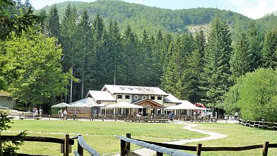
The Lagdei refuge is located at an altitude of 1,250 metres (4,100 feet), near the sources of the Parma river, within the Tuscan-Emilian Apennine National Park. Several trekking routes start from here.
Here are the average temperatures.
Lagdei - Average temperatures (2006-2019) |
| Month | Min | Max | Mean |
|---|
| January | -3.7 | 2.4 | -0.7 |
|---|
| February | -4.3 | 3.1 | -0.6 |
|---|
| March | -1.7 | 6.2 | 2.2 |
|---|
| April | 1.5 | 10.5 | 6 |
|---|
| May | 5.1 | 13.9 | 9.5 |
|---|
| June | 9 | 18.6 | 13.8 |
|---|
| July | 11.1 | 21.6 | 16.4 |
|---|
| August | 10.6 | 21 | 15.8 |
|---|
| September | 7.2 | 16.3 | 11.7 |
|---|
| October | 3.9 | 11.8 | 7.9 |
|---|
| November | 0.8 | 6.7 | 3.7 |
|---|
| December | -2.7 | 2.9 | 0.1 |
|---|
| Year | 3.1 | 11.3 | 7.2 |
|---|

The area is
windy, since we are close to the Apennine ridge.
In
winter heavy snowfalls can occur. However, sometimes the wind from Tyrrhenian Sea can blow, capable of raising the temperature up to 10 °C (50 °F) or more.
During cold spells, the temperature can drop to -10/-12 °C (10/14 °F), and occasionally lower. At the end of February 2018, it dropped to -19 °C (-2 °F).
In
summer, the weather is often good in the morning, then in the afternoon, cloud cover increases and thunderstorms can break out.
During heat waves, when the temperature in the lowlands exceeds 35 °C (95 °F), here it can reach or exceed 25 °C (77 °F). In August 2013 and 2017 it reached 29 °C (84 °F). However, inside the woods, the temperature is a few degrees cooler.

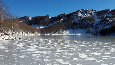
A little higher, at an altitude of 1,500 metres (4,900 ft), in a small valley, is the Mariotti refuge, which can be reached on foot along a path through a wood of about half an hour, or by chair lift. Nearby is a lake,
Lago Santo. In this area there is a cold microclimate, in fact, in winter, from December to February, the lake is normally frozen.
Climbing further on foot, you can reach some
peaks of the Apennines about 1,800 meters (5,900 ft) high (Orsaro, Braiola, Marmagna, Matto and Sillara), with a view of the Lunigiana Valley (see Pontremoli), and of the sea (Gulf of La Spezia and Palmaria island). In conditions of good visibility, you can also see the islands of Elba and Corsica.
Best Time
You can go to Lagdei in
summer, for trekking in the mountains and to escape the heat of the plains. You can go trekking even in winter, but you need to be equipped for the snow, or for the ice that can resist inside the woods even in periods of mild weather.
The refuges, with restaurant and refreshment point, are open every day from 15 June to 15 September, but also during the Christmas and New Year period, and during the weekends the rest of the year.