Select units of measurement for the temperature and rainfall tables (metric or imperial).
Average weather, temperature, rainfall, sunshine hours
Index
Introduction
In Sardinia, an island and an Italian region, the climate is
Mediterranean, with mild, fairly rainy winters and hot, sunny summers, a bit sultry but tempered by sea breezes. At sea level, the daily average temperature ranges from about 9,5 °C (49 °F) in January and February to about 25 °C (77 °F) in July and August.
Rainfall is not abundant, in fact, it typically ranges from 400 to 550 millimeters (15.5 to 21.5 inches) per year on the coast (but it can locally drop even below, for instance, in the southeastern tip of the island) and follows the Mediterranean pattern, that is, it is more common in autumn and winter, it gradually decreases during spring, and hits a low in summer, when it almost never rains. In inland areas, rainfall locally exceeds 700 millimeters (27.5 inches) per year in hilly areas and 1,000 mm (40 in) in the mountains.
However, sometimes there may be more abundant rains than normal, which can persist in the same areas for several hours and cause flooding, and this happens more easily in autumn and on the eastern side, as happened in November 2013 in the Olbia area and in the November 2020 in the Nuoro area.
Sardinia is a
windy island, especially from October to April. This happens because of the
Maestrale, the northwest wind, which blows from France (where it is called Mistral) and affects particularly the western part and the Strait of Bonifacio, but also because of the "Ponente", which blows from the west.
In summer, sea breezes blow, but they are welcome because they make the heat more bearable. On other occasions, the
Sirocco can blow from the south-east, bringing heat waves from Africa, which are felt especially in inland plains and valleys, with peaks of 40 °C (104 °F) and more, and even 45 °C in the worst moments.
The amount of
sunshine in Sardinia is very good in summer, especially along the coast, when clear skies prevail, while it's not so high from November to February. However, some sunny periods can also occur in winter.
The island is quite sheltered from
cold waves; along the coasts and in the plains, snowfall is quite rare, but it can occur in the coldest winters (as happened in January 1985 and February 2012), more easily in the north of the island. An exception is represented by the Costa Smeralda ("Emerald Coast", see Olbia), in the northeast, where snowfalls, though usually not abundant, are a bit more frequent.
Night frosts in the plains are rare, and when they occur, they are light: generally the temperature does not drop below -2/-3 °C (27/28 °F). On the other hand, in inland areas, already at an altitude of a few hundred meters (see Nuoro, Macomer, Tempio Pausania), snow is relatively more frequent and abundant.
Coast and plain
Alghero

In
Alghero, located on the coast, in the north-west of the island, the average temperature ranges from 9.5 °C (49.5 °F) in January and February to 25 °C (77 °F) in August. Here are the average temperatures.
Alghero - Average temperatures (1991-2020) |
| Month | Min | Max | Mean |
|---|
| January | 4.9 | 14.3 | 9.6 |
|---|
| February | 4.6 | 14.5 | 9.6 |
|---|
| March | 6.2 | 16.6 | 11.4 |
|---|
| April | 8.2 | 19.3 | 13.8 |
|---|
| May | 11.6 | 23.6 | 17.6 |
|---|
| June | 15.4 | 28.1 | 21.7 |
|---|
| July | 18 | 31.1 | 24.5 |
|---|
| August | 18.2 | 31.5 | 24.9 |
|---|
| September | 15.7 | 27.4 | 21.6 |
|---|
| October | 12.8 | 23.7 | 18.3 |
|---|
| November | 9.2 | 18.7 | 14 |
|---|
| December | 6.3 | 15.4 | 10.9 |
|---|
| Year | 11 | 22.1 | 16.5 |
|---|
Rainfall amounts to 570 mm (22.5 in) per year, with a maximum in October and November, and rare rains in the summer.
Alghero - Average precipitation| Month | Days |
|---|
| January | 70 | 8 |
|---|
| February | 55 | 8 |
|---|
| March | 60 | 7 |
|---|
| April | 50 | 7 |
|---|
| May | 25 | 4 |
|---|
| June | 15 | 2 |
|---|
| July | 5 | 1 |
|---|
| August | 25 | 2 |
|---|
| September | 40 | 4 |
|---|
| October | 80 | 7 |
|---|
| November | 80 | 8 |
|---|
| December | 65 | 7 |
|---|
| Year | 570 | 65 |
|---|
In
Cagliari, the largest city and the capital of the region, situated on the coast, in the southern part of the island, rainfall is lower, and amounts to 425 mm or 16.5 in per year.
In inland plains (which in any case are not extensive), the climate is slightly more continental. In
Decimomannu, about 20 kilometers (12 miles) north-west of Cagliari, the maximum temperatures in July and August are 33 °C (91.5 °F). Here, the temperature dropped to -5 °C (23 °F) in January 1981 and February 1999, while it reached 47 °C (116.5 °F) in July 2023, an exceptional month during which the average maximum was 37.3 °C (99.1 °F).

The temperature of the
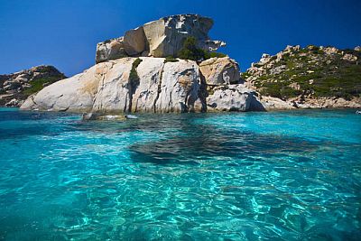
sea is fairly uniform on the island, and just lower in the western part. The sea is warm enough for swimming from July to September; in contrast, it's a bit cool in June and October. Here, for example, is the sea temperature in Porto Cervo, on the Costa Smeralda ("Emerald Coast").
Porto Cervo - Sea temperature| Month |
|---|
| January | 14 |
|---|
| February | 13.5 |
|---|
| March | 14 |
|---|
| April | 15 |
|---|
| May | 17.5 |
|---|
| June | 21 |
|---|
| July | 24 |
|---|
| August | 25 |
|---|
| September | 23.5 |
|---|
| October | 21 |
|---|
| November | 18"> |
|---|
| December | 15.5 |
|---|
| Year | 18.6 |
|---|
Inland areas
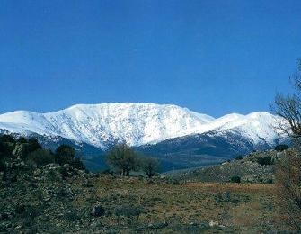
In the interior, where hills and mountains are found, the climate becomes gradually colder with increasing altitude, and as mentioned, the rains in some areas are more abundant as well, so much so that thick forests are found. The highest peak, 1,834 meters (6,017 feet) high, is located in the
Gennargentu Massif.
Above 1,500 metres (4,900 ft), heavy snowfalls occur in winter, and on the summits, the accumulated snow can last until the first half of June.
There is also a ski lift under construction, at Bruncu Spina, currently under renovation.

Fonni

In
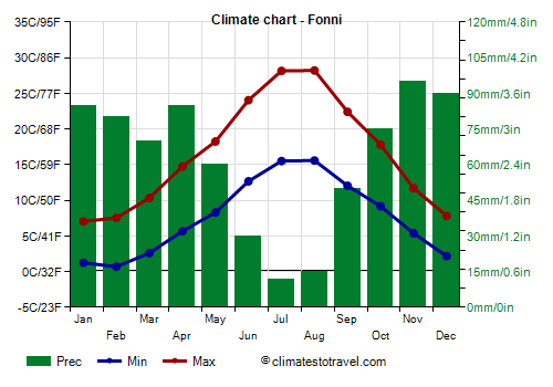
Fonni, located north of Gennargentu, at 1,000 meters (3,300 feet) of altitude, the average temperature ranges from 4 °C (39 °F) in January and February to 22 °C (71.5 °F) in July and August.
Winter is cold, while summer is generally warm but without excess. On average, 90 cm (35 in) of snow fall per year. Sometimes it can snow even in April. The temperature dropped to -9.4 °C (15 °F) in February 1956, to -8 °C (17.5 °F) in January 1963, and to -10 °C (14 °F) in January 1981. In summer, it reached 37 °C (98.5 °F) in July 2009 and 38 °C (100.5 °F) in August 2017. Here are the average temperatures.
Fonni - Average temperatures (2006-2020) |
| Month | Min | Max | Mean |
|---|
| January | 1.2 | 7 | 4.1 |
|---|
| February | 0.7 | 7.5 | 4.1 |
|---|
| March | 2.6 | 10.3 | 6.5 |
|---|
| April | 5.7 | 14.8 | 10.2 |
|---|
| May | 8.3 | 18.2 | 13.3 |
|---|
| June | 12.7 | 24 | 18.4 |
|---|
| July | 15.5 | 28.2 | 21.8 |
|---|
| August | 15.6 | 28.2 | 21.9 |
|---|
| September | 12 | 22.4 | 17.2 |
|---|
| October | 9.2 | 17.8 | 13.5 |
|---|
| November | 5.4 | 11.7 | 8.5 |
|---|
| December | 2.2 | 7.8 | 5 |
|---|
| Year | 7.6 | 16.6 | 12.05 |
|---|
Fonni receives 750 mm (29.5 in) of rain or snow per year.
Fonni - Average precipitation| Month | Days |
|---|
| January | 85 | 9 |
|---|
| February | 80 | 10 |
|---|
| March | 70 | 9 |
|---|
| April | 85 | 11 |
|---|
| May | 60 | 7 |
|---|
| June | 30 | 4 |
|---|
| July | 12 | 2 |
|---|
| August | 15 | 2 |
|---|
| September | 50 | 6 |
|---|
| October | 75 | 9 |
|---|
| November | 95 | 11 |
|---|
| December | 90 | 8 |
|---|
| Year | 750 | 88 |
|---|
Best Time
The
best time to visit Sardinia for a beach holiday is the summer, from June to August. The sea temperature is comfortable enough from July to September, although in September, which in any case is still a good month (especially in the first half), the first periods of bad weather can occur. In June, as mentioned, the sea is still a bit cool, while it's even cold in May, when the air can sometimes be a little cold for sunbathing as well.
April and May are advisable months for hiking and for visiting cities, while in summer, it can sometimes be too hot to get around with ease. In October, temperatures are mild or pleasantly warm, but the days are shorter and the weather can be rainy and windy.
Back to topSee also the
temperatures by month.