In Abruzzo, a region of central Italy, overlooking the Adriatic Sea and crossed by the Apennines in the central-western part, we have the following climatic zones:
- the climate of the
coast and of the hills parallel to it, which can be described as transitional Mediterranean, since it has relatively mild, rainy winters and hot, sunny summers.
- the climate of the
Apennines, with continental characteristics in the valleys and at intermediate altitudes, but also cold in the mountains at the highest altitudes.
The region is exposed to the
cold wind coming from Eastern Europe, which can bring snowfalls in winter, after being loaded with moisture from the sea. The eastern part, east of the Apennines, is also exposed to the Garbino, the
warm wind from the south-west, which, already mild or hot in origin (it comes from the Mediterranean or North Africa), warms up further as it descends from the mountains due to compression.
Plains and hills
On the
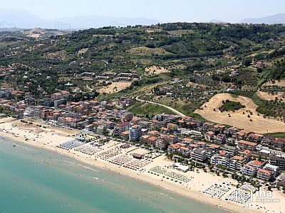
coast of Abruzzo (see Giulianova, Roseto degli Abruzzi, Pineto, Pescara, Francavilla al Mare, Ortona, Vasto), there is a
Mediterranean climate. The average temperature in January is about 7 °C (44.5 °F), that of July and August is about 24 °C (75 °F).
In winter, temperatures are lower than on the Tyrrhenian side, in Lazio, especially when cold air irruptions from Eastern Europe occur, which can even bring snowfall.
Summer is hot and sunny, with the breeze blowing from the sea, and some thunderstorms that can come from the Apennines.
Here are the average temperatures of
Pescara, the capital, located on the coast.
Pescara - Average temperatures (1991-2020) | Month | Min (°C) | Max (°C) | Mean (°C) | Min (°F) | Max (°F) | Mean (°F) |
|---|
| January | 1.9 | 12 | 6.9 | 35 | 54 | 44.5 |
|---|
| February | 2.2 | 12.7 | 7.5 | 36 | 55 | 45.4 |
|---|
| March | 4.4 | 15.4 | 9.9 | 40 | 60 | 49.8 |
|---|
| April | 7.3 | 18.4 | 12.8 | 45 | 65 | 55.1 |
|---|
| May | 11.6 | 22.9 | 17.3 | 53 | 73 | 63.1 |
|---|
| June | 15.6 | 27.4 | 21.5 | 60 | 81 | 70.7 |
|---|
| July | 17.8 | 29.9 | 23.9 | 64 | 86 | 75 |
|---|
| August | 17.9 | 30 | 24 | 64 | 86 | 75.2 |
|---|
| September | 14.4 | 25.9 | 20.1 | 58 | 79 | 68.3 |
|---|
| October | 10.9 | 21.5 | 16.2 | 52 | 71 | 61.2 |
|---|
| November | 6.9 | 16.9 | 11.9 | 44 | 62 | 53.4 |
|---|
| December | 3.1 | 13.1 | 8.1 | 38 | 56 | 46.6 |
|---|
| Year | 9.5 | 20.6 | 15 | 49.2 | 69 | 59 |
|---|
in Abruzzo is generally moderate, and lower than those of Lazio, which is located on the Tyrrhenian side and receives humid winds from the west and south-west. On the coast, typically 650 mm (25.5 in) of rain fall per year, while about 800 mm (31 in) fall in inland areas at low altitudes. Generally, the rainiest season is autumn.

In
inland areas at low altitudes (see
Teramo,
Chieti, Lanciano), where the influence of the sea is lower, the climate can be described as transitional Mediterranean. In winter, snowfalls are more frequent than on the coast, and can sometimes be quite heavy, while in summer, it is a little hotter than on the coast.
On the coast and the hills east of the Apennines, and the temperature generally does not drop below -5 °C (23 °F) even during cold spells, even though lower values have been recorded in the past.
The south-west wind can bring temperatures of 20 °C (68 °F) in the middle of winter. In summer there can be
heat waves, which are becoming more frequent due to global warming. The hottest days are recorded with the Garbino, which neutralizes the sea breeze. The records exceed 40 °C (104 °F).
Mountains
The central-western part of Abruzzo is occupied by the
Central Apennines, with mountain massifs, but also plateaus and valleys.
The climate gradually gets
colder as the altitude increases. Precipitation is more abundant: it generally fluctuates between 800 and 1,000 mm (31 and 40 in) per year, but on the northern slopes of the mountains it can reach 1,500 mm (60 in) per year. In winter, there can be heavy snowfalls, while in summer, thunderstorms can break out in the afternoon.
The capital of the region,
L'Aquila, is located in a valley at 700 meters (2,300 feet) above sea level, between the Ocre and Velino mountains to the south and the Gran Sasso massif to the north. Here, in winter the temperature can drop below -10 °C (14 °F), while in summer it can exceed 35 °C (95 °F). Here are the average temperatures.
L Aquila - Average temperatures (1991-2014) | Month | Min (°C) | Max (°C) | Mean (°C) | Min (°F) | Max (°F) | Mean (°F) |
|---|
| January | -1.2 | 7.9 | 3.3 | 30 | 46 | 38 |
|---|
| February | -1.2 | 9.6 | 4.2 | 30 | 49 | 39.6 |
|---|
| March | 1.7 | 13.9 | 7.8 | 35 | 57 | 46.1 |
|---|
| April | 4.4 | 17.1 | 10.8 | 40 | 63 | 51.4 |
|---|
| May | 8.4 | 22.4 | 15.4 | 47 | 72 | 59.7 |
|---|
| June | 11.9 | 26.8 | 19.3 | 53 | 80 | 66.8 |
|---|
| July | 13.8 | 29.9 | 21.9 | 57 | 86 | 71.3 |
|---|
| August | 14 | 30.4 | 22.2 | 57 | 87 | 72 |
|---|
| September | 10.4 | 24.5 | 17.5 | 51 | 76 | 63.5 |
|---|
| October | 6.9 | 19.5 | 13.2 | 44 | 67 | 55.8 |
|---|
| November | 3.1 | 12.9 | 8 | 38 | 55 | 46.4 |
|---|
| December | -0.2 | 7.8 | 3.8 | 32 | 46 | 38.8 |
|---|
| Year | 6 | 18.6 | 12.3 | 42.9 | 65.5 | 54 |
|---|
As mentioned, in Abruzzo there are some plateaus, the largest of which is the
Cinquemiglia Plateau, located in the south of the region at an altitude of around 1,250 metres (4,100 ft), where the municipalities of Rivisondoli, Rocca Pia and Roccaraso are found. In winter the temperature can drop to -20 °C (-4 °F), while in summer it can exceed 30 °C (86 °F).
At altitudes between 1,000 and 1,500 meters (3,300 and 4,900 ft) above sea level, the average January temperature is around 0 °C (32 °F). Here are the average temperatures of
Pescasseroli, a town located in the south of the region, in the
National Park of Abruzzo, Lazio and Molise, at an altitude of 1,150 metres (3,770 ft).
Pescasseroli - Average temperatures (1991-2009) | Month | Min (°C) | Max (°C) | Mean (°C) | Min (°F) | Max (°F) | Mean (°F) |
|---|
| January | -4.5 | 5 | 0.3 | 24 | 41 | 32.5 |
|---|
| February | -4.7 | 5.7 | 0.5 | 24 | 42 | 32.9 |
|---|
| March | -1.9 | 8.8 | 3.5 | 29 | 48 | 38.2 |
|---|
| April | 0.6 | 11.8 | 6.2 | 33 | 53 | 43.2 |
|---|
| May | 4.1 | 18 | 11.1 | 39 | 64 | 51.9 |
|---|
| June | 7 | 22.2 | 14.6 | 45 | 72 | 58.2 |
|---|
| July | 8.6 | 25.4 | 17 | 47 | 78 | 62.5 |
|---|
| August | 9 | 25.7 | 17.4 | 48 | 78 | 63.3 |
|---|
| September | 6 | 19.8 | 12.9 | 43 | 68 | 55.2 |
|---|
| October | 3.2 | 15.5 | 9.3 | 38 | 60 | 48.8 |
|---|
| November | 0.2 | 9.6 | 4.9 | 32 | 49 | 40.8 |
|---|
| December | -3 | 5.1 | 1 | 27 | 41 | 33.8 |
|---|
| Year | 2.1 | 14.4 | 8.25 | 35.7 | 58 | 47 |
|---|
The
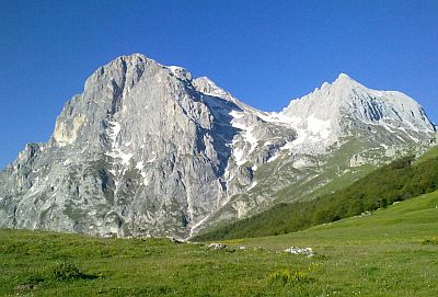
Gran Sasso of Italy is the highest mountain massif of the Apennines and of peninsular Italy, and reaches 2,912 meters (9,554 ft) in the Corno Grande. In a basin to the north of the summit, above 2,650 metres (8,695 ft), is the small
Calderone glacier, the only Apennine glacier and one of the southernmost in Europe, which, however, is disappearing due to global warming.
Here are the average temperatures of
Campo Imperatore, located at 2,140 meters (7,021 ft) on the southern slope of the Gran Sasso.
Campo Imperatore - Average temperatures (2009-2014) | Month | Min (°C) | Max (°C) | Mean (°C) | Min (°F) | Max (°F) | Mean (°F) |
|---|
| January | -5.1 | 0.1 | -2.5 | 23 | 32 | 27.5 |
|---|
| February | -6.5 | -0.5 | -3.5 | 20 | 31 | 25.7 |
|---|
| March | -3.7 | 2.6 | -0.6 | 25 | 37 | 31 |
|---|
| April | -0.9 | 5.2 | 2.2 | 30 | 41 | 35.9 |
|---|
| May | 1.6 | 7.9 | 4.7 | 35 | 46 | 40.5 |
|---|
| June | 5.9 | 12.3 | 9.1 | 43 | 54 | 48.4 |
|---|
| July | 8.8 | 15.7 | 12.2 | 48 | 60 | 54 |
|---|
| August | 9.6 | 16.9 | 13.2 | 49 | 62 | 55.8 |
|---|
| September | 5.9 | 12.3 | 9.1 | 43 | 54 | 48.4 |
|---|
| October | 2.3 | 8 | 5.1 | 36 | 46 | 41.2 |
|---|
| November | -0.8 | 3.8 | 1.5 | 31 | 39 | 34.7 |
|---|
| December | -5.4 | 0.1 | -2.6 | 22 | 32 | 27.3 |
|---|
| Year | 1 | 7.1 | 4.05 | 33.8 | 44.7 | 39.5 |
|---|
The Gran Sasso area is protected in a national park, which extends to the northwest, on the border with Lazio, where we find the
Monti della Laga, which reach 2,458 meters (8,064 ft) in Monte Gorzano.
In the southeast of the region we find the second highest mountain massif of the Apennines, the
Maiella, which reaches 2,793 meters (9,164 ft) in Monte Amaro.

In Abruzzo there are also
ski lifts, for example Alto Sangro - Roccaraso/Rivisondoli, Campo Felice - Rocca di Cambio, Gran Sasso - Campo Imperatore, Prati di Tivo. It must be said that there is not always snow on the slopes.
Best Time
For a
beach holiday along the coast of Abruzzo, the best period is the summer, especially in July and August, since they are the warmest and sunniest months, and when the sea is also warmer.
To visit the
cities, given that it can be very hot in summer, you can choose the periods from mid-April to mid-June and from September to early October. In June, the weather is often nice, but sometimes it can get very hot, especially in the second half of the month.
You can go to the
mountains both in winter, perhaps for skiing, and in summer, perhaps for trekking in the mountains and to escape the heat of the plains.
See also the
temperatures by month.