Select units of measurement for the temperature and rainfall tables (metric or imperial).
Average weather, temperature, rainfall, sunshine
In Spain there are, broadly speaking, five types of climate:
- the climate of the
northern Atlantic coast, cool, humid and rainy;
- the climate of the
central plateau, quite arid and moderately continental, with relatively cold winters and hot summers (see Madrid);
- the Mediterranean climate of the
southern and eastern coasts (see Barcelona, Balearic Islands, Valencia, Málaga), mild and sunny;
- the almost African climate of the
Andalusian plain (see Seville, Córdoba), mild in winter and very hot in summer;
- finally, the mountainous climate of the
Pyrenees and the Sierras, more or less cold depending on altitude.
Therefore, Spain is not always warm and sunny as you might think.
However, if you exclude the north-facing coast, in much of Spain the summer is hot, dry and sunny.
In the following map, we can see the
climate zones in Spain.

The climate in detail
The north
Atlantic coast
In the north, along the coast bordering the Atlantic Ocean (see La Coruna, Gijon, Santander,
Bilbao),
winter is mild and humid: rainfall is frequent and sunshine is relatively rare.
The coasts of
Galicia and
Asturias, more exposed to the westerly winds, are often
windy, but sometimes this can happen in
Cantabria and in the
Basque Country too.
In Galicia (see
Santiago de Compostela), the rainfall is particularly abundant, especially from October to April.
In this area,
summer is cool and quite rainy, and even in July and August the sky is often covered with clouds; the sea is not warm, barely reaching 21 °C (70 °F) in August.
In
Santander, in Cantabria, the average temperature ranges from 10.5 °C (51 °F) in January and February, to 20.5 °C (69 °F) in August.
In this northern area, the rains are abundant, and some rain may also fall in summer. In Santander, more than 1,100 mm (43 in) of rain fall per year.
On the north coast of the Atlantic Ocean, the sun does not shine very often, even in summer.

Mediterranean climate
On the coast of the Mediterranean Sea and on the small Atlantic coastline of the Gulf of Cádiz (see Barcelona, Valencia, Balearic Islands, Almeria, Málaga, Cádiz, Jerez de la Frontera),
winter is mild. However, in comparison to the northern coast, the rains are rarer and the sunshine is more frequent. This is due to the fact that the Mediterranean coasts of Spain, exposed as they are to the east and the south, are relatively sheltered from Atlantic weather fronts.
Along the Mediterranean coast and on the Balearic Islands,
summer is hot and sunny, as is typical of the Mediterranean climate. The air is humid, but sea breezes temper the heat during the day.
On the Costa Brava, in Catalonia, on the border with France (see
Lloret de Mar), the average January temperature is 8.5 °C (47 °F). In the northernmost part of the coast, the tramontana, the cold wind from France, can sometimes blow.
Further to the south, in
Barcelona, the January average reaches 10 °C (50 °F). The summer is hot and sunny, a little less hot but more humid than in Madrid, with occasional thunderstorms during the afternoon.
The rains are not abundant, approximately 600 mm (23.5 in) per year, and residents are asked not to waste water.

Further south, in the
Valencian Community (see
Castellón de la Plana,
Valencia), the January average is around 11 °C (52 °F), and the rainfall is even lower, 470 mm (18.5 in) per year.
East of Valencia, the
Balearic Islands (Mallorca, Menorca, Ibiza, Formentera) have a Mediterranean climate, but they are also quite windy. While the easternmost island, Menorca, is the windiest because of the cool wind blowing at times from southern France, Ibiza and Formentera, located more to the south, are milder and more sheltered. However, summer is hot and sunny on all the islands.
South of Valencia, in the province of
Alicante and in the
Costa Blanca, where the coast is exposed to the south-east, the winter is particularly mild, with an average in January of about 12 °C (53.5 °F). Besides, annual rainfall drops below 400 mm (15.5 in) per year, and the sun shines quite often even in winter.

More to the south, the southern part of the
Costa de Murcia (Costa Cálida) and the
Costa de Almería, being protected by the Sierra Nevada, are even more arid, and have a relatively dry and sunny winter.
As a result, the climate of these areas is
semi-desert, and this happens also in Los Monegros, between Zaragoza and Lleida, where the movies called "spaghetti Western" were shot.
On the coast of Andalusia (
Costa del Sol), continuing westwards, the climate is still Mediterranean (see
Málaga), but on the southern tip, where
Gibraltar and
Tarifa are found, it is cooler and windier in summer, and rainier in winter.
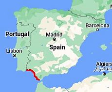 Costa de la Luz, where is located
In south-western Spain, we find another portion of the coast facing the Atlantic Ocean, the
Costa de la Luz (see
Huelva,
Rota,
Cádiz). However, here the climate is Mediterranean, ie with hot and sunny summers, although the influence of the ocean is felt, so the heat is generally not as sultry as on the Mediterranean coast; moreover, the sea is very cool even in the middle of summer (see below).
Interior
Meseta
The interior of Spain (see
Valladolid, León, Pamplona, Madrid, Salamanca, Zaragoza), is largely occupied by a
plateau, called meseta, which has an average altitude of 700/800 meters (2,300/2,600 feet) and has colder winters.
In
Madrid, the capital, located at the center of the plateau, 650 meters (2,100 ft) above sea level, in January the temperatures hover around 2 °C (36 °F) at night and around 11 °C (52 °F) during the day, but sometimes, during cold spells, it can freeze and snow.
On the plateau, the summer days are often scorching, with highs well above 30 °C (86 °F), but thanks to the altitude, nights are pretty cool, and on the other hand, moisture is low, so the heat is more bearable. In Madrid, the temperature easily reaches 35/36 °C (95/97 °F), and sometimes as high as 40 °C (104 °F).
On the plateau, precipitation is not abundant (though it is quite frequent in winter) because the bulk of the moisture coming from the ocean falls as rain on the Atlantic slopes. In Madrid, precipitation amounts to 455 mm (18 in) per year.

Andalusian plain
In the southern inland regions, in the lower areas of
Extremadura (see Badajoz) and in the interior of
Andalusia, winter is mild, with daily averages above 10 °C, furthermore, summer is very hot:
Seville and
Córdoba are actually the hottest cities in Europe, and this area is like a piece of Africa in Europe. In summer, the temperatures often reach 38/40 °C (100/104 °F), and sometimes up to 45 °C (113 °F).
In inland areas, especially in the south, in summer the sky is normally clear, and even in winter there are many sunny days.

In the southern cities located at an altitude higher than the plain, such as
Granada, located at 700 meters (2,300 feet) above sea level, the heat is tempered by the altitude, and nights are a bit cooler, but the days are often scorching.
Mountains
In the
mountain regions, the climate becomes progressively more cold and snowy with increasing altitude. In addition, at the same altitude the Pyrenees in the north are certainly colder than the
Sierra Nevada, but the latter is higher (Mount Mulhacen reaches nearly 3,500 meters or 11,500 ft), so, even though it is located at a southern latitude, usually it has enough snow for skiing (at high altitudes). It is possible to combine a morning's skiing with an afternoon on the coast in order to enjoy the balmy air of the nearby
Costa Tropical (Motril is about an hour and a half drive away).
There is also a mountainous range that crosses the Meseta, called
Central System, which is divided into various chains. The one closest to the capital is the
Sierra de Guadarrama, whose highest peak is Peñalara (2,428 meters or 7,966 feet), where you can ski in winter. To the south-west we find another chain, the
Sierra de Gredos, at no great distance from Madrid as well.
In
Puerto de Navacerrada, located at 1,858 meters (6,095 ft) above sea level, the average temperature ranges from 0 °C (32 °F) in January to 17.5 °C (63.5 °F) in July and August.
Here the landscape is green because of the higher amount of precipitation, 1,240 mm (49 in) per year, with a maximum between October and December of 160/180 mm (6.3/7.1 in) per month and a minimum in July and August of 25 mm (1 in) per month.

In the northern parts of
Navarre,
Aragon and
Catalonia, we find the chain of the
Pyrenees. The highest peak,
Pico de Aneto, 3,404 meters (11,168 feet) high, is located in Aragon. Above 2,700 meters (9,000 feet) glaciers are found.
In the North, we also find a mountain chain parallel to the coast, the
Cantabrian Mountains, whose highest peak,
Torre Cerredo, 2,648 meters (8,688 ft), belongs to the group of the
Picos de Europa.
Sea temperature
On the
north-west coast, for example in La Coruña, the
sea is always very cool, if not cold, and reaches a maximum of 19 °C (66 °F) in August.
On the
north coast, the sea temperature is still very cool, although it is a little higher. For example, in Bilbao it reaches 21.5 °C (70.5 °F) in August.
On the
coast of the Mediterranean Sea (see Barcelona, Balearic Islands,
Costa Blanca), the sea temperature is higher, and it is warm enough for swimming from July to September. In August, the sea temperature is 25 °C (77 °F) in Barcelona and 26 °C (79 °F) in Valencia.
On the
Costa del Sol (see Malaga), the sea is not as warm as in the rest of the Mediterranean because of the infiltration of Atlantic waters, and reaches 23 °C (73.5 °F) in August.
The sea in the small portion of the south-west overlooking the Atlantic Ocean (
Costa de la Luz) is even cooler. Here, the ocean temperature reaches only 22 °C (72 °F) in August and September, even though the weather is hot and sunny.
When to go
For a
beach holiday in Spain, the Northern Atlantic coast has a cool and fairly rainy summer. Moreover, the ocean temperature is quite cool even in this period, so the Mediterranean coast is preferable, and the best months are July and August.
For those wishing to
visit cities and go on excursions, summer is a great season on the Atlantic side (north and north-west), where you can find cool or mild weather, very different from the rest of Spain. The same can be said with regard to the mountainous areas, which are sunny but not too hot.
The rest of Spain, during summer, is hot, especially in July and August, and the heat can be difficult to bear, at least for those who don't like it. This applies especially to the Southern inland areas (see Seville, Córdoba), which are literally on fire, almost an outpost of Africa in Europe.
In general, the best seasons to visit the southern and central parts of Spain are
spring and autumn. In Madrid and Barcelona, for example, May, June and September are the best months (though in September, especially in Barcelona, the first autumn rains occur); in Seville, which is characterized by a particularly long and hot summer, the best months are May, October and April, when the maximum temperature can already exceed 25 °C (77 °F) with some ease.
In
winter, the weather in the southern coasts of Spain (
Costa de la Luz,
Costa del Sol,
Costa Blanca) is usually mild and sunny, so a stay in these areas can be pleasant even in this season (at least when compared to other parts of Europe).
For a
ski holiday, snow is more likely in the Pyrenees than in the mountainous areas of the center and south. As mentioned above, you can also ski north of Madrid, in the Sierra de Guadarrama, and further south in the Sierra Nevada. However, even though ski runs in the Sierra Nevada are located at very high altitudes, above 3,000 meters (10,000 ft), they are not always covered with snow, as we saw some years ago, when the World Ski Championships were postponed to the next year because of lack of snow.
What to pack
In
winter, for Madrid and the plateau, pack warm clothes such as a sweater, a down jacket, and a raincoat or umbrella. For the Northern Atlantic coast and Barcelona, bring warm clothes like a sweater, a jacket, a raincoat or umbrella. For the south coast: spring/autumn clothes are appropriate, including a sweater, a jacket, a raincoat or umbrella. For the high mountains: mountain clothing.
In
summer, for the Northern Atlantic coast, bring light clothing such T-shirts, but also a jacket, a sweatshirt or sweater and a raincoat or umbrella. For Madrid and the plateau, you will also need light clothing as well as a sun hat, a sweatshirt for cool evenings and possibly an umbrella. For Barcelona, the Balearic Islands and the South it is wise to pack light clothes, a sun hat, and a sweatshirt for the evening in June and September (but also in July and August in the Costa de la Luz and in Tarifa).
For the mountains, bring a sweatshirt, a jacket, hiking shoes, sunscreen and sunglasses.
See also the climate of the
Canary Islands.
Climate data - Spain
| Abaurregaina (1,050 meters) |
|---|
Abaurregaina, location on the map |
|---|
| Jan | Feb | Mar | Apr | May | Jun | Jul | Aug | Sep | Oct | Nov | Dec |
|---|
| Min temp. | -1 | -1 | 1 | 2 | 6 | 9 | 11 | 11 | 9 | 6 | 2 | 0 |
|---|
| Max temp. | 6 | 6 | 9 | 11 | 16 | 20 | 24 | 24 | 20 | 15 | 9 | 7 |
|---|
| Precip. | 155 | 135 | 135 | 155 | 125 | 85 | 65 | 60 | 105 | 145 | 180 | 160 |
|---|
|
|
|
|
|
| Alicante |
|---|
Alicante, location on the map |
|---|
| Jan | Feb | Mar | Apr | May | Jun | Jul | Aug | Sep | Oct | Nov | Dec |
|---|
| Min temp. | 7 | 7 | 9 | 11 | 14 | 18 | 21 | 22 | 19 | 15 | 11 | 8 |
|---|
| Max temp. | 17 | 18 | 19 | 21 | 24 | 28 | 30 | 31 | 28 | 25 | 21 | 18 |
|---|
| Precip. | 20 | 20 | 20 | 30 | 30 | 10 | 5 | 5 | 40 | 45 | 35 | 25 |
|---|
| Prec. days | 4 | 3 | 3 | 4 | 4 | 2 | 1 | 1 | 4 | 4 | 4 | 4 |
|---|
| Humidity | 64% | 63% | 63% | 62% | 63% | 62% | 65% | 66% | 66% | 68% | 66% | 66% |
|---|
| Day length | 10 | 11 | 12 | 13 | 14 | 15 | 14 | 14 | 12 | 11 | 10 | 10 |
|---|
| Sun hours | 6 | 6 | 7 | 8 | 9 | 11 | 11 | 10 | 8 | 7 | 6 | 5 |
|---|
| Sea temp | 15 | 14 | 14 | 16 | 18 | 22 | 25 | 26 | 25 | 22 | 19 | 16 |
|---|
| Barcelona |
|---|
Barcelona, location on the map |
|---|
| Jan | Feb | Mar | Apr | May | Jun | Jul | Aug | Sep | Oct | Nov | Dec |
|---|
| Min temp. | 6 | 6 | 8 | 10 | 14 | 18 | 21 | 21 | 18 | 14 | 9 | 6 |
|---|
| Max temp. | 14 | 15 | 16 | 19 | 22 | 26 | 28 | 29 | 26 | 22 | 18 | 15 |
|---|
| Precip. | 40 | 40 | 35 | 40 | 55 | 30 | 20 | 65 | 85 | 100 | 65 | 40 |
|---|
| Prec. days | 4 | 4 | 5 | 5 | 5 | 4 | 2 | 5 | 5 | 7 | 5 | 5 |
|---|
| Humidity | 72% | 71% | 72% | 72% | 73% | 72% | 71% | 71% | 72% | 75% | 72% | 72% |
|---|
| Day length | 10 | 11 | 12 | 13 | 15 | 15 | 15 | 14 | 12 | 11 | 10 | 9 |
|---|
| Sun hours | 5 | 6 | 6 | 7 | 8 | 9 | 10 | 9 | 7 | 6 | 5 | 4 |
|---|
| Sea temp | 13 | 13 | 13 | 14 | 17 | 20 | 23 | 25 | 23 | 20 | 17 | 15 |
|---|
| Bilbao |
|---|
Bilbao, location on the map |
|---|
| Jan | Feb | Mar | Apr | May | Jun | Jul | Aug | Sep | Oct | Nov | Dec |
|---|
| Min temp. | 5 | 5 | 7 | 8 | 11 | 14 | 16 | 16 | 14 | 12 | 8 | 6 |
|---|
| Max temp. | 14 | 14 | 17 | 18 | 21 | 24 | 26 | 27 | 25 | 22 | 17 | 14 |
|---|
| Precip. | 120 | 85 | 90 | 105 | 80 | 60 | 50 | 75 | 75 | 110 | 145 | 120 |
|---|
| Prec. days | 13 | 11 | 11 | 13 | 11 | 7 | 7 | 8 | 8 | 11 | 13 | 12 |
|---|
| Humidity | 74% | 71% | 68% | 70% | 71% | 73% | 74% | 73% | 73% | 72% | 75% | 74% |
|---|
| Day length | 9 | 11 | 12 | 14 | 15 | 15 | 15 | 14 | 12 | 11 | 10 | 9 |
|---|
| Sun hours | 3 | 3 | 4 | 5 | 5 | 6 | 6 | 6 | 5 | 4 | 3 | 3 |
|---|
| Sea temp | 13 | 12 | 13 | 13 | 15 | 18 | 21 | 22 | 20 | 18 | 16 | 14 |
|---|
| Cadiz |
|---|
Cadiz, location on the map |
|---|
| Jan | Feb | Mar | Apr | May | Jun | Jul | Aug | Sep | Oct | Nov | Dec |
|---|
| Min temp. | 10 | 10 | 12 | 14 | 17 | 20 | 22 | 22 | 20 | 18 | 13 | 11 |
|---|
| Max temp. | 16 | 17 | 19 | 20 | 23 | 25 | 28 | 28 | 26 | 24 | 20 | 17 |
|---|
| Precip. | 70 | 60 | 35 | 45 | 25 | 5 | 0 | 0 | 25 | 65 | 100 | 90 |
|---|
| Prec. days | 7 | 6 | 5 | 6 | 3 | 1 | 0 | 0 | 3 | 6 | 7 | 8 |
|---|
| Humidity | 75% | 74% | 71% | 69% | 70% | 69% | 68% | 70% | 71% | 74% | 74% | 76% |
|---|
| Day length | 10 | 11 | 12 | 13 | 14 | 15 | 14 | 14 | 12 | 11 | 10 | 10 |
|---|
| Sun hours | 6 | 7 | 7 | 8 | 10 | 11 | 11 | 11 | 8 | 7 | 6 | 5 |
|---|
| Sea temp | 16 | 16 | 16 | 17 | 18 | 20 | 22 | 23 | 22 | 21 | 19 | 17 |
|---|
| Granada (700 meters) |
|---|
Granada, location on the map |
|---|
| Jan | Feb | Mar | Apr | May | Jun | Jul | Aug | Sep | Oct | Nov | Dec |
|---|
| Min temp. | 2 | 3 | 5 | 8 | 11 | 15 | 18 | 18 | 14 | 11 | 6 | 4 |
|---|
| Max temp. | 13 | 15 | 18 | 20 | 25 | 30 | 34 | 34 | 28 | 22 | 17 | 14 |
|---|
| Precip. | 40 | 35 | 35 | 35 | 30 | 10 | 0 | 5 | 25 | 40 | 50 | 50 |
|---|
| Prec. days | 6 | 6 | 5 | 6 | 5 | 2 | 0 | 1 | 3 | 5 | 7 | 7 |
|---|
| Humidity | 72% | 68% | 60% | 57% | 51% | 43% | 37% | 41% | 51% | 62% | 71% | 75% |
|---|
| Day length | 10 | 11 | 12 | 13 | 14 | 15 | 14 | 14 | 12 | 11 | 10 | 10 |
|---|
| Sun hours | 5 | 6 | 7 | 8 | 9 | 11 | 12 | 11 | 8 | 7 | 5 | 5 |
|---|
|
| Ibiza |
|---|
Ibiza, location on the map |
|---|
| Jan | Feb | Mar | Apr | May | Jun | Jul | Aug | Sep | Oct | Nov | Dec |
|---|
| Min temp. | 8 | 8 | 9 | 12 | 15 | 18 | 22 | 22 | 20 | 16 | 12 | 9 |
|---|
| Max temp. | 16 | 16 | 18 | 20 | 23 | 27 | 30 | 30 | 28 | 24 | 20 | 17 |
|---|
| Precip. | 40 | 30 | 40 | 40 | 25 | 15 | 5 | 25 | 45 | 70 | 55 | 60 |
|---|
| Prec. days | 6 | 5 | 6 | 6 | 5 | 3 | 1 | 3 | 4 | 5 | 6 | 6 |
|---|
| Humidity | 76% | 74% | 73% | 73% | 73% | 72% | 72% | 73% | 73% | 76% | 74% | 77% |
|---|
| Day length | 10 | 11 | 12 | 13 | 14 | 15 | 15 | 14 | 12 | 11 | 10 | 10 |
|---|
| Sun hours | 5 | 6 | 7 | 8 | 9 | 10 | 11 | 10 | 8 | 7 | 5 | 5 |
|---|
| Sea temp | 15 | 14 | 15 | 16 | 18 | 21 | 24 | 26 | 24 | 22 | 19 | 16 |
|---|
| La Coruña |
|---|
La Coruña, location on the map |
|---|
| Jan | Feb | Mar | Apr | May | Jun | Jul | Aug | Sep | Oct | Nov | Dec |
|---|
| Min temp. | 8 | 8 | 9 | 10 | 12 | 14 | 16 | 17 | 15 | 13 | 11 | 9 |
|---|
| Max temp. | 14 | 14 | 16 | 17 | 19 | 21 | 22 | 23 | 22 | 20 | 16 | 14 |
|---|
| Precip. | 115 | 90 | 80 | 90 | 80 | 45 | 35 | 35 | 65 | 135 | 140 | 135 |
|---|
| Prec. days | 15 | 12 | 12 | 14 | 11 | 7 | 6 | 6 | 8 | 13 | 15 | 15 |
|---|
| Humidity | 80% | 76% | 73% | 74% | 74% | 74% | 75% | 75% | 75% | 79% | 82% | 81% |
|---|
| Day length | 9 | 11 | 12 | 14 | 15 | 15 | 15 | 14 | 12 | 11 | 10 | 9 |
|---|
| Sun hours | 3 | 4 | 5 | 6 | 6 | 7 | 8 | 8 | 6 | 5 | 3 | 3 |
|---|
| Sea temp | 13 | 13 | 13 | 13 | 14 | 16 | 18 | 19 | 18 | 17 | 15 | 14 |
|---|
| Madrid (685 meters) |
|---|
Madrid, location on the map |
|---|
| Jan | Feb | Mar | Apr | May | Jun | Jul | Aug | Sep | Oct | Nov | Dec |
|---|
| Min temp. | 2 | 3 | 5 | 7 | 11 | 16 | 19 | 19 | 15 | 10 | 5 | 3 |
|---|
| Max temp. | 11 | 13 | 16 | 19 | 24 | 30 | 33 | 33 | 28 | 21 | 15 | 11 |
|---|
| Precip. | 40 | 35 | 25 | 50 | 55 | 30 | 15 | 15 | 25 | 50 | 55 | 60 |
|---|
| Prec. days | 6 | 6 | 5 | 7 | 8 | 4 | 2 | 2 | 3 | 6 | 7 | 7 |
|---|
| Humidity | 69% | 60% | 53% | 52% | 46% | 37% | 33% | 35% | 43% | 56% | 66% | 70% |
|---|
| Day length | 10 | 11 | 12 | 13 | 14 | 15 | 15 | 14 | 12 | 11 | 10 | 9 |
|---|
| Sun hours | 5 | 6 | 7 | 8 | 9 | 11 | 12 | 11 | 8 | 7 | 5 | 4 |
|---|
|
| Malaga |
|---|
Malaga, location on the map |
|---|
| Jan | Feb | Mar | Apr | May | Jun | Jul | Aug | Sep | Oct | Nov | Dec |
|---|
| Min temp. | 8 | 8 | 10 | 11 | 14 | 18 | 21 | 21 | 19 | 15 | 11 | 9 |
|---|
| Max temp. | 17 | 18 | 20 | 22 | 25 | 29 | 31 | 32 | 28 | 24 | 20 | 18 |
|---|
| Precip. | 70 | 60 | 50 | 45 | 20 | 5 | 0 | 5 | 20 | 55 | 100 | 100 |
|---|
| Prec. days | 6 | 5 | 4 | 5 | 3 | 1 | 0 | 1 | 2 | 4 | 6 | 7 |
|---|
| Humidity | 70% | 68% | 68% | 64% | 61% | 57% | 59% | 60% | 64% | 71% | 71% | 73% |
|---|
| Day length | 10 | 11 | 12 | 13 | 14 | 15 | 14 | 14 | 12 | 11 | 10 | 10 |
|---|
| Sun hours | 6 | 6 | 7 | 8 | 9 | 11 | 11 | 10 | 8 | 7 | 6 | 5 |
|---|
| Sea temp | 16 | 15 | 15 | 16 | 17 | 20 | 22 | 23 | 22 | 20 | 18 | 16 |
|---|
| Merida (215 meters) |
|---|
Merida, location on the map |
|---|
| Jan | Feb | Mar | Apr | May | Jun | Jul | Aug | Sep | Oct | Nov | Dec |
|---|
| Min temp. | 4 | 5 | 8 | 9 | 12 | 16 | 17 | 17 | 15 | 12 | 8 | 6 |
|---|
| Max temp. | 14 | 17 | 20 | 21 | 27 | 33 | 35 | 35 | 32 | 25 | 18 | 15 |
|---|
| Precip. | 50 | 40 | 35 | 50 | 45 | 15 | 5 | 5 | 25 | 60 | 70 | 70 |
|---|
| Prec. days | 10 | 9 | 8 | 9 | 8 | 2 | 1 | 2 | 5 | 10 | 10 | 13 |
|---|
|
|
| Sun hours | 5 | 6 | 7 | 8 | 9 | 11 | 12 | 11 | 9 | 7 | 5 | 4 |
|---|
|
| Palma |
|---|
Palma, location on the map |
|---|
| Jan | Feb | Mar | Apr | May | Jun | Jul | Aug | Sep | Oct | Nov | Dec |
|---|
| Min temp. | 4 | 4 | 6 | 8 | 12 | 16 | 19 | 20 | 17 | 13 | 9 | 6 |
|---|
| Max temp. | 16 | 16 | 18 | 20 | 24 | 28 | 31 | 32 | 28 | 24 | 19 | 16 |
|---|
| Precip. | 35 | 30 | 30 | 35 | 25 | 15 | 5 | 15 | 50 | 70 | 50 | 45 |
|---|
| Prec. days | 5 | 5 | 5 | 5 | 4 | 2 | 1 | 2 | 4 | 6 | 6 | 6 |
|---|
|
|
| Sun hours | 5 | 6 | 7 | 8 | 9 | 11 | 11 | 10 | 7 | 7 | 5 | 5 |
|---|
|
| Puerto Navacerrada (1,858 meters) |
|---|
Puerto Navacerrada, location on the map |
|---|
| Jan | Feb | Mar | Apr | May | Jun | Jul | Aug | Sep | Oct | Nov | Dec |
|---|
| Min temp. | -3 | -3 | -1 | 0 | 4 | 9 | 12 | 12 | 8 | 4 | 0 | -2 |
|---|
| Max temp. | 3 | 3 | 6 | 8 | 13 | 19 | 23 | 23 | 17 | 11 | 6 | 4 |
|---|
| Precip. | 125 | 95 | 85 | 125 | 125 | 65 | 25 | 25 | 60 | 155 | 175 | 165 |
|---|
| Prec. days | 12 | 10 | 9 | 12 | 12 | 7 | 3 | 4 | 7 | 12 | 12 | 13 |
|---|
| Humidity | 78% | 76% | 69% | 70% | 64% | 57% | 46% | 47% | 57% | 70% | 77% | 79% |
|---|
| Day length | 10 | 11 | 12 | 13 | 14 | 15 | 15 | 14 | 12 | 11 | 10 | 9 |
|---|
| Sun hours | 4 | 4 | 5 | 6 | 7 | 10 | 11 | 10 | 7 | 5 | 3 | 3 |
|---|
|
| Santander |
|---|
Santander, location on the map |
|---|
| Jan | Feb | Mar | Apr | May | Jun | Jul | Aug | Sep | Oct | Nov | Dec |
|---|
| Min temp. | 8 | 8 | 9 | 10 | 12 | 15 | 17 | 18 | 16 | 14 | 10 | 9 |
|---|
| Max temp. | 13 | 13 | 15 | 16 | 18 | 20 | 22 | 23 | 22 | 20 | 16 | 14 |
|---|
| Precip. | 110 | 85 | 85 | 100 | 75 | 60 | 50 | 70 | 90 | 115 | 155 | 125 |
|---|
| Prec. days | 13 | 11 | 10 | 12 | 11 | 9 | 8 | 9 | 10 | 12 | 10 | 13 |
|---|
| Humidity | 74% | 74% | 73% | 74% | 76% | 77% | 77% | 77% | 76% | 75% | 75% | 74% |
|---|
| Day length | 9 | 11 | 12 | 14 | 15 | 15 | 15 | 14 | 12 | 11 | 10 | 9 |
|---|
| Sun hours | 3 | 4 | 4 | 5 | 6 | 6 | 6 | 6 | 5 | 4 | 3 | 2 |
|---|
| Sea temp | 13 | 12 | 13 | 13 | 15 | 17 | 20 | 21 | 20 | 18 | 15 | 14 |
|---|
| Seville |
|---|
Seville, location on the map |
|---|
| Jan | Feb | Mar | Apr | May | Jun | Jul | Aug | Sep | Oct | Nov | Dec |
|---|
| Min temp. | 6 | 7 | 9 | 11 | 14 | 18 | 20 | 20 | 18 | 15 | 10 | 7 |
|---|
| Max temp. | 17 | 19 | 22 | 24 | 28 | 33 | 36 | 36 | 32 | 27 | 21 | 17 |
|---|
| Precip. | 65 | 50 | 35 | 55 | 30 | 10 | 0 | 5 | 25 | 70 | 90 | 100 |
|---|
| Prec. days | 6 | 6 | 4 | 6 | 4 | 1 | 0 | 1 | 2 | 6 | 6 | 8 |
|---|
| Humidity | 75% | 69% | 63% | 59% | 53% | 48% | 45% | 46% | 54% | 63% | 71% | 76% |
|---|
| Day length | 10 | 11 | 12 | 13 | 14 | 15 | 14 | 14 | 12 | 11 | 10 | 10 |
|---|
| Sun hours | 6 | 7 | 7 | 8 | 9 | 11 | 11 | 11 | 8 | 7 | 6 | 5 |
|---|
|
| Tarifa |
|---|
Tarifa, location on the map |
|---|
| Jan | Feb | Mar | Apr | May | Jun | Jul | Aug | Sep | Oct | Nov | Dec |
|---|
| Min temp. | 10 | 10 | 12 | 13 | 15 | 18 | 19 | 20 | 19 | 17 | 13 | 12 |
|---|
| Max temp. | 15 | 15 | 17 | 18 | 20 | 23 | 25 | 25 | 24 | 21 | 18 | 16 |
|---|
| Precip. | 75 | 85 | 55 | 60 | 25 | 5 | 0 | 5 | 20 | 80 | 95 | 120 |
|---|
| Prec. days | 7 | 9 | 6 | 7 | 4 | 1 | 0 | 0 | 2 | 6 | 8 | 10 |
|---|
| Humidity | 77% | 79% | 78% | 77% | 78% | 79% | 80% | 81% | 81% | 81% | 79% | 78% |
|---|
| Day length | 10 | 11 | 12 | 13 | 14 | 15 | 14 | 13 | 12 | 11 | 10 | 10 |
|---|
| Sun hours | 5 | 6 | 6 | 7 | 9 | 9 | 10 | 10 | 8 | 7 | 6 | 5 |
|---|
| Sea temp | 16 | 16 | 16 | 16 | 18 | 20 | 22 | 23 | 22 | 20 | 18 | 17 |
|---|
| Valencia |
|---|
Valencia, location on the map |
|---|
| Jan | Feb | Mar | Apr | May | Jun | Jul | Aug | Sep | Oct | Nov | Dec |
|---|
| Min temp. | 5 | 6 | 8 | 10 | 14 | 18 | 21 | 21 | 18 | 14 | 9 | 6 |
|---|
| Max temp. | 16 | 17 | 19 | 21 | 25 | 28 | 31 | 31 | 28 | 25 | 20 | 17 |
|---|
| Precip. | 40 | 35 | 30 | 40 | 40 | 20 | 15 | 15 | 65 | 70 | 55 | 50 |
|---|
| Prec. days | 4 | 4 | 3 | 5 | 5 | 3 | 1 | 2 | 5 | 5 | 4 | 4 |
|---|
| Humidity | 67% | 64% | 63% | 62% | 62% | 61% | 64% | 65% | 67% | 68% | 66% | 69% |
|---|
| Day length | 10 | 11 | 12 | 13 | 14 | 15 | 15 | 14 | 12 | 11 | 10 | 9 |
|---|
| Sun hours | 6 | 6 | 7 | 8 | 9 | 10 | 11 | 9 | 8 | 7 | 6 | 5 |
|---|
| Sea temp | 14 | 13 | 14 | 15 | 17 | 21 | 24 | 26 | 24 | 21 | 18 | 15 |
|---|
| Valladolid (700 meters) |
|---|
Valladolid, location on the map |
|---|
| Jan | Feb | Mar | Apr | May | Jun | Jul | Aug | Sep | Oct | Nov | Dec |
|---|
| Min temp. | 1 | 1 | 3 | 5 | 8 | 12 | 14 | 15 | 12 | 8 | 4 | 2 |
|---|
| Max temp. | 8 | 11 | 15 | 18 | 22 | 27 | 31 | 30 | 26 | 19 | 12 | 9 |
|---|
| Precip. | 45 | 25 | 30 | 45 | 45 | 25 | 15 | 10 | 30 | 60 | 50 | 45 |
|---|
| Prec. days | 7 | 5 | 6 | 8 | 7 | 4 | 2 | 2 | 4 | 8 | 7 | 7 |
|---|
| Humidity | 83% | 71% | 63% | 63% | 58% | 49% | 43% | 44% | 52% | 65% | 78% | 84% |
|---|
| Day length | 10 | 11 | 12 | 13 | 15 | 15 | 15 | 14 | 12 | 11 | 10 | 9 |
|---|
| Sun hours | 4 | 6 | 7 | 8 | 9 | 11 | 12 | 11 | 8 | 6 | 4 | 3 |
|---|
|
| Zaragoza (250 meters) |
|---|
Zaragoza, location on the map |
|---|
| Jan | Feb | Mar | Apr | May | Jun | Jul | Aug | Sep | Oct | Nov | Dec |
|---|
| Min temp. | 3 | 3 | 6 | 8 | 12 | 16 | 18 | 18 | 15 | 11 | 6 | 3 |
|---|
| Max temp. | 11 | 14 | 18 | 20 | 25 | 30 | 33 | 32 | 27 | 22 | 15 | 11 |
|---|
| Precip. | 20 | 20 | 20 | 40 | 45 | 25 | 20 | 15 | 30 | 35 | 30 | 20 |
|---|
| Prec. days | 4 | 4 | 4 | 6 | 7 | 4 | 3 | 2 | 3 | 5 | 5 | 5 |
|---|
| Humidity | 76% | 68% | 61% | 58% | 55% | 50% | 48% | 50% | 56% | 65% | 73% | 78% |
|---|
| Day length | 10 | 11 | 12 | 13 | 15 | 15 | 15 | 14 | 12 | 11 | 10 | 9 |
|---|
| Sun hours | 4 | 6 | 7 | 8 | 9 | 10 | 11 | 10 | 8 | 6 | 5 | 4 |
|---|
|
See also the
temperatures month by month