Select units of measurement for the temperature and rainfall tables (metric or imperial).
Average weather, temperature, rainfall, sunshine
In Venezuela, the climate is
tropical, hoy all year round, at least at low altitudes, so the main differences are to be found in the seasonal rain pattern. In fact, there is a
dry season (which usually runs from mid-December to mid-April) and a
rainy season (usually, from late April to mid-November). The rainy season is also the most sultry and unpleasant.
However, the vastness of the territory and the presence of
mountain ranges and plateaus make the situation more complicated, so the climate is more or less rainy depending on area and more or less warm depending on altitude.
Venezuela is located just north of the Equator, so temperature fluctuations are limited, although the dry season, in which the
north-east trade winds prevail, is typically the coolest, albeit slightly.
The climate in detail
The coast
Along the coast, the weather is hot all year round, furthermore, the Caribbean Sea is pleasantly warm for swimming all year round. However, there are significant differences in rainfall.
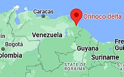 Orinoco delta, where is located
The eastern part is quite rainy, so much so that the huge
Orinoco Delta is covered with mangroves and rainforests. Here, about 2,000 millimeters (80 inches) of rain fall per year, and there is no real dry season, however, the least rainy period is February to March.
Proceeding west, precipitation drops to around 1,000 mm (40 in) per year or even below, as happens in
Guiria, where it's about 900 mm (35.5 in), and the period from January to May is quite dry.

Further to the west, in
Barcelona, only 650 mm (25.6 in) of rain fall per year, and the rainy season runs from June to September, while it rains very little from December to April.
In Barcelona, the maximum temperatures are 32.5/33.5 °C (90.5/92.5 °F) all year round.
The sun shines all year round, but especially in the dry period.
In the western part, the coast bordering the Gulf of Venezuela (see Maracaibo,
Coro) is particularly arid. In the short stretch of coast belonging to the Guajira Peninsula, we find the Venezuelan side of the
Guajira desert, where less than 300 millimeters (12 inches) of rain fall per year. North of Coro, and south of the isthmus connecting the mainland with the Paraguaná Peninsula, we find the
Medanos de Coro national park, where there is a small sand desert, with towering dunes as high as 40 meters (130 feet).
Maracaibo

In
Maracaibo, it almost never rains from December to April, and usually, the rainfall is not abundant even in the period from May to October, excluding September and October, when it exceeds 100 mm (4 in) per month. However, the rains are irregular from year to year, and sometimes they can be plentiful, although there is a decrease in the rains in July, which almost always occur.
In Maracaibo, it's hot all year round. From May to October, temperatures are slightly higher, while January and February (and also the Christmas period) are the least hot months (or better, the least sultry and therefore the most pleasant) as well as the sunniest of the year.
In Maracaibo too, the sun shines all year round, but especially in the dry period.

The islands
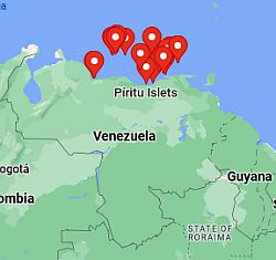 Islands of Venezuela, where they are located
The islands of the Caribbean Sea (
Isla Margarita,
Los Roques, Las Aves, La Orchila, La Blanquilla, Los Hermanos, Los Testigos, La Tortuga) are
arid, since the annual amount of precipitation is usually around 500 mm (20 in) and sometimes even below.
In the summer months, the prevailing winds, ie the southeast trade winds, blow from the mainland, in fact, the islands are part of the so-called
Leeward Antilles, where the rainy season is not so noticeable. However, from November to mid-February, some additional showers may occur because of the northeast trade winds, which blow in this period.

Hills and mountains
In the north of Venezuela, there are two mountain ranges, the
Cordillera de la Costa, parallel to the coast, where Caracas is located, and the
Cordillera de Mérida in the north-west, which is the Andean part of Venezuela.
Caracas

The capital,
Caracas, is located in a valley, about 15 km (9 miles) away from the sea. However, the city is isolated from the sea by the mountain range called
Cordillera de la Costa Central, in the part of the range where the
Ávila National Park is found. Moreover, the altitude where the city is located, about 900 meters (3,000 feet) above sea level, is sufficient to
temper the climate, making it warm but without excesses: the average temperature ranges from 21.5 °C (71 °F) in the coolest month (January) to 25 °C (77.5 °F) in the hottest month (May).
In fact, around this altitude, the so-called
tierras templadas (temperate lands) begin. The coolest period is from December to February, when the night temperature can drop to 12 °C (53.5 °F) and fog can appear in the coolest hours.
At
La Carlota air base, located at 835 meters (2,740 feet) of altitude, at the lowest point, and therefore the hottest, of Caracas, highs range from 27 °C (80.5 °F) in January to 30 °C (86 °F) in April and May. Other neighborhoods are located at 1,000/1,200 meters (3,300/4,000 ft) and have a slightly cooler climate.
From May to December, the rains are quite frequent, however, they occur in the form of showers and thunderstorms, which do not last long and leave space for the sun after not long. The period from January to mid-April, when the rains are scarce, is the driest. Total annual precipitation is about 835 mm (33 in).
The sun in Caracas shines quite often all year round; however, the sunniest period (albeit slightly) is from January to March.

In addition to the capital, there are other Venezuelan cities located at high elevations and whose climate is tempered by altitude.
Barquisimeto is located at 600 meters (2,000 feet), so the temperature is a bit higher than in Caracas: around 30/31 °C (86/88 °F) during the day and 20/21 °C (68/70 °F) at night. The city is located in the north-western arid region, in fact, it receives only 540 mm (21.2 in) of rainfall per year, which is also quite irregular, but most abundant from April to July.
Mérida

On the contrary,
Mérida is located at a higher altitude, 1,500 meters (5,000 feet), so it has a cooler climate, with average highs around 25/27 °C (77/81 °F).
The city is located in the south-west, in a valley, and a short distance from the highest mountain in Venezuela, Pico Bolìvar, which towers over the city with its 4,978 meters (16,332 feet). Here the rains are plentiful: 1,700 mm (67 in) per year, with a very rainy period from April to November and a fairly dry period from January to March.
The sun in Mérida shines more often in the dry winter period, while in the long rainy season, all in all it can be seen quite often (about half the time).

As we have already said, in Venezuela, there are also high
mountains, especially in the west, where there is a small portion of the Andes (the Cordillera de Mérida). In the aforementioned Pico Bolìvar, at almost 5,000 meters (16,400 ft) above sea level, there are three small glaciers. In fact, the average temperature is around freezing at 5,000 meters (16,400 ft). As previously mentioned, since the country lies at the Equator, temperatures are quite constant throughout the year. Usually, it gets cold above 3,000 meters (9,800 ft).
Savannah
Llanos
South of Caracas, there is a large flat area (called
El Llano or
Los llanos as plural), very interesting with respect to wildlife, and covered by
savanna (especially in the states of Apure and Guarico). From the point of view of the climate, this region is characterized by a sharp alternation between a dry and a rainy season. In this area, there are some national parks, such as Aguaro-Guariquito and Santos Luzardo.
San Fernando

The city of
San Fernando de Apure is located in this area. Lying in the plain, it is hot all year round, but because of the distance from the sea, in the last part of the dry season (which runs from mid-November to mid April), it becomes really hot: highs around 35/36 °C (95/97 °F) in March and April are the norm. But later, the rains arrive, which become intense from June to mid-September, when the weather conditions become fully tropical, with temperatures around 31/32 °C (88/90 °F) and high humidity.
Rainfall amounts to 1,500 mm (60 in) per year, but the dry season is too long to allow the forest to grow.
The sun in San Fernando shines very often in the dry period, while in the rainy season, the sky is often cloudy.
Although it is hot, the best time in this area is December-January, since from February to April it becomes even hotter.

To the east, in the area of
Ciudad Bolìvar and El Tigre (ie the southern part of the states of Anzoategui and Monagas, and the north of Bolìvar) there is an even more arid landscape, since precipitation is lower than 1,000 mm (40 in) per year, though the rainfall pattern is similar, with a rainy season from May to October.
Gran Sabana
Another area covered by the savanna is located in the south-east, in the plateau called
Gran Sabana, on the border with Guyana and Brazil. This plateau is part of the larger
Guiana Shield. In this area, there are also mountain peaks such as Mount Roraima and Kukenan Tepui.
Santa Elena

In
Santa Elena de Uairén, at 900 meters (3,000 feet) above sea level, the heat is less intense than in the plains because it's tempered by altitude.
The rains are quite abundant, since they amount to 1,800 mm (71 in) per year. The driest months are January and February, while the wettest period is from May to August.
Further to the west, but still in the state of Bolìvar, we find the huge Canaima National Park, which is generally more humid and has greener landscapes; here we find incredible waterfalls such as Salto Angel, 979 meters (3,211 feet) high, and Salto Kukenan, 674 meters (2,211 feet) high.

Amazon rainforest
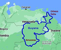 Venezuela, area occupied by the forest
In eastern and southern Venezuela, from the Orinoco Delta to the southern state of Amazonas (with the exception of the aforementioned Gran Sabana), in the macro-region known as
Venezuelan Guayana, where the Venezuelan part of the
Amazon rainforest is found, the climate is so rainy as to give life to
rainforests. Rainfall exceeds 2,000 mm (80 in) per year, and the relatively dry season (in which, however, the rains are not so rare) is from December to March (and from January to March in the Orinoco delta).

In
San Carlos de Río Negro, located in the extreme south of Venezuela, in the southern part of the state of Amazonas, near the border with Colombia, daytime temperatures range from around 30 °C in June to July, to around 32.5 °C (90.5 °F) from January to March.
In this southern area, rainfall is abundant all year round, however, there is a certain decrease from December to February.
Hurricanes
The
northernmost part of Venezuela, namely the Paraguanà Peninsula, the Paria Peninsula and the islands (but sometimes also the northern coast and the area of Caracas), is located in the southern end of the trajectory of
hurricanes, the tropical cyclones of the Atlantic, which means that it can sometimes be affected, though less often than the rest of the Antilles, which are further north.
The season when hurricanes form runs from June to November, but the phenomenon is more likely between August and October.
For example, these areas have been affected by the Hurricane 2 of July 1933 (or Trinidad Hurricane), by Tropical Storm Alma in August 1974, Hurricane Joan in October 1988, Tropical Storm Bret in August 1993, Hurricane Cesar in late July 1996, Hurricane Ivan in September 2004, and Hurricane Felix in September 2007.
Instead, in August 2021 the precursor to Hurricane Ida brought heavy rains to large areas of northern Venezuela.
When to go
Apart from the individual regions, whose climate has been already explained in detail above, if you want to take a trip throughout Venezuela, you can choose
January and February, also including the Christmas period at the end of December.
More generally, the dry period, or in any case the least rainy (
mid-December to mid-April), is preferable to the rainy season (late April to mid-November).
What to pack
For the
plain, in general, pack light clothing all year round. For the forest, tropics-friendly, loose-fitting clothing, light shirts and pants of natural fibers (cotton or linen) or synthetics that breathe, maybe with long sleeves for mosquitoes; a light sweater and a light raincoat for thunderstorms, which can be brought also in the savanna during the rainy season. For the coasts, although it's always hot, you can bring a light sweatshirt for the evening breeze, especially from December to February.
For
Caracas, you can add a sweatshirt for the evening, especially from December to February, and a raincoat or umbrella from May to December.
For
Mérida and the tierras templadas, pack light clothing, a sweater for the evening, a jacket for the evening especially from December to March; a raincoat or umbrella throughout the year, but especially from April to November.
For the
high mountains, pack warm clothes, such as a down jacket, a hat, gloves, a scarf, hiking shoes.
Climate data - Venezuela
| Barcelona |
|---|
|
| Jan | Feb | Mar | Apr | May | Jun | Jul | Aug | Sep | Oct | Nov | Dec |
|---|
| Min temp. | 22 | 22 | 23 | 24 | 25 | 24 | 23 | 24 | 24 | 24 | 23 | 23 |
|---|
| Max temp. | 32 | 33 | 33 | 34 | 34 | 33 | 33 | 33 | 34 | 33 | 33 | 33 |
|---|
| Precip. | 10 | 5 | 5 | 5 | 45 | 100 | 135 | 110 | 75 | 65 | 50 | 25 |
|---|
| Prec. days | 1 | 1 | 1 | 1 | 4 | 12 | 14 | 13 | 10 | 7 | 6 | 3 |
|---|
| Humidity | 71% | 71% | 68% | 69% | 70% | 76% | 77% | 77% | 75% | 75% | 75% | 72% |
|---|
| Day length | 12 | 12 | 12 | 12 | 13 | 13 | 13 | 12 | 12 | 12 | 12 | 12 |
|---|
| Sun hours | 9 | 10 | 10 | 8 | 8 | 7 | 8 | 8 | 8 | 9 | 9 | 9 |
|---|
| Sea temp | 26 | 25 | 25 | 26 | 26 | 27 | 27 | 28 | 28 | 28 | 28 | 27 |
|---|
| Caracas (835 meters) |
|---|
|
| Jan | Feb | Mar | Apr | May | Jun | Jul | Aug | Sep | Oct | Nov | Dec |
|---|
| Min temp. | 16 | 17 | 18 | 19 | 20 | 20 | 20 | 20 | 20 | 20 | 19 | 18 |
|---|
| Max temp. | 27 | 28 | 29 | 30 | 30 | 29 | 28 | 28 | 29 | 29 | 28 | 27 |
|---|
| Precip. | 20 | 10 | 15 | 35 | 80 | 100 | 110 | 110 | 105 | 110 | 95 | 45 |
|---|
| Prec. days | 5 | 2 | 2 | 4 | 8 | 13 | 13 | 13 | 12 | 11 | 11 | 8 |
|---|
| Humidity | 68% | 66% | 65% | 64% | 66% | 71% | 73% | 72% | 69% | 69% | 73% | 71% |
|---|
| Day length | 12 | 12 | 12 | 12 | 13 | 13 | 13 | 12 | 12 | 12 | 12 | 12 |
|---|
| Sun hours | 7 | 8 | 8 | 6 | 6 | 6 | 7 | 7 | 7 | 7 | 7 | 7 |
|---|
|
| Maracaibo |
|---|
|
| Jan | Feb | Mar | Apr | May | Jun | Jul | Aug | Sep | Oct | Nov | Dec |
|---|
| Min temp. | 23 | 24 | 24 | 25 | 25 | 25 | 25 | 25 | 25 | 25 | 24 | 24 |
|---|
| Max temp. | 33 | 33 | 33 | 34 | 34 | 34 | 34 | 35 | 34 | 33 | 32 | 33 |
|---|
| Precip. | 5 | 5 | 5 | 50 | 65 | 55 | 25 | 60 | 105 | 115 | 70 | 15 |
|---|
| Prec. days | 1 | 0 | 1 | 4 | 6 | 7 | 4 | 6 | 8 | 9 | 5 | 2 |
|---|
| Humidity | 70% | 68% | 68% | 72% | 75% | 72% | 68% | 71% | 73% | 77% | 77% | 72% |
|---|
| Day length | 12 | 12 | 12 | 12 | 13 | 13 | 13 | 12 | 12 | 12 | 12 | 12 |
|---|
| Sun hours | 10 | 10 | 9 | 9 | 8 | 8 | 10 | 9 | 9 | 9 | 9 | 9 |
|---|
| Sea temp | 26 | 26 | 26 | 26 | 27 | 28 | 27 | 28 | 29 | 29 | 28 | 27 |
|---|
| Mérida (1,500 meters) |
|---|
|
| Jan | Feb | Mar | Apr | May | Jun | Jul | Aug | Sep | Oct | Nov | Dec |
|---|
| Min temp. | 15 | 15 | 16 | 17 | 17 | 17 | 16 | 16 | 16 | 16 | 16 | 15 |
|---|
| Max temp. | 25 | 26 | 26 | 26 | 26 | 26 | 26 | 27 | 27 | 26 | 26 | 25 |
|---|
| Precip. | 40 | 50 | 50 | 170 | 230 | 160 | 130 | 140 | 190 | 260 | 190 | 80 |
|---|
| Prec. days | 8 | 8 | 11 | 16 | 20 | 16 | 18 | 18 | 19 | 19 | 16 | 10 |
|---|
| Humidity | 65% | 66% | 69% | 72% | 73% | 71% | 69% | 67% | 66% | 70% | 72% | 68% |
|---|
| Day length | 12 | 12 | 12 | 12 | 12 | 13 | 13 | 12 | 12 | 12 | 12 | 12 |
|---|
| Sun hours | 8 | 8 | 7 | 6 | 6 | 6 | 7 | 7 | 7 | 6 | 7 | 8 |
|---|
|
| San Carlos |
|---|
|
| Jan | Feb | Mar | Apr | May | Jun | Jul | Aug | Sep | Oct | Nov | Dec |
|---|
| Min temp. | 21 | 22 | 23 | 22 | 22 | 22 | 22 | 22 | 22 | 22 | 22 | 22 |
|---|
| Max temp. | 32 | 33 | 32 | 32 | 31 | 30 | 30 | 31 | 32 | 32 | 32 | 32 |
|---|
| Precip. | 180 | 175 | 210 | 300 | 390 | 410 | 365 | 300 | 260 | 210 | 215 | 185 |
|---|
| Prec. days | 16 | 13 | 16 | 19 | 25 | 24 | 24 | 21 | 19 | 17 | 17 | 15 |
|---|
|
| Day length | 12 | 12 | 12 | 12 | 12 | 12 | 12 | 12 | 12 | 12 | 12 | 12 |
|---|
| Sun hours | 6 | 6 | 5 | 5 | 5 | 5 | 5 | 6 | 6 | 6 | 6 | 6 |
|---|
|
| San Fernando |
|---|
|
| Jan | Feb | Mar | Apr | May | Jun | Jul | Aug | Sep | Oct | Nov | Dec |
|---|
| Min temp. | 23 | 23 | 24 | 25 | 24 | 24 | 24 | 24 | 24 | 24 | 24 | 23 |
|---|
| Max temp. | 34 | 35 | 36 | 35 | 34 | 32 | 31 | 31 | 32 | 33 | 33 | 33 |
|---|
| Precip. | 0 | 5 | 15 | 70 | 185 | 280 | 305 | 280 | 170 | 130 | 40 | 10 |
|---|
| Prec. days | 0 | 1 | 1 | 4 | 12 | 19 | 24 | 20 | 15 | 10 | 4 | 2 |
|---|
| Humidity | 70% | 66% | 64% | 67% | 73% | 81% | 84% | 84% | 82% | 80% | 78% | 73% |
|---|
| Day length | 12 | 12 | 12 | 12 | 12 | 13 | 12 | 12 | 12 | 12 | 12 | 12 |
|---|
| Sun hours | 10 | 10 | 9 | 7 | 6 | 5 | 6 | 6 | 7 | 8 | 9 | 9 |
|---|
|
| Santa Elena (900 meters) |
|---|
|
| Jan | Feb | Mar | Apr | May | Jun | Jul | Aug | Sep | Oct | Nov | Dec |
|---|
| Min temp. | 17 | 17 | 17 | 18 | 18 | 18 | 17 | 17 | 17 | 17 | 17 | 17 |
|---|
| Max temp. | 28 | 28 | 28 | 28 | 27 | 26 | 26 | 27 | 28 | 28 | 28 | 27 |
|---|
| Precip. | 75 | 60 | 95 | 155 | 235 | 275 | 250 | 205 | 130 | 140 | 110 | 90 |
|---|
| Prec. days | 9 | 7 | 8 | 11 | 17 | 19 | 19 | 17 | 11 | 10 | 10 | 10 |
|---|
|
|
| Sun hours | 7 | 7 | 7 | 7 | 6 | 6 | 7 | 7 | 8 | 8 | 8 | 7 |
|---|
|
See also the
temperatures month by month