Select units of measurement for the temperature and rainfall tables (metric or imperial).
Average weather, temperature, rainfall, sunshine
In most of Germany, there is a
moderately continental climate, characterized by cold winters, with average daily temperatures around freezing or slightly above, and warm summers.
Then, there is the
mountain climate in some massifs of south-central Germany and in the small portion of the Alps in the far south, which becomes of course colder as altitude increases.
Germany is a country located in the center of Europe, from 47 to 55 degrees north latitude.
The northernmost area (see Bremen, Hamburg, Lübeck, Rostock, Kiel) is slightly milder, but it's also rainier and windier because of the stronger influence of the Atlantic Ocean.
The
prevailing currents come from the Atlantic Ocean: those coming from the North Sea or the North Atlantic are cold, while those coming from the southwest, the Azores or the Iberian Peninsula, are mild or warm. More rarely, cold currents from the Arctic or Siberia can arrive in winter.
All in all, due to different types of currents, there is an
unstable climate, so that there can be cold or warm weather, as well as wind, fog, snow and thunderstorms.
Precipitation in Germany is generally not abundant at low altitude, but it is are frequent and well distributed throughout the year.
The least rainy area is the plain of the former GDR (see Berlin, Leipzig), where about 500-550 millimeters (20-21.5 inches) of rain (or snow) fall per year. In the center-south at low altitudes (see Frankfurt, Nuremberg), rainfall amounts to about 600 mm (23.5 in) per year. In the north-west facing the North Sea (see Hamburg, Kiel) it reaches 700-750 mm (27.5-29.5 in) per year, while in Rhineland-Westphalia (see Cologne, Düsseldorf) it ranges from 750 to 850 mm (29.5 to 33.5 in) per year, but with peaks of 1,150 mm (45.2 in) in the cities close to the hills (see
Wuppertal). In Bavaria, where summer rains are more abundant, it reaches 950 mm (37.5 in) in Munich.
In the mountains, precipitation is more abundant, and exceeds 1,500 mm (60 in) in the Harz massif, in the north, and in the Alps, in the south.
The
sun in Germany does not shine often. In winter, even when there is high pressure, a cloud layer often forms on the lowlands, while the sunniest period is from April to September.
On average, there are about 1,600 hours of sunshine per year in the north-west (see Hamburg and North Rhine-Westphalia), just over 1,700 hours in the north-east (see Berlin), while at most 1,800/1,850 hours are reached on the Baltic coast (see Rostock), in the south-west (see Frankfurt, Freiburg) and in Bavaria (see Munich). However, in Zugspitze, Germany's Alpine peak, there are 1,900 hours of sunshine per year.
The climate in detail
The seasons
In
winter, the average temperatures are around 2/3 °C (35/37 °F) in the west and the north, while they are around 0 °C (32 °F) in the east andin Bavaria.
Snowfalls are quite frequent though generally not abundant (except in Bavaria and in the mountains, and sometimes in the north-eastern plain). Snow is more common across the eastern belt, from Bavaria to the plains of the former GDR and up to the Baltic coast, while it is rarer in the western part, from the Rhine corridor to north-west exposed to the North Sea.
During
cold waves from Siberia (which, however, are becoming rarer due to global warming), temperatures can plunge to -15/-20 °C (-4/5 °F) in much of Germany, but these periods usually last for a few days in the north and central part, while they tend to last longer in Bavaria, where cold air stagnates with more ease. Snowfalls often occur after a cold wave, when the winds from the Atlantic begin to blow again. Later, with the persistence of the westerlies, the temperature rises further and the snow turns into rain.
When the
westerly winds blow more intensely, they can bring fairly mild weather even in winter, with highs around 10/12 °C (50/54 °F) in much of the country (except in mountainous areas).

The
spring, from March to May, is an unstable season.
On the one hand, currents from the northwest can bring
cold periods, so much so that in March, and sometimes up to mid-April, it can still snow. Late cold spells typical of spring can occur, which come directly from the north and pass quickly over the plains of Germany, and are felt especially in Bavaria, where they cause snow showers with a higher frequency.
In early April, short snowfalls with night frost are still possible, especially in Munich and in Bavaria. A German proverb says that the month of April "does whatever it pleases". In addition, some cold days, with highs around 10 °C (50 °F), can also occur in May, especially in the first half of the month.
On the other hand, currents from the southwest can bring
very mild or quite warm periods, with highs above 20 °C (68 °F) in April and above 25 °C (77 °F) in May. During the first warm days, thunderstorms can develop in the afternoon, especially in areas far from the sea.
In spring and autumn, in the Alps and in the valleys of Bavaria, the
Föhn, a southern warm wind that descends from the mountains and brings sudden increases in temperature, may blow, causing the rapid melting of snow, if present. This phenomenon is rarer in winter, when the wind usually doesn't blow from the south.
The German
summer, although it often brings pleasant temperatures, is not very sunny. In fact, in this season there are
cool and rainy days, when Atlantic disturbances move over the country. There are also periods in which high pressure brings good weather, and in which it can also get hot, but then
thunderstorms can break out in the afternoon.
Thunderstorms are less frequent in the northernmost region, which, however, is cooler and may experience more frequent rains due to disturbances coming from the Atlantic Ocean.
Sometimes, from late June to mid-August, there may be short
heat waves, which are becoming more frequent due to global warming, during which the temperature can reach 37/38 °C (99/100 °F), especially in the lowland areas, while the northern coasts and Bavaria are a little more sheltered.
In
autumn, in September, and sometimes in early October, temperatures are usually pleasant, but later the weather becomes progressively colder and rainy, with the first mists as well.
In addition, the wind can be strong, especially in the northern areas.
In November, the sun rarely shines; by mid-November, it is practically winter, and the first snowfalls are possible.
The coast
The northernmost part of Germany overlooks the North Sea and the Baltic Sea. Here, the weather is often
cold, humid, cloudy, and rainy.
In addition, this area is subject to
strong winds and sea storms, especially the west coast, overlooking the North Sea. Even if the temperatures are not very low, the wind increases the feeling of cold.
However, in winter, when a high pressure system is formed on nearby Scandinavia, there may be very cold periods, when the temperature can remain below freezing even during the day.
On the Baltic coast, the climate is similar to that of the North Sea coast, but the wind blows less frequently and less intensely, while in summer it rains a bit more rarely.
Owing to the wind,
Kiel, in Schleswig-Holstein, the Land south of Denmark, is considered as the German capital of sailing and kitesurfing.
In
Hamburg, which is not exactly on the coast, but halfway between the two coasts, the average temperature in January is of 2 °C (35.5 °F), that of July of 18.5 °C (65 °F).
On average, 775 millimeters (30.5 inches) of rain or snow fall per year, well distributed over the seasons, although there is a relative minimum from February to April and a maximum in summer.

The
sea in Germany is very cool even in summer. For instance, in
Rostock, on the Baltic Sea Coast, the water temperature range from 2.5 °C (36.5 °F) in February to 18 °C (64 °F) in August.
In winter, the North Sea is a bit warmer than the Baltic Sea, while in summer, the two seas have the same temperature. Along the coasts, a moderate breeze often blows from the north, that's why there are special beach chairs equipped with roof and back protection.

The west
The western part of Germany is the one having the mildest climate overall.
North Rhine-Westphalia
 North Rhine-Westphalia, where is located
In the north-west, the Land of North Rhine-Westphalia, which borders the Netherlands and Belgium, has a
climate influenced by the ocean. With an average January temperature of around 3 °C (37.5 °F), in winter, it is the mildest area of Germany, but it is also humid and sometimes windy. In summer, it is a bit warmer than the north coast, given the greater distance from the sea. The average in July is around 19 °C (66 °F).
Here we find cities such as
Essen,
Dortmund,
Cologne,
Dusseldorf,
Mönchengladbach,
Duisburg, and
Bonn.

In the
south-west, in the upper Rhine Valley (see Frankfurt, Mannheim, Karlsruhe,
Freiburg), the climate is less windy in winter, when fog can sometimes form, and a bit warmer in summer. Indeed, in summer this is the warmest area of Germany.
In
Frankfurt, the average temperature ranges from 2 °C (35.5 °F) in January to 20.5 °C (69 °F) in July.
Because of the greater distance from the sea, Frankfurt is not as rainy as Hamburg and the northwestern cities, in fact, 600 mm (23.5 in) of rain or snow fall per year.
The north-east
In the northeastern plain, in the former East Germany, the climate is
slightly more continental, and in cities such as Berlin,
Leipzig and
Dresden, the average January temperature is around freezing.
Because of the greater distance from the Atlantic Ocean, precipitation is not abundant, but sometimes, in winter, there can be quite heavy snowfalls due to cold air masses from the Baltic Sea.

In
Berlin, the capital, the average temperature ranges from 0.5 °C (33 °F) in January to 19.5 °C (67 °F) in July.
Precipitation amounts to 535 mm (21 in) per year, so it's not abundant, but it's well distributed over the seasons.
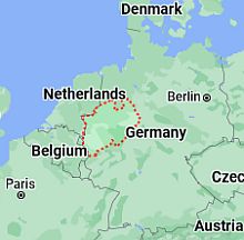
Bavaria
Bavaria, the southernmost region, experiences the coldest and longer winter, both because of the distance from the sea and of the altitude that rises above sea level.
In
Munich, at 500 meters (1,600 feet) above sea level, the average temperature in January is -0.5 °C (31 °F), and there are around 100 days per year with temperatures below freezing, at least at night. In summer, when the weather is good, the temperature can reach 30 °C (86 °F), but there are also cool and rainy days.

In Munich, 950 mm (37.5 in) of rain or snow fall per year. Here, the proximity to the Alps enhances the chances of summer thunderstorms, so there's an evident peak in the summer rainfall. In contrast, in winter and spring, when the north wind collides with the mountains, snowfall easily occurs.
Mountains
Alps
In southern Germany, we find a narrow strip occupied by the Alps. Here, winter gets colder with increasing altitude.
In summer, the temperature varies greatly depending on weather conditions, and it can be quite warm on sunny days (which tend to become overcast during the afternoon, with possible thunderstorms), at least at intermediate altitudes, while it decreases abruptly when Atlantic cold fronts, which as mentioned can affect Germany even in summer, arrive in the area.
In
Garmisch-Partenkirchen, a ski resort situated at 700 meters (2,300 feet) above sea level, the average temperature ranges from -1 °C (30 °F) in January to 17.5 °C (63.5 °F) in July.
Precipitation amounts to 1,365 mm (53.5 in) per year, therefore it is abundant, especially in summer, when heavy thunderstorms occur.

Near Garmisch, on
Zugspitze, the highest peak in Germany with its 2,962 meters (9,718 feet), it's cold even in summer. The average temperature is around -10.5 °C (13 °F) in winter and around 4 °C (39 °F) in summer. At the highest altitudes, snow can fall even in mid-summer.
As mentioned, Zugspitze is the sunniest place in Germany, at least in winter, in fact, it is often above the layer of clouds or mists that affects plains and valleys in this season. In contrast, clouds or fogs often form in summer, especially from noon onwards.
Harz
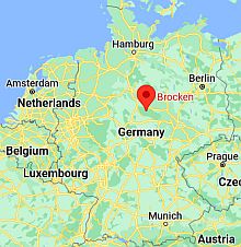 Brocken, where is located
In addition to the Alps in the south, we find the
Harz Mountains, which are isolated in the center-north of the country, and whose highest point is
Brocken, 1,141 meters (3,743 feet) high.
Here, the temperature at equal altitude is lower than in the Alps because of the higher latitude. The average ranges from -3 °C (26.5 °F) in January to 12 °C (53.5 °F) in July.
On average, 1,800 mm (70 in) of rain or snow fall per year, with a relative minimum in spring and a maximum in winter, when there are heavy snowfalls. Also, the summit is often foggy.
Further south, at the highest points of the
Thuringian Forest (Großer Beerberg and Großer Inselsberg), at almost 1,000 meters (3,300 feet) above sea level, the temperatures are similar, just barely higher in summer.
When to go
Although there is no season that might guarantee stable weather conditions, the best period to visit Germany goes from
mid-May to September, since the temperatures are generally pleasant. Sometimes there can be cool and rainy days, with highs around 15 °C (59 °F) or slightly higher, while in other periods, even hot days may occur, with highs around 30 °C (86 °F) or above, although nights remain pleasantly cool.
It should be noted that from late June to late August, there can also be short heat waves, with highs of 35 °C (95 °F) or more in the lowlands.
September is usually appreciated because of the lower chance of thunderstorms and because of the fall foliage that can be admired in this month, however, the days begin to shorten (on September 23, the day of the autumn equinox, both day and night last 12 hours).
In contrast, in
June, the days are very long, especially in the north.
Summer is a good time for hiking in the
mountains, though thunderstorms can break out in the afternoon. If you want to go on a ski holiday, it is worthwhile to recall that in February, the days are longer than in December and January, so you can take advantage of more daylight hours.
What to pack
In
winter: bring warm clothes, such as a sweater, a down jacket, a hat, gloves and a scarf, a raincoat or umbrella.
In
summer: bring light clothes, but also some clothes for spring and autumn, a jacket, a sweater or sweatshirt; a raincoat or umbrella.
Climate data - Germany
| Berlin |
|---|
|
| Jan | Feb | Mar | Apr | May | Jun | Jul | Aug | Sep | Oct | Nov | Dec |
|---|
| Min temp. | -2 | -2 | 0 | 4 | 8 | 12 | 14 | 14 | 10 | 6 | 2 | -1 |
|---|
| Max temp. | 3 | 5 | 9 | 15 | 20 | 23 | 25 | 25 | 20 | 14 | 8 | 4 |
|---|
| Precip. | 40 | 30 | 35 | 30 | 55 | 60 | 70 | 50 | 45 | 40 | 40 | 40 |
|---|
| Prec. days | 10 | 8 | 9 | 6 | 8 | 9 | 9 | 8 | 8 | 8 | 8 | 10 |
|---|
| Humidity | 87% | 80% | 74% | 64% | 62% | 60% | 63% | 62% | 71% | 83% | 87% | 88% |
|---|
| Day length | 8 | 10 | 12 | 14 | 16 | 17 | 16 | 15 | 13 | 10 | 9 | 8 |
|---|
| Sun hours | 2 | 3 | 4 | 6 | 7 | 8 | 7 | 7 | 5 | 4 | 2 | 2 |
|---|
|
| Brocken (1,141 meters) |
|---|
|
| Jan | Feb | Mar | Apr | May | Jun | Jul | Aug | Sep | Oct | Nov | Dec |
|---|
| Min temp. | -5 | -5 | -4 | 0 | 4 | 7 | 9 | 9 | 6 | 2 | -1 | -4 |
|---|
| Max temp. | -1 | -1 | 1 | 6 | 10 | 13 | 15 | 15 | 11 | 7 | 3 | 0 |
|---|
| Precip. | 205 | 145 | 150 | 90 | 125 | 115 | 160 | 135 | 155 | 165 | 165 | 205 |
|---|
| Prec. days | 21 | 18 | 17 | 12 | 14 | 13 | 15 | 14 | 14 | 17 | 20 | 22 |
|---|
| Humidity | 90% | 89% | 89% | 83% | 82% | 84% | 83% | 83% | 89% | 91% | 90% | 90% |
|---|
| Day length | 8 | 10 | 12 | 14 | 16 | 17 | 16 | 14 | 13 | 11 | 9 | 8 |
|---|
| Sun hours | 2 | 3 | 4 | 5 | 6 | 6 | 6 | 6 | 4 | 3 | 2 | 2 |
|---|
|
| Dusseldorf |
|---|
|
| Jan | Feb | Mar | Apr | May | Jun | Jul | Aug | Sep | Oct | Nov | Dec |
|---|
| Min temp. | 1 | 1 | 3 | 5 | 9 | 12 | 14 | 14 | 11 | 8 | 4 | 2 |
|---|
| Max temp. | 6 | 7 | 11 | 16 | 19 | 22 | 25 | 24 | 20 | 15 | 10 | 7 |
|---|
| Precip. | 60 | 55 | 55 | 50 | 65 | 65 | 75 | 80 | 60 | 60 | 65 | 70 |
|---|
| Prec. days | 12 | 11 | 10 | 9 | 10 | 10 | 11 | 10 | 10 | 10 | 12 | 13 |
|---|
| Humidity | 83% | 78% | 72% | 64% | 65% | 66% | 65% | 68% | 72% | 80% | 84% | 84% |
|---|
| Day length | 8 | 10 | 12 | 14 | 16 | 16 | 16 | 14 | 13 | 11 | 9 | 8 |
|---|
| Sun hours | 2 | 3 | 4 | 6 | 6 | 7 | 7 | 6 | 5 | 4 | 2 | 2 |
|---|
|
| Frankfurt |
|---|
|
| Jan | Feb | Mar | Apr | May | Jun | Jul | Aug | Sep | Oct | Nov | Dec |
|---|
| Min temp. | 0 | 0 | 2 | 6 | 10 | 13 | 15 | 15 | 11 | 7 | 3 | 1 |
|---|
| Max temp. | 5 | 7 | 11 | 16 | 20 | 24 | 26 | 26 | 21 | 15 | 9 | 6 |
|---|
| Precip. | 45 | 40 | 40 | 35 | 60 | 55 | 65 | 60 | 50 | 50 | 50 | 55 |
|---|
| Prec. days | 10 | 8 | 8 | 8 | 9 | 9 | 10 | 9 | 8 | 9 | 9 | 10 |
|---|
| Humidity | 83% | 78% | 70% | 61% | 63% | 63% | 60% | 63% | 71% | 82% | 86% | 87% |
|---|
| Day length | 9 | 10 | 12 | 14 | 16 | 16 | 16 | 14 | 12 | 11 | 9 | 8 |
|---|
| Sun hours | 2 | 3 | 4 | 6 | 7 | 8 | 8 | 7 | 5 | 3 | 2 | 1 |
|---|
|
| Garmisch (700 meters) |
|---|
|
| Jan | Feb | Mar | Apr | May | Jun | Jul | Aug | Sep | Oct | Nov | Dec |
|---|
| Min temp. | -6 | -5 | -2 | 2 | 6 | 10 | 11 | 11 | 7 | 4 | -1 | -5 |
|---|
| Max temp. | 3 | 6 | 10 | 14 | 18 | 22 | 23 | 23 | 19 | 15 | 8 | 3 |
|---|
| Precip. | 75 | 65 | 90 | 90 | 145 | 170 | 175 | 190 | 115 | 90 | 80 | 80 |
|---|
| Prec. days | 10 | 10 | 12 | 12 | 15 | 16 | 16 | 15 | 12 | 10 | 11 | 11 |
|---|
| Humidity | 86% | 81% | 76% | 72% | 74% | 76% | 76% | 79% | 83% | 84% | 87% | 89% |
|---|
| Day length | 9 | 10 | 12 | 14 | 15 | 16 | 16 | 14 | 12 | 11 | 9 | 8 |
|---|
| Sun hours | 2 | 4 | 5 | 6 | 6 | 6 | 6 | 6 | 5 | 4 | 3 | 2 |
|---|
|
| Hamburg |
|---|
|
| Jan | Feb | Mar | Apr | May | Jun | Jul | Aug | Sep | Oct | Nov | Dec |
|---|
| Min temp. | 0 | 0 | 1 | 4 | 8 | 11 | 14 | 13 | 10 | 6 | 3 | 0 |
|---|
| Max temp. | 4 | 5 | 9 | 14 | 18 | 21 | 23 | 23 | 19 | 14 | 8 | 5 |
|---|
| Precip. | 65 | 50 | 55 | 40 | 60 | 75 | 80 | 80 | 65 | 65 | 65 | 75 |
|---|
| Prec. days | 12 | 10 | 10 | 9 | 10 | 11 | 12 | 11 | 10 | 11 | 11 | 12 |
|---|
| Humidity | 86% | 82% | 76% | 70% | 69% | 69% | 71% | 73% | 78% | 84% | 89% | 88% |
|---|
| Day length | 8 | 10 | 12 | 14 | 16 | 17 | 16 | 15 | 13 | 10 | 9 | 8 |
|---|
| Sun hours | 1 | 2 | 4 | 6 | 7 | 7 | 7 | 6 | 5 | 4 | 2 | 1 |
|---|
|
| Munich (500 meters) |
|---|
|
| Jan | Feb | Mar | Apr | May | Jun | Jul | Aug | Sep | Oct | Nov | Dec |
|---|
| Min temp. | -3 | -3 | 0 | 3 | 8 | 11 | 13 | 13 | 8 | 5 | 1 | -2 |
|---|
| Max temp. | 3 | 5 | 9 | 14 | 19 | 22 | 24 | 24 | 19 | 14 | 7 | 4 |
|---|
| Precip. | 55 | 45 | 60 | 55 | 110 | 120 | 120 | 115 | 80 | 70 | 60 | 60 |
|---|
| Prec. days | 10 | 9 | 11 | 9 | 12 | 12 | 13 | 11 | 11 | 10 | 10 | 12 |
|---|
| Humidity | 85% | 81% | 74% | 68% | 69% | 70% | 69% | 71% | 78% | 84% | 88% | 87% |
|---|
| Day length | 9 | 10 | 12 | 14 | 15 | 16 | 16 | 14 | 12 | 11 | 9 | 8 |
|---|
| Sun hours | 2 | 3 | 5 | 6 | 7 | 8 | 8 | 8 | 6 | 4 | 2 | 2 |
|---|
|
| Rostock |
|---|
|
| Jan | Feb | Mar | Apr | May | Jun | Jul | Aug | Sep | Oct | Nov | Dec |
|---|
| Min temp. | 0 | 0 | 2 | 5 | 9 | 13 | 15 | 15 | 12 | 8 | 4 | 1 |
|---|
| Max temp. | 4 | 4 | 7 | 12 | 16 | 20 | 22 | 22 | 18 | 13 | 8 | 5 |
|---|
| Precip. | 45 | 35 | 40 | 35 | 50 | 70 | 70 | 70 | 55 | 50 | 45 | 50 |
|---|
| Prec. days | 10 | 9 | 8 | 8 | 9 | 10 | 10 | 10 | 9 | 10 | 10 | 10 |
|---|
| Humidity | 93% | 89% | 83% | 79% | 75% | 76% | 77% | 77% | 80% | 86% | 88% | 92% |
|---|
| Day length | 8 | 10 | 12 | 14 | 16 | 17 | 17 | 15 | 13 | 10 | 8 | 7 |
|---|
| Sun hours | 2 | 2 | 4 | 7 | 8 | 8 | 8 | 7 | 6 | 4 | 2 | 1 |
|---|
| Sea temp | 3 | 2 | 3 | 6 | 10 | 14 | 17 | 18 | 16 | 12 | 8 | 5 |
|---|
| Zugspitze (2,962 meters) |
|---|
|
| Jan | Feb | Mar | Apr | May | Jun | Jul | Aug | Sep | Oct | Nov | Dec |
|---|
| Min temp. | -13 | -14 | -12 | -9 | -4 | -1 | 1 | 1 | -2 | -4 | -9 | -12 |
|---|
| Max temp. | -7 | -8 | -6 | -3 | 1 | 5 | 6 | 7 | 3 | 1 | -4 | -6 |
|---|
| Precip. | 175 | 155 | 210 | 175 | 195 | 180 | 185 | 185 | 150 | 125 | 160 | 185 |
|---|
| Prec. days | 14 | 14 | 16 | 15 | 16 | 17 | 17 | 16 | 13 | 11 | 13 | 16 |
|---|
| Humidity | 69% | 72% | 76% | 81% | 86% | 87% | 87% | 85% | 82% | 74% | 74% | 72% |
|---|
| Day length | 9 | 10 | 12 | 14 | 15 | 16 | 16 | 14 | 12 | 11 | 9 | 8 |
|---|
| Sun hours | 4 | 5 | 5 | 6 | 6 | 5 | 6 | 6 | 6 | 6 | 4 | 4 |
|---|
|
See also the
temperatures month by month