Select units of measurement for the temperature and rainfall tables (metric or imperial).
Average weather, temperature, rainfall, sunshine
Kazakhstan, a vast country of Central Asia, has a
markedly continental climate, with freezing to cold winters, and warm to very hot summers.
Because of the huge distance from the oceans, the Asian continent cools down a lot in winter and heats up in summer. In addition, there are no obstacles that could protect the country from cold air masses of polar or Siberian origin in winter, while in summer, hot winds from the deserts of Iran and Afghanistan can blow.
As a result, both the highest and the lowest
records are noticeable. In fact, in the north, the temperature can reach -45 °C (-49 °F) in winter and 40 °C (104 °F) in summer, while in the south, it can go from -30 °C (-22 °F) in winter to 45 °C (113 °F) in summer.
The clash between different air masses can give rise to
strong winds and dust storms, especially in spring and in the south. In winter, on the other hand, the north wind can cause snow storms, but without great accumulation on account of the scarcity of precipitation.
The distance from the sea is also the cause of the
aridity of the climate; in fact, the country is almost entirely covered by steppes and deserts. The rainiest part in the vast lowlands is the north (roughly above the 50th parallel), where precipitation exceeds 300 millimeters (12 inches) per year, mainly because of afternoon thunderstorms that occur in summer, while in the center and south, it drops to around 150/200 mm (6/8 in) per year, and to as low as 100 mm (4 in) or so in the area of the Aral Sea.
So,
precipitation varies from north to south: the northern part, the rainiest one, is occupied by the Kazakh steppe (or Kirghiz steppe), while the central and southern regions are semi-desert or desert. However, precipitation rises again in the southeastern mountainous area.
Snow is quite common in the long winter months, but it's often light and not abundant. There are approximately a hundred days with snowfall each year on the plains of the far north (see Petropavl), about 60 days in the central region, and about 20 days in the southernmost part.
Index
The north
The north, which as mentioned is occupied by the steppe, receives a little more
precipitation than the center-south, because it can experience some thunderstorms in the summer.
In the north,
winter is long, from November to March, and freezing. Snowfall is frequent but usually light. The ground is usually snow-covered.
Temperatures remain below freezing for a few months (see
Petropavl, Pavlodar), where the January average even drops below -15 °C (5 °F), and is close to this value in the capital,
Astana. In general, at a given latitude, the winter temperature decreases as you proceed towards the east.
Summer in the north is pleasantly warm and quite sunny, although rain and thunderstorms are quite frequent.
The average in July is 20/21 °C (68/70 °F). However, heat waves can occur, during which the temperature can reach and exceed 37/38 °C (99/100 °F).
The sun shines quite often, although rain and thunderstorms are quite frequent.
Spring and autumn are very unstable seasons: in April and October, the temperature can drop below -15 °C (5 °F), but it can also exceed 25 °C (77 °F). The clash between different air masses can also cause strong winds.
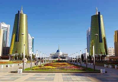 Astana
The center-south
In the center-south, winters are cold, although less so than in the north, while summers are hot or very hot. In the lowlands, the January average ranges from -10 °C to +1 °C (14 to 32 °F), while that of July ranges from around 23 °C to 28 °C (73.5 to 82.5 °F).
Except for the mountain ranges that are located along the eastern and southern borders, rainfall is very scarce and summers are dry, to the point that
vast deserts are found.
In the west of the country, the area of the
Caspian Sea is arid, and on the north coast, it's continental, with freezing winters and hot summers.
In
Atyrau (formerly Guryev), the average temperature ranges from -6 °C (21 °F) in January to 27.5 °C (81.5 °F) in July, when the days are often scorching.
Precipitation is definitely scarce: about 185 mm (7.5 in) of rain or snow fall per year.
In Atyrau, the sun is not very frequent in winter, while summer is very sunny.
In the northern part, the Caspian Sea is very cold in winter (and can freeze at times), but in July and August, it gets warm enough for swimming.
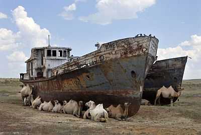
Aral Sea
 Aral, where it is located
East of the Caspian Sea, we find the area of the
Aral Sea, a former large lake, which was once fed by the Amu Darya and Syr Darya rivers, but has partly dried up in recent decades on account of the exploitation of the same rivers for agricultural purposes.
In
Aral (formerly Aralsk), which was a port before the lake shrank, the average temperature ranges from -10.5 °C (13 °F) in January to 27.5 °C (81.5 °F) in July. Winters are freezing, while summers are hot.
Here, the climate is desert, with around 135 mm (5.3 in) of rain or snow per year.
 Aralsk
About 200 kilometers (120 miles) east of the Aral Sea, we find the
Baikonur Cosmodrome, which used to host the Soviet space program and continues to operate under the Russian administration; here, the climate is similar to that of Lake Aral, that is, continental and desert.
Lake Balkash
In the east of the country, north of Almaty, in the area of
Lake Balkhash, a large lake, half fresh water and half saline, located at 340 meters (1,100 feet) above sea level, the climate is strongly continental, with an average temperature rainging from -13.5 °C (7.5 °F) in January to around 24 °C (75 °F) in July.
In
Balkhash, a city located on the north shore of the lake, in a year, only 140 mm (5.5 in) of rain or snow fall.
In Balkhash, the sun shines very often in summer, but it shines for a good number of hours also in winter.
More to the south, on the eastern coast of the Caspian Sea, the average temperature in January is 0 °C (32 °F) in
Aktau, and surpasses this value on the border with Turkmenistan. Here too, the climate is desert, with precipitation around 150 mm (6 in).
East of the Caspian Sea, the
Ustjurt Plateau is desert, with very little precipitation, about 100 mm (4 in). It is cold in winter (in January, the average temperature is around the freezing point or a few degrees below) and hot in summer, when average highs are around 35 °C (95 °F), but with peaks of scorching heat, around 45/47 °C (113/117 °F).
About 200 kilometers (120 miles) south-east of the Baikonur Cosmodrome, we find the offshoots of the
Kzyl Kum desert, which is very hot in summer.
In the far south, there are some cities located on hills, at the foot of the mountains, whose climate is affected by the altitude and proximity of the mountains.
Almaty (formerly Alma-Ata), the most populous city and the former capital of Kazakhstan, is located in the south-east, on the first slopes of the Tian Shan, and its altitude varies depending on district, however, the center is at 800 meters (2,600 feet) above sea level. Here, the average temperature ranges from -4 °C (25 °F) in January to 24.5 °C (76 °F) in July; there is often a large temperature range between night and day.
During
winter, there can be cold waves, sometimes prolonged, and the temperature can plunge to -30 °C (-22 °F) in the worst moments.
Because of the location at the foot of the mountains,
precipitation in Almaty is more abundant than in other parts of the country, and amounts to 675 mm (26.5 in) per year, with a maximum in spring, between March and May, when intense clashes between air masses occur, which is why spring is also a windy season.
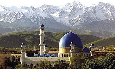 Almaty
Mountains
Most of Kazakhstan is occupied by plains, or at most, by hills at an altitude below 500 meters (1,600 feet).
In the north, however, are the Kokshetau Hills, which reach 947 meters (3,106 feet).
In the center we find a vast plateau, called
Kazakh Uplands or Kazakh Hummocks, whose altitude ranges from 700 to 1,000 meters (2,300 to 3,300 feet) south-east of Karaganda, and locally exceeds them: in the
Kyzylarai massif, the altitude reaches 1,565 meters (5,135 feet) with Mount Aksoran.
The only important
mountainous areas are the
Tian Shan in the south and south-east (towards the border with Kyrgyzstan and China), which also includes the highest peak of Kazakhstan,
Khan Tengri, 7,010 meters (22,999 feet) high, and the
Altai Mountains in the east (towards the border with China and Mongolia).
In the mountains, precipitation is more abundant than in the plains; in fact, they are often covered by forests, although it depends on slope exposure (for instance, the Charyn Canyon, closed among the mountains, is arid). At high altitudes, above 3,500 meters (11,500 ft), there are large glaciers.
When to go
Since there is no month that can be safe from either the cold or the heat, it's hard to find the
best time to visit Kazakhstan.
In the north and in Astana, in
summer, from June to August, the average temperature is pleasantly warm, but you cannot rule out a few heat waves with peaks around 40 °C (104 °F).
In the central and southern areas, where the heat is more common in summer, and it's scorching often enough, you may prefer
spring and autumn, in particular, from mid-April to mid-May, and the second half of September.
Around
mid-April and mid-September, you can usually find acceptable weather conditions throughout the country.
What to pack
In
winter: for Astana and the north, bring cold weather clothing, synthetic, thermal long underwear, a fleece, a parka, a wind jacket, gloves, and warm boots.
In the southernmost cities, like Shymkent and Aktau, you can wear lighter clothes during mild days, but it's useful to bring a scarf for the wind.
In
summer: for Astana and the north, bring light clothing, T-shirts, but also long pants, a light jacket and a sweater for the evening and for cooler days; a raincoat or umbrella.
For the vast southern plains (Ustjurt Plateau, Turkistan, Shardara), lightweight clothes, loose-fitting and made of natural fabric, a scarf or desert turban, and a sweatshirt for the evening.
For Almaty, Shymkent, the Caspian Sea, Baikonur, the Aral Sea, and Lake Balkash, bring light clothes, a sun hat, a scarf, and a sweatshirt for the evening.
In the southern mountains (Tian Shan), at middle altitudes, light clothes for the day, a sun hat, a sweatshirt and a jacket for the evening, and hiking shoes; above 3,000 meters (10,000 ft), a sweater and a warm jacket for the evening; above 4,000 meters (13,000 ft), a down jacket, a hat, gloves, and a scarf.
In the mountains of the north-east (Altai), the cold starts at lower altitudes: at 1,500 meters (5,000 feet) you already need clothes for spring and autumn, like a sweater and a jacket.
It's better for women to avoid shorts and miniskirts, especially outside the big cities.
Climate data - Kazakhstan
| Almaty (800 meters) |
|---|
|
| Jan | Feb | Mar | Apr | May | Jun | Jul | Aug | Sep | Oct | Nov | Dec |
|---|
| Min temp. | -8 | -6 | 0 | 7 | 12 | 16 | 19 | 17 | 12 | 5 | -1 | -6 |
|---|
| Max temp. | 0 | 3 | 10 | 18 | 23 | 28 | 30 | 30 | 24 | 17 | 8 | 2 |
|---|
| Precip. | 35 | 45 | 70 | 110 | 100 | 60 | 45 | 35 | 30 | 50 | 55 | 45 |
|---|
| Prec. days | 6 | 7 | 9 | 10 | 9 | 7 | 7 | 4 | 3 | 6 | 7 | 7 |
|---|
| Humidity | 81% | 80% | 71% | 60% | 56% | 50% | 45% | 44% | 47% | 61% | 76% | 82% |
|---|
| Day length | 9 | 10 | 12 | 13 | 15 | 15 | 15 | 14 | 12 | 11 | 10 | 9 |
|---|
| Sun hours | 4 | 4 | 5 | 6 | 8 | 9 | 9 | 9 | 8 | 6 | 4 | 3 |
|---|
|
| Aral |
|---|
|
| Jan | Feb | Mar | Apr | May | Jun | Jul | Aug | Sep | Oct | Nov | Dec |
|---|
| Min temp. | -14 | -14 | -4 | 6 | 13 | 18 | 20 | 18 | 11 | 3 | -4 | -11 |
|---|
| Max temp. | -7 | -5 | 5 | 18 | 27 | 33 | 34 | 33 | 25 | 16 | 4 | -4 |
|---|
| Precip. | 10 | 10 | 15 | 15 | 15 | 10 | 10 | 5 | 5 | 10 | 15 | 15 |
|---|
| Prec. days | 3 | 3 | 3 | 3 | 3 | 2 | 2 | 1 | 1 | 2 | 3 | 4 |
|---|
| Humidity | 83% | 81% | 72% | 50% | 41% | 35% | 35% | 35% | 41% | 55% | 75% | 82% |
|---|
| Day length | 9 | 10 | 12 | 14 | 15 | 16 | 15 | 14 | 12 | 11 | 9 | 9 |
|---|
| Sun hours | 4 | 6 | 6 | 9 | 11 | 12 | 12 | 12 | 10 | 7 | 5 | 3 |
|---|
|
| Astana (345 meters) |
|---|
|
| Jan | Feb | Mar | Apr | May | Jun | Jul | Aug | Sep | Oct | Nov | Dec |
|---|
| Min temp. | -19 | -18 | -10 | 1 | 8 | 14 | 15 | 13 | 7 | 1 | -9 | -16 |
|---|
| Max temp. | -10 | -9 | -1 | 12 | 21 | 26 | 27 | 26 | 19 | 10 | -1 | -8 |
|---|
| Precip. | 20 | 15 | 20 | 20 | 35 | 40 | 55 | 30 | 20 | 25 | 30 | 25 |
|---|
| Prec. days | 6 | 5 | 5 | 5 | 7 | 7 | 8 | 5 | 4 | 6 | 7 | 7 |
|---|
| Humidity | 78% | 77% | 79% | 64% | 54% | 53% | 59% | 57% | 59% | 68% | 80% | 79% |
|---|
| Day length | 8 | 10 | 12 | 14 | 16 | 16 | 16 | 14 | 13 | 11 | 9 | 8 |
|---|
| Sun hours | 3 | 5 | 6 | 8 | 10 | 11 | 11 | 9 | 8 | 4 | 3 | 3 |
|---|
|
| Atyrau |
|---|
|
| Jan | Feb | Mar | Apr | May | Jun | Jul | Aug | Sep | Oct | Nov | Dec |
|---|
| Min temp. | -9 | -9 | -2 | 7 | 14 | 19 | 21 | 19 | 13 | 6 | -2 | -7 |
|---|
| Max temp. | -3 | -1 | 7 | 17 | 25 | 31 | 34 | 32 | 25 | 16 | 5 | -1 |
|---|
| Precip. | 15 | 10 | 15 | 15 | 30 | 15 | 10 | 10 | 10 | 20 | 15 | 15 |
|---|
| Prec. days | 4 | 3 | 3 | 4 | 4 | 3 | 2 | 2 | 2 | 3 | 4 | 4 |
|---|
| Humidity | 84% | 80% | 74% | 58% | 50% | 45% | 45% | 46% | 52% | 64% | 80% | 84% |
|---|
| Day length | 9 | 10 | 12 | 14 | 15 | 16 | 16 | 14 | 12 | 11 | 9 | 9 |
|---|
| Sun hours | 3 | 5 | 5 | 8 | 10 | 11 | 11 | 10 | 9 | 6 | 4 | 2 |
|---|
|
| Balkhash (340 meters) |
|---|
|
| Jan | Feb | Mar | Apr | May | Jun | Jul | Aug | Sep | Oct | Nov | Dec |
|---|
| Min temp. | -18 | -16 | -7 | 4 | 11 | 17 | 18 | 16 | 9 | 2 | -6 | -14 |
|---|
| Max temp. | -9 | -6 | 3 | 15 | 22 | 28 | 29 | 28 | 21 | 13 | 3 | -5 |
|---|
| Precip. | 15 | 10 | 15 | 10 | 15 | 15 | 15 | 5 | 5 | 10 | 15 | 15 |
|---|
| Prec. days | 5 | 3 | 3 | 3 | 3 | 3 | 3 | 2 | 1 | 2 | 4 | 4 |
|---|
| Humidity | 79% | 78% | 74% | 56% | 51% | 46% | 49% | 47% | 47% | 60% | 75% | 79% |
|---|
| Day length | 9 | 10 | 12 | 14 | 15 | 16 | 15 | 14 | 12 | 11 | 9 | 9 |
|---|
| Sun hours | 5 | 6 | 7 | 9 | 11 | 12 | 12 | 12 | 10 | 7 | 5 | 4 |
|---|
|
| Shymkent (500 meters) |
|---|
|
| Jan | Feb | Mar | Apr | May | Jun | Jul | Aug | Sep | Oct | Nov | Dec |
|---|
| Min temp. | -4 | -2 | 3 | 8 | 13 | 17 | 19 | 18 | 13 | 7 | 2 | -3 |
|---|
| Max temp. | 5 | 7 | 14 | 20 | 26 | 32 | 34 | 34 | 28 | 20 | 12 | 6 |
|---|
| Precip. | 80 | 90 | 80 | 75 | 55 | 25 | 10 | 5 | 10 | 40 | 75 | 75 |
|---|
| Prec. days | 10 | 10 | 9 | 9 | 7 | 4 | 2 | 1 | 1 | 4 | 7 | 9 |
|---|
| Humidity | 78% | 74% | 65% | 61% | 49% | 37% | 32% | 30% | 34% | 51% | 70% | 79% |
|---|
| Day length | 10 | 11 | 12 | 13 | 15 | 15 | 15 | 14 | 12 | 11 | 10 | 9 |
|---|
|
|
| Turkistan |
|---|
|
| Jan | Feb | Mar | Apr | May | Jun | Jul | Aug | Sep | Oct | Nov | Dec |
|---|
| Min temp. | -7 | -5 | 2 | 9 | 14 | 19 | 20 | 19 | 12 | 5 | -1 | -6 |
|---|
| Max temp. | 2 | 6 | 14 | 22 | 29 | 35 | 37 | 35 | 29 | 21 | 11 | 4 |
|---|
| Precip. | 25 | 25 | 30 | 25 | 20 | 10 | 5 | 0 | 0 | 10 | 25 | 25 |
|---|
| Prec. days | 5 | 5 | 4 | 4 | 3 | 2 | 0 | 0 | 0 | 2 | 5 | 5 |
|---|
| Humidity | 79% | 73% | 63% | 50% | 43% | 33% | 34% | 32% | 36% | 51% | 69% | 79% |
|---|
| Day length | 9 | 10 | 12 | 13 | 15 | 15 | 15 | 14 | 12 | 11 | 10 | 9 |
|---|
| Sun hours | 4 | 6 | 6 | 8 | 11 | 13 | 13 | 12 | 10 | 8 | 6 | 4 |
|---|
|
See also the
temperatures month by month