Select units of measurement for the temperature and rainfall tables (metric or imperial).
Average weather, temperature, rainfall, sunshine
In Kyrgyzstan, a mountainous country of central Asia, the climate is generally
continental, and varies according to the altitude. The winters are cold, often freezing, and the summers warm and sunny, sometimes hot at relatively low altitudes, but cooler in the high mountains.
Precipitation is moderate in the west, while the center-east of the country is arid, and even desert at lower elevations.
From the vast deserts of the neighbouring countries,
strong winds able to bring sandstorms can blow.
The climate in detail
Hills
In Kyrgyzstan, there are no plains, and the lowest areas are located between 500 and 1,000 meters (1,600 and 3,300 feet) of altitude.
In the north, in the
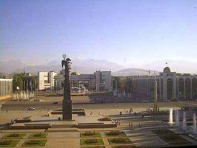
Chüy River valley, located between the Kyrgyz Alatau mountains to the south and the Kazakh steppes to the north, between 600 and 900 meters (2,000 and 2,900 feet) above sea level, we find the capital,
Bishkek (formerly Frunze), as well as other cities such as Tokmok, Kant and Kara-Balta.
Here, the climate is
continental, with cold winters and hot summers. The average temperature in January is around -2 °C (28.5 °F), that of July is around 25 °C (77 °F).
Precipitation is not abundant, since it amounts to around 450 millimeters (17.5 inches) per year. The driest season is summer, while the rainiest period is between March and May, due to the clashes of air masses typical of spring.
In
winter, fog can form during periods of stable weather.
From the mountains located south, a
warm, dry wind can blow in all seasons, which in winter can raise the temperature up to 15 °C (59 °F) and more.
On the other hand, there are no obstacles to
cold air masses coming from the north, which can bring intense cold waves. The temperature drops to -15 °C (5 °F) almost every year, and in the past it has even dropped below -30 °C (-22 °F).
Summer is hot and sunny, with dry air and lively breezes in the afternoon, and with rare showers. There can be heat waves, during which the temperature reaches 38/40 °C (100/104 °F).
 Osh
Osh, Kyrgyzstan's second largest city, is located in the south-west at 1,000 meters (3,300 feet) of altitude, and
Jalal-Abad, the third, is at no great distance and at 750 meters (2,450 ft). In these cities, the temperature is similar to that of Bishkek, with slight differences due to the altitude, but the more southern location, and especially the presence of mountain ranges to the north, make them less vulnerable to cold spells, however, glacial days are possible here as well.
Mountains
Kyrgyzstan is crossed by several mountain ranges: the aforementioned Kyrgyz Alatau in the north, the foothills of Pamir and Alay in the south-west, while in the center and east, we find the various branches of the
Tien Shan, whose highest point is Jengish Chokusu (formerly Pik Pobedy), on the border with China, 7,439 meters (24,406 feet) high.
In the vast mountainous areas, winters are very cold, while summers are cold to relatively warm depending on the altitude.
The mountainous areas of Kyrgyzstan are
arid, especially, as mentioned, the central-eastern one, in fact there are valleys and desert plateaus, plus some forests at high altitudes. At the highest altitudes, above 4,000 meters (13,000 ft), in the other hand, there are
vast glaciers, which feed rivers, which in turn flow in the deep valleys between the mountains.
In
Naryn, 2,000 meters (6,500 feet) above sea level, the daily average temperature ranges from -14 °C (7 °F) in January to 18 °C (64.5 °F) in July and August. Throughout the year, 340 mm (13.5 in) of rain or snow fall, so the climate is quite arid. There is a minimum in autumn and winter, when precipitation is very scarce, and a maximum in spring and early summer, between April and July.

In the north-east, at 1,600 meters (5,250 feet), we find Lake
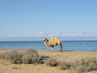
Ysyk-Köl (or Issyk Kul, the "warm lake"), which is large enough to create a relatively mild micro-climate. The lake almost never freezes because it's salty. Winter temperatures, though cold, are similar to those of Bishkek, located at a lower altitude. Summer is pleasantly warm, with highs around 23/25 °C (73/77 °F) and cool nights; in this season, locals swim in the lake.
The main city in the area is
Karakol, located at 1,750 meters (5,750 ft) above sea level, not far from the lake.
When to go
If you want to visit the major cities of Kyrgyzstan and the lowlands, the best times are
spring and autumn, especially the periods of April-May and September-October.
Considering the climate variability and the diurnal temperature range, it must be said that it can be cold at night in April and October, and it can get hot during the day in May and September: you can therefore choose the intermediate periods (mid-April to mid-May and mid-September to mid-October).
If you want to visit high altitude areas,
summer is the recommended season, from May to September at around 2,000 meters (6,500 feet) and from June to August above 3,000 meters (9,800 ft), since it is the only period when the temperature rises above freezing.
What to pack
In
winter: in Bishkek and the major cities, under a thousand meters (3,300 feet), bring warm clothes, such as a sweater, a down jacket, a hat, a scarf, and gloves; you will need some lighter clothes for mild days, and a scarf for the wind. In the Tien Shan and in high mountains, bring cold weather clothing, synthetic, thermal long underwear, a fleece, a parka, a wind jacket, and warm boots.
In
summer: in Bishkek and the major cities, under a thousand meters (3,300 feet), bring light clothes, a sun hat, a scarf for the wind, and a sweatshirt for the evening. In the mountains, at intermediate altitudes, bring light clothes for the day, a sun hat, a sweatshirt and a light jacket for the evening, and hiking shoes; above 3,000 meters (9,800 ft), add a sweater and a jacket for the evening; above 4,000 meters (13,000 ft), bring a down jacket, a hat, gloves, and a scarf.
It's better for women to avoid shorts and miniskirts.
Climate data - Kyrgyzstan
| Bishkek (760 meters) |
|---|
|
| Jan | Feb | Mar | Apr | May | Jun | Jul | Aug | Sep | Oct | Nov | Dec |
|---|
| Min temp. | -7 | -5 | 1 | 7 | 11 | 16 | 18 | 17 | 12 | 6 | 0 | -5 |
|---|
| Max temp. | 3 | 5 | 12 | 19 | 24 | 30 | 32 | 31 | 26 | 18 | 10 | 5 |
|---|
| Precip. | 25 | 30 | 50 | 75 | 65 | 35 | 20 | 10 | 15 | 45 | 45 | 25 |
|---|
| Prec. days | 6 | 6 | 9 | 9 | 8 | 4 | 3 | 2 | 3 | 6 | 7 | 6 |
|---|
| Humidity | 75% | 75% | 71% | 63% | 60% | 50% | 46% | 45% | 48% | 62% | 70% | 75% |
|---|
| Day length | 9 | 11 | 12 | 14 | 15 | 15 | 15 | 14 | 12 | 11 | 10 | 9 |
|---|
| Sun hours | 4 | 5 | 5 | 6 | 8 | 10 | 11 | 10 | 9 | 6 | 5 | 4 |
|---|
|
| Naryn (2,040 meters) |
|---|
|
| Jan | Feb | Mar | Apr | May | Jun | Jul | Aug | Sep | Oct | Nov | Dec |
|---|
| Min temp. | -19 | -16 | -6 | 2 | 6 | 9 | 11 | 10 | 6 | 1 | -6 | -16 |
|---|
| Max temp. | -9 | -5 | 4 | 14 | 19 | 22 | 25 | 25 | 22 | 14 | 5 | -6 |
|---|
| Precip. | 10 | 15 | 20 | 35 | 65 | 65 | 45 | 25 | 15 | 15 | 15 | 15 |
|---|
| Prec. days | 3 | 6 | 6 | 7 | 9 | 10 | 7 | 4 | 3 | 3 | 3 | 3 |
|---|
|
|
| Sun hours | 4 | 5 | 6 | 7 | 8 | 10 | 10 | 10 | 9 | 7 | 5 | 4 |
|---|
|
See also the
temperatures month by month