Select units of measurement for the temperature and rainfall tables (metric or imperial).
Average weather, temperature, rainfall, sunshine
In Jordan, a country in the Middle East, the climate is usually
subtropical arid or semi-arid, with quite mild, relatively rainy winters, partly cooled by the altitude, and hot to very hot, sunny summers, partly tempered by the same altitude.
In fact, most of Jordan is occupied by a
plateau, which has an altitude between 700 and 1,200 meters (2,300 and 3,900 feet). The plateau is interrupted only in the west by the narrow
Jordan River Valley, which goes even below sea level and has higher temperatures, with mild winters and very hot summers.
In the south, there are also mountains, culminating in
Jabal Umm Dami, 1,854 meters (6,083 feet) high.
In Jordan,
rainfall is generally scarce, and occur from November to April, with a maximum in winter, between December and February. Total annual rainfall ranges between 250 and 450 millimeters (10 to 18 inches) in the north-western area, and it decreases to a desert level, below 100 mm (4 in) per year in the rest of the country, that is, in the south-central Jordan Valley, and in the vast areas of the north-east and the south-east, which are offshoots of the Syrian and Arabian deserts.
Therefore, most of the country is
desert, while the north-western area is
semi-desert, and some parts of it, located above 1,000 meters (3,300 feet) are even quite green.
From November to March,
rains more intense than usual and concentrated in time can sometimes occur, and in these cases, the river beds, called
wadis, which remain dry most of the year, can suddenly fill up and make it difficult to get around.
Sometimes, Jordan can be affected by a strong and hot
wind blowing from the Egyptian Desert, which brings dust and sand storms; this happens more easily in spring and autumn.
The climate in detail
Plateau
Northwest
The northwest of Jordan, occupied by the
Transjordan plateau, the only area that receives moderate rainfall in winter, has a climate with some Mediterranean characteristics, that is, mild and quite rainy in winter, hot and sunny in summer.
In this area we find the capital,
Amman. The city is located at around 800 meters (2,600 feet) above sea level, and has an average temperature ranging from 8.5 °C (47 °F) in January to around 27 °C (80.5 °F) in July and August. Here, 245 millimeters (9.5 inches) fall per year, with a maximum of 60/65 mm (2.4/2.6 in) per month in January and February, while basically it never rains from May to October.
During
winter, every now and then, cold air masses from the north can arrive here and cause snowfalls, especially in the western suburbs of the city, which are located at a slightly higher altitude, around 1,000 meters (3,300 feet), and the temperature at night can drop a few degrees below freezing (0 °C or 32 °F).
In
Summer, there can be scorching days, with peaks of 37/40 °C (99/104 °F) from May to September, and more likely in July and August.
 Irbid
Irbid, in the extreme north-west, is even more rainy than Amman; in fact, precipitation reaches 450 mm (17.5 in) per year, but the pattern is the same, with a maximum in winter and a dry summer. Irbid is located at 600 meters (2,000 feet) above sea level, so it is slightly warmer than Amman.
North-east
As mentioned, in the north-east of the country (see
Ruwaished), where the altitude ranges from 700 to 900 metres (2,300 to 2,900 ft), the climate is
desert. Winter temperatures are similar to those of Amman, with possible snowfalls and night frosts, while summer is hotter, and despite the altitude, daytime temperatures around 39 °C (102 °F) are normal, with peaks of 45 °C (113 °F).
Rainfall does not even reach 100 millimeters (4 inches) per year, and it's therefore rare and sporadic even in winter.
In the desert too, the sun shines all year round, but especially in summer.
Center-south
The central and southern part of the plateau, like the northeast, has a
desert climate.
The famous archaeological site of
Petra is located in the south, at 900 meters (3,000 feet) above sea level. Its temperatures are slightly higher than those of Amman. Here too, however, in winter the temperature can drop below freezing, while in summer, it can reach 40 °C (104 °F).
Although the climate is arid, in winter it can sometimes snow, moreover, there can occasionally be heavy rains that can fill the
wadis, the beds of ephemeral rivers, which remain dry for much of the time. For example, at the end of December 2022, the Petra area was flooded.

Ma'an
The closest city,
Ma'an, has a similar climate to Petra, though a bit cooler because it is located a bit higher, at 1,100 meters (3,600 ft) above sea level.
In Ma'an too, rainfall does not reach 100 millimeters (4 inches) per year, and it's rare and sporadic even in winter.
Here too, the sun shines all year round, but especially in summer.
Jordan Valley
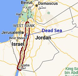 Jordan Valley, where is located
Owing to the low altitude, the Jordan Valley is
very mild in winter and scorchingly hot in summer. However, while the rainfall pattern in the north is almost Mediterranean like that of Amman, with rains in the period from November to April which amount to about 300 mm (12 in) per year, going south, it becomes progressively more arid.
The climate is
desert already in the area of the
Dead Sea, the salt lake whose banks are located in a deep depression, 400 meters (1,300 feet) below sea level, and which loses most of its waters on the spot because of the strong evaporation. In the Dead Sea area, just over 100 mm (4 in) of rain fall per year.
Although the Jordan River ends its course in the Dead Sea, the valley continues to the south, at altitudes below 200 meters (650 ft), up to the only access to the sea in Jordan (see Aqaba).
Aqaba
In the Jordan Valley, the daily average temperature in January is around 15 °C (59 °F), while in July and August, it ranges from 31 °C (88 °F) in the north to 33 °C (91 °F) in the south, as happens in
Aqaba, the Red Sea port which, as mentioned, is also the only small portion of the Jordan territory overlooking the sea.
In Aqaba, the rains are very rare and do not even reach 50 mm (2 in) per year. The sun regularly shines throughout the year, but some cloud banks can occasionally reach the area, even in summer.
Near Aqaba, the
Red Sea is a bit cool for swimming in winter, while it is pleasantly warm in the summer months.

When to go
The best times to visit Jordan are
spring and autumn, and in particular, the months of April, May (when days can already be hot), and October.
For a beach holiday on the
Red Sea coast, the best months are April, and from mid-October to mid-November; summer is too hot, in fact, it's not easy to sunbathe when the temperature exceeds 40 °C (104 °F) in the shade. Winter on the coast is very mild and sunny, so it can be pleasant, but the sea is a bit cool, and sometimes, the air temperature can be cool or even cold at night.
What to pack
In
winter: in Amman, Petra and the plateau: bring warm clothes, a jacket, a hat, a raincoat or umbrella, a scarf for the wind-borne sand and dust, and hiking shoes. For the Jordan Valley and Aqaba: bring spring/autumn clothes, a jacket and a sweater, an umbrella for the area to the north of the Dead Sea.
In
summer: in Amman, Petra and the plateau: bring light clothes, a sun hat, a sweatshirt or sweater for evenings outdoors, a desert turban for the wind-borne sand and dust, hiking shoes, and a sleeping bag for outdoor overnight stays. For the Jordan valley and Aqaba: lightweight clothes, and a desert turban. It's better for women to avoid shorts and miniskirts in rural and non-tourist areas.
Climate data - Jordan
| Amman (760 meters) |
|---|
|
| Jan | Feb | Mar | Apr | May | Jun | Jul | Aug | Sep | Oct | Nov | Dec |
|---|
| Min temp. | 4 | 5 | 8 | 11 | 15 | 18 | 21 | 21 | 19 | 15 | 10 | 6 |
|---|
| Max temp. | 13 | 14 | 18 | 23 | 28 | 31 | 33 | 33 | 31 | 27 | 20 | 15 |
|---|
| Precip. | 60 | 65 | 35 | 5 | 5 | 0 | 0 | 0 | 0 | 5 | 25 | 45 |
|---|
| Prec. days | 11 | 11 | 8 | 4 | 2 | 0 | 0 | 0 | 0 | 2 | 5 | 8 |
|---|
| Humidity | 70% | 66% | 58% | 46% | 38% | 39% | 40% | 45% | 48% | 50% | 57% | 67% |
|---|
| Day length | 10 | 11 | 12 | 13 | 14 | 14 | 14 | 13 | 12 | 11 | 10 | 10 |
|---|
| Sun hours | 6 | 6 | 7 | 9 | 11 | 12 | 12 | 12 | 10 | 9 | 8 | 6 |
|---|
|
| Aqaba |
|---|
|
| Jan | Feb | Mar | Apr | May | Jun | Jul | Aug | Sep | Oct | Nov | Dec |
|---|
| Min temp. | 11 | 12 | 15 | 19 | 23 | 25 | 27 | 28 | 26 | 22 | 17 | 12 |
|---|
| Max temp. | 22 | 24 | 27 | 32 | 36 | 39 | 41 | 40 | 38 | 34 | 28 | 23 |
|---|
| Precip. | 5 | 5 | 5 | 0 | 0 | 0 | 0 | 0 | 0 | 5 | 0 | 5 |
|---|
| Prec. days | 1 | 1 | 0 | 0 | 0 | 0 | 0 | 0 | 0 | 0 | 0 | 0 |
|---|
| Humidity | 45% | 39% | 34% | 28% | 25% | 24% | 26% | 29% | 34% | 39% | 40% | 44% |
|---|
| Day length | 10 | 11 | 12 | 13 | 14 | 14 | 14 | 13 | 12 | 11 | 11 | 10 |
|---|
| Sun hours | 7 | 8 | 8 | 9 | 10 | 11 | 11 | 11 | 10 | 9 | 8 | 7 |
|---|
| Sea temp | 21 | 20 | 21 | 22 | 24 | 26 | 27 | 28 | 28 | 27 | 25 | 23 |
|---|
| Petra (900 meters) |
|---|
|
| Jan | Feb | Mar | Apr | May | Jun | Jul | Aug | Sep | Oct | Nov | Dec |
|---|
| Min temp. | 2 | 3 | 6 | 10 | 14 | 17 | 19 | 19 | 17 | 13 | 7 | 3 |
|---|
| Max temp. | 14 | 16 | 20 | 25 | 30 | 33 | 35 | 35 | 33 | 28 | 21 | 16 |
|---|
| Precip. | 15 | 15 | 15 | 5 | 5 | 0 | 0 | 0 | 0 | 5 | 5 | 15 |
|---|
| Prec. days | 5 | 4 | 4 | 2 | 1 | 0 | 0 | 0 | 0 | 1 | 2 | 3 |
|---|
|
|
| Sun hours | 8 | 9 | 9 | 10 | 11 | 13 | 13 | 13 | 12 | 10 | 9 | 8 |
|---|
|
| Ruwaished (700 meters) |
|---|
|
| Jan | Feb | Mar | Apr | May | Jun | Jul | Aug | Sep | Oct | Nov | Dec |
|---|
| Min temp. | 2 | 4 | 7 | 11 | 16 | 19 | 21 | 21 | 18 | 14 | 8 | 4 |
|---|
| Max temp. | 14 | 17 | 22 | 27 | 32 | 36 | 39 | 39 | 35 | 30 | 22 | 16 |
|---|
| Precip. | 10 | 15 | 10 | 10 | 5 | 0 | 0 | 0 | 0 | 5 | 10 | 10 |
|---|
| Prec. days | 1 | 2 | 2 | 2 | 1 | 0 | 0 | 0 | 0 | 1 | 1 | 2 |
|---|
| Humidity | 68% | 62% | 52% | 44% | 41% | 38% | 38% | 41% | 44% | 50% | 60% | 66% |
|---|
| Day length | 10 | 11 | 12 | 13 | 14 | 14 | 14 | 13 | 12 | 11 | 10 | 10 |
|---|
| Sun hours | 7 | 8 | 9 | 11 | 12 | 14 | 13 | 12 | 11 | 10 | 8 | 7 |
|---|
|
See also the
temperatures month by month