Select units of measurement for the temperature and rainfall tables (metric or imperial).
Average weather, temperature, rainfall, sunshine
Israel, a small country in western Asia, facing the Mediterranean to the west and the Red Sea to the south, has a
Mediterranean climate on the west coast,
temperate in the hills of the interior, and
desert in the flat areas of the east and the south.
The climate in Israel is characterized by
hot, sunny summers and by a long period of sunshine, with clear skies from May to September. The rains (where they occur) are concentrated from November to March.
The climate in detail
Mediterranean coast
Along the west coast (see
Tel Aviv,
Haifa, Netanya, Ashdod), the climate is
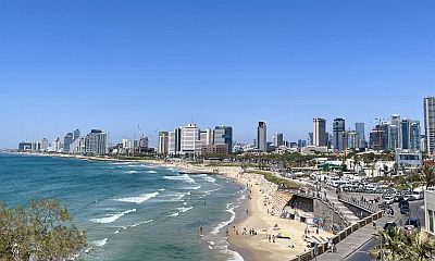
Mediterranean, with very mild, rainy winters and hot, sunny summers, during which the air is humid but tempered the breeze.
Winters are milder than on the Mediterranean coasts further north, in countries such as France, Italy and Spain, while summers are particularly muggy.
The average temperature ranges from 13/14 °C (55/57 °F) in January to about 28 °C (81/82 °F) in July and August.
Rainfall, concentrated in the winter months, amounts to around 550 millimeters (21.5 inches) per annum, and it is quite abundant from December to February.
Sometimes in winter there can be
periods a bit cold and windy, with lows close to freezing and highs of 10/12 °C (50/54 °F).
Especially in the period from April to June,
heat waves can occur due to the wind from the Egyptian desert, which can raise the temperature to around 40 °C (104 °F) even on the coast. In these cases, however, the humidity decreases.
The
sun in often shines even in winter, except for the periods of bad weather, while in the long dry season, the sky is normally clear.
On the Mediterranean coast, the
sea is warm enough for swimming from June to November.

Hills and mountains
In the interior, in the
Judean Mountains, the climate is more continental, due to the greater distance from the sea as well as the altitude. Jerusalem is located at 700 meters (2,300 feet) above sea level, Bethlehem, in the West Bank, at almost 800 meters (2,600 feet), while Nazareth is located at a lower altitude, around 300/500 meters (1,000/1,600 feet).
In these areas, winter is still quite mild, but there can be intrusions of
cold air masses from Russiam which can even bring
snow in January and February (and sometimes also in early March), usually above 600 meters (2,000 feet).
During summer, the air in this area is dry, and the heat is usually tolerable, but the sun hits hard; moreover, hot air masses from the Egyptian desert can sometimes bring some days with scorching heat even here.
In
Jerusalem, the average temperature ranges from 9.5 °C (49 °F) in January to 25 °C (77 °F) in August. Annual precipitation is around 525 mm (20.5 in), concentrated in the cold half of the year, while it almost never rains from May to mid-October.

The highest peak in Israel is
Mount Meron, 1,208 meters (3,963 feet) high, located in the north, in the Upper Galilee. However, outside of the Israeli territory (in the Golan Heights) we find Mount Hermon, on the border between Syria and Lebanon but controlled by Israel, which reaches 2,814 mt (9,232 ft).
East and south
Jordan Valley
 Jordan Valley, where is located
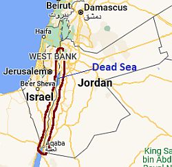
In the easternmost part of Israel, on the border with Jordan, we find the Jordan River Valley, where the altitude goes even below sea level (from Lake Tiberias to the Dead Sea). Here, the winter is very mild, more or less like on the coast, but the summer is definitely hot.
In
Tiberias, on the shores of the lake of the same name (or Sea of Galilee), the average temperature ranges from 14 °C (57 °F) in January to 31.5 °C (88.5 °F) in July and August, when the maximum temperatures are around 38 °C (100 °F). Here, an average of 435 mm (17 in) of rain falls each year, concentrated, as usual, in the winter months.
Continuing south we find the
Dead Sea, the salt lake whose banks are located in a deep depression, 400 meters (1,300 feet) below sea level, and which loses most of its waters on the spot because of the strong evaporation. Here, precipitation becomes scarcer, and the landscape, apart from the areas where the river's waters are used to irrigate fields, is desert.
Negev Desert
Although the Jordan River ends its course in the Dead Sea, the valley continues south, at altitudes below 200 meters (650 ft), to the only access to the Red Sea in Israel (see Eilat). In southern Israel, between Sinai (Egypt) to the west and the Jordan Valley to the east, in the Southern District, we find a plateau, at altitudes generally between 300 and 600 meters (985 and 1,950 ft), the Negev desert. The winters are mild and the summers very hot.
Rainfall is very scarce, less than 100 millimeters (4 inches) per year, and 30 mm (1.2 in) in the driest areas.

In the extreme south of Israel, there is a small area overlooking the Gulf of Aqaba, which belongs to the
Red Sea. Here we find the city of
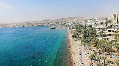
Eilat, which in winter is the mildest in the country. However, every now and then, at night it can get a little cold, with lows of around 5 °C (41 °F).
The summer is very hot. The average maximum in July and August is 40/41 °C (104/105 °F), but it can sometimes exceed 45 °C (113 °F). So, unlike on the Mediterranean coast, summer is not the best time for a beach holiday on the Red Sea Coast.
The
sun regularly shines throughout the year, but some cloud banks can occasionally reach the area even in summer.
Near Eilat, the
sea is a bit cool for swimming in winter, in fact the water temperature drops to 20.5/21 °C (69/70 °F) from January to March, while it is pleasantly warm in the summer months.
When to go
The best times to visit Israel are
spring and autumn, and in particular, the months of April, May and October. Easter is therefore usually a good time to visit the sites of historical and religious interest in the country.
For a
beach holiday, on the
Mediterranean coast, the warm and sunny season is long and runs from mid-May to mid-October, although the sea in May is still a bit cool.
The
Red Sea is warmer, but in summer the heat is too intense for sunbathing, especially from June to September, while in winter, from December to February, pleasant days alternate with others that can be a bit cold: so, the best periods for a beach holiday here are the month of April, and from mid-October to mid-November.
What to pack
In
winter. In Jerusalem and inland hills, bring warm clothes, a jacket, a hat, a raincoat or umbrella, a scarf for the wind, and hiking shoes. In the Jordan Valley and Eilat, bring spring/autumn clothes, a shirt for the day, a jacket and a sweater, and an umbrella for the area north of the Dead Sea. In Tel Aviv and the Mediterranean coast, bring spring/autumn clothes, a sweater and a jacket, and a raincoat or umbrella.
In
summer. In Jerusalem and inland hills, bring light clothes, a sun hat, a sweatshirt for the evening, a scarf for the wind-borne sand and dust, and hiking shoes. In the Jordan valley and Eilat, bring lightweight clothing of natural fibers, and a desert turban. In Tel Aviv and the Mediterranean coast, bring light clothing, and a light sweatshirt for the evening.
When going to the reef, you can bring snorkeling equipment, including water shoes or rubber-soled shoes.
Climate data - Israel
| Eilat |
|---|
|
| Jan | Feb | Mar | Apr | May | Jun | Jul | Aug | Sep | Oct | Nov | Dec |
|---|
| Min temp. | 11 | 12 | 15 | 19 | 23 | 25 | 27 | 28 | 26 | 22 | 17 | 12 |
|---|
| Max temp. | 22 | 24 | 27 | 32 | 36 | 39 | 41 | 40 | 38 | 34 | 28 | 23 |
|---|
| Precip. | 5 | 5 | 5 | 0 | 0 | 0 | 0 | 0 | 0 | 5 | 0 | 5 |
|---|
| Prec. days | 1 | 1 | 0 | 0 | 0 | 0 | 0 | 0 | 0 | 0 | 0 | 0 |
|---|
| Humidity | 45% | 39% | 34% | 28% | 25% | 24% | 26% | 29% | 34% | 39% | 40% | 44% |
|---|
| Day length | 10 | 11 | 12 | 13 | 14 | 14 | 14 | 13 | 12 | 11 | 11 | 10 |
|---|
| Sun hours | 7 | 8 | 8 | 9 | 10 | 11 | 11 | 11 | 10 | 9 | 8 | 7 |
|---|
| Sea temp | 21 | 20 | 21 | 22 | 24 | 26 | 27 | 28 | 28 | 27 | 25 | 23 |
|---|
| Jerusalem (800 meters) |
|---|
|
| Jan | Feb | Mar | Apr | May | Jun | Jul | Aug | Sep | Oct | Nov | Dec |
|---|
| Min temp. | 7 | 7 | 10 | 12 | 16 | 18 | 20 | 20 | 19 | 17 | 13 | 9 |
|---|
| Max temp. | 13 | 14 | 17 | 22 | 26 | 29 | 30 | 30 | 29 | 26 | 20 | 15 |
|---|
| Precip. | 135 | 120 | 65 | 20 | 5 | 0 | 0 | 0 | 0 | 10 | 50 | 110 |
|---|
| Prec. days | 9 | 8 | 6 | 2 | 1 | 0 | 0 | 0 | 0 | 2 | 5 | 8 |
|---|
| Humidity | 76% | 75% | 71% | 56% | 51% | 53% | 57% | 60% | 61% | 59% | 65% | 74% |
|---|
| Day length | 10 | 11 | 12 | 13 | 14 | 14 | 14 | 13 | 12 | 11 | 10 | 10 |
|---|
| Sun hours | 6 | 7 | 7 | 9 | 11 | 13 | 12 | 12 | 10 | 9 | 8 | 6 |
|---|
|
| Tel Aviv |
|---|
|
| Jan | Feb | Mar | Apr | May | Jun | Jul | Aug | Sep | Oct | Nov | Dec |
|---|
| Min temp. | 8 | 8 | 10 | 13 | 16 | 20 | 22 | 23 | 21 | 18 | 13 | 10 |
|---|
| Max temp. | 18 | 19 | 22 | 25 | 28 | 30 | 32 | 32 | 31 | 29 | 25 | 20 |
|---|
| Precip. | 145 | 90 | 50 | 15 | 5 | 0 | 0 | 0 | 0 | 25 | 75 | 130 |
|---|
| Prec. days | 10 | 8 | 5 | 2 | 1 | 0 | 0 | 0 | 0 | 2 | 5 | 8 |
|---|
| Humidity | 69% | 68% | 65% | 60% | 59% | 62% | 65% | 66% | 63% | 62% | 60% | 66% |
|---|
| Day length | 10 | 11 | 12 | 13 | 14 | 14 | 14 | 13 | 12 | 11 | 10 | 10 |
|---|
| Sun hours | 6 | 7 | 8 | 9 | 11 | 12 | 12 | 12 | 10 | 9 | 8 | 6 |
|---|
| Sea temp | 18 | 18 | 18 | 19 | 21 | 24 | 27 | 28 | 28 | 26 | 23 | 20 |
|---|
| Tiberias |
|---|
|
| Jan | Feb | Mar | Apr | May | Jun | Jul | Aug | Sep | Oct | Nov | Dec |
|---|
| Min temp. | 10 | 10 | 12 | 15 | 19 | 22 | 25 | 25 | 23 | 21 | 16 | 12 |
|---|
| Max temp. | 18 | 19 | 23 | 28 | 33 | 36 | 38 | 38 | 36 | 32 | 26 | 20 |
|---|
| Precip. | 105 | 90 | 55 | 20 | 5 | 0 | 0 | 0 | 0 | 15 | 50 | 95 |
|---|
| Prec. days | 12 | 10 | 8 | 3 | 1 | 0 | 0 | 0 | 0 | 3 | 6 | 10 |
|---|
|
|
|
|
See also the
temperatures month by month