Select units of measurement for the temperature and rainfall tables (metric or imperial).
Average weather, temperature, rainfall, sunshine
The climate of Georgia is
mild and rainy on the coast and in the western plain, while it is more
continental and arid in the central and eastern inland areas. In the mountains, it is obviously colder.
Georgia is a country located between Europe and Asia and overlooking the eastern coasts of the Black Sea. The mountains of the Caucasus to the north separate it from Russia.
The
sea in Georgia is warm enough for swimming from July to September, and reaches 25 °C (77 °F) in July and August.
The climate in detail
Coast and plain
In ancient times, the area comprising the coast and the western plain of present-day Georgia (zone 1 on the map) was called
Colchis.
Coast
Along the
coast of the Black Sea, the climate is
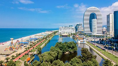
mild and rainy, with almost oceanic characteristics.
Rainfall is abundant, since it ranges from 1,500 millimeters (60 inches) per year in the northern part (see Sukhumi, in Abkhazia), to 2,000 mm (80 in) in the central part (see Poti), to 2,500 mm (100 in) in the southern part (see
Batumi). Rain falls in all months, although the wettest season is autumn.
Winter along the coast is fairly mild, since the average temperature in January is about 7/8 °C (44/46 °F). The sea moderates the climate, while the Caucasus Mountains in the north partially protect this area from cold winds. However, beyond the Caucasus, we find the freezing Russian plains, and a bit of cold air can sometimes surpass the mountains and reach the coast: there are on average about ten days with
snowfall per year. Snowfall can sometimes be heavy. However, even in these cases, the temperature generally only drops to -2/-3 °C (27/28 °F).
Summer is warm but not too much, in fact the temperature rarely exceeds 30 °C (86 °F). As mentioned, even in this season there can be rain and thunderstorms, however, there are also some days of good weather.

Plain
In the western plains of Georgia, east of the coast, in cities like Kutaisi, Samtredia and Senaki, the climate is similar, however it is somewhat more continental, colder in the winter and hotter in the summer.
Here too, as on the coast, in winter, there can be cold periods, when it can snow and the temperature can drop below freezing.
Unlike on the coast, on the other hand, in summer, there can be very hot periods, when the temperature can reach 38/40 °C (100/104 °F).
In
Kutaisi, located 80 km (50 mi) away from the coast and 150 meters (500 ft) above sea level, the average temperature ranges from 6.5 °C (43.5 °F) in January to 25.5 °C (78 °F) in August. Precipitation amounts to 1,350 mm (53 in) per year.
Inland areas
In the
interior (zone 2 on the map), separated from the western plains by secondary mountain ranges such as the Likhi Mountains, we find valleys and plateaus lying at an altitude between 400 and 1,000 meters (1,300 and 3,300 feet).
In the capital,
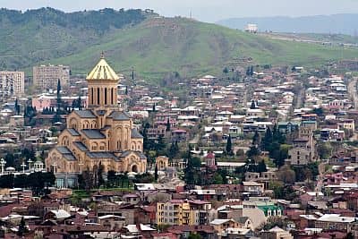
Tbilisi, located in the valley of the Kura, at 450 meters (1,450 ft) above sea level, the climate is
slightly continental, and it's much more
arid than on the coast and on the western plain.
The monthly average temperature ranges from 3 °C (37 °F) in January to 25.5 °C (78 °F) in July.
The rainfall amounts to 500 mm (20 in) per year, with a minimum in winter, and a maximum in late spring, in May and June, mainly because of afternoon instability, which can cause showers and thunderstorms and partly continues in summer.
Tbilisi is a
windy city, and can experience strong winds quite frequently.
During winter, snowfall is quite frequent (although it's not abundant because of the low level of precipitation), and so are cold spells. Occasionally the temperature can drop to -15 °C (5 °F).
Summer is sunny, despite a few afternoon downpours or thunderstorms. There can also be heatwaves, with peaks around 38/40 °C (100/104 °F).

Mountains
The
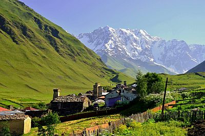
Caucasus Mountains (Greater Caucasus in the north and Lesser Caucasus in the south) and the secondary chains (zone 3 on the map) have an Alpine climate, more or less cold depending on altitude, with heavy snowfalls in winter; there are vast glaciers above 3,500 meters (11,500 ft), especially along the watershed of the Greater Caucasus, which is higher.
The highest peak in Georgia is Mount
Shkhara, 5,193 meters (17,037 ft) high.

Precipitation is particularly abundant in the westernmost mountains: the
Mtirala National Park, in the Autonomous Republic of Ajara, receives more than 4,500 mm (177 in) of rain per year.
In
Akhalkalaki, a town of 8,000 inhabitants located in the south, near the border with Turkey and Armenia, at an altitude of 1,700 metres (67 in), on the
Javakheti plateau, the average temperature goes from -6.3 °C (20.7 °F) to January to 17.3 °C (63.1 °F) in August.
In winter there can be intense cold spells, while in summer, despite the altitude, it can get very hot. The coldest record is -29.6 °C (-21.3 °F) and was set in January 2008. The highest record is 37.4 °C (99.3 °F) and was set in July 2000.
In this area, precipitation is not abundant, in fact it amounts to 570 mm (22.4 in) per year. The rainiest months are May to June, due to afternoon thunderstorms.
At the
Bethlemi Hut, located at 3,650 meters (11,975 ft) on the slopes of Mount Kazbek (whose peak is at 5,047 meters or 16,558 ft), in the north, in the Caucasus chain, the average temperature ranges from -14 °C (7 °F) in January to 4 °C (39 °F) in July. The cold record is -36 °C (-33 °F), the heat record is 16.5 °C (61.5 °F).
Precipitation amounts to 1,155 mm (45.5 in).
When to go
The best times to visit Georgia are
spring and autumn, especially from mid-May to mid-June and from mid-September to mid-October. Since autumn is very rainy in the coastal area, here, you may prefer spring.
The best period for a beach holiday, and also for hiking in high mountains, is of course the
summer, from June to August, when it can get hot in Tbilisi and in inland valleys (but those who can stand the heat can choose this season to visit the whole country).
What to pack
In
winter: in Tbilisi, the plains and the coast, bring warm clothes, such as a sweater, a jacket, a hat, and a raincoat or umbrella. For high mountains, bring mountain clothing, hiking boots.
In
summer: in Tbilisi, bring light clothes for the day, a sun hat, a light sweatshirt for the evening, and possibly an umbrella for the afternoon rains. For the coast, bring light clothing, a light sweatshirt for the evening, a scarf for the breeze. For the mountains, bring spring/autumn clothes, a sun hat, a sweater and a jacket, hiking shoes, and a raincoat or umbrella; for the highest peaks, bring mountain clothing.
Climate data - Georgia
| Akhalkalaki (1,700 meters) |
|---|
|
| Jan | Feb | Mar | Apr | May | Jun | Jul | Aug | Sep | Oct | Nov | Dec |
|---|
| Min temp. | -11 | -11 | -6 | 0 | 4 | 6 | 9 | 9 | 5 | 1 | -4 | -9 |
|---|
| Max temp. | -1 | 0 | 5 | 12 | 17 | 21 | 24 | 25 | 21 | 16 | 8 | 2 |
|---|
| Precip. | 30 | 25 | 40 | 50 | 85 | 80 | 65 | 45 | 40 | 40 | 30 | 30 |
|---|
| Prec. days | 7 | 6 | 7 | 9 | 13 | 11 | 9 | 8 | 6 | 7 | 6 | 6 |
|---|
|
|
|
|
| Batumi |
|---|
|
| Jan | Feb | Mar | Apr | May | Jun | Jul | Aug | Sep | Oct | Nov | Dec |
|---|
| Min temp. | 5 | 4 | 6 | 9 | 13 | 18 | 20 | 21 | 18 | 14 | 9 | 6 |
|---|
| Max temp. | 11 | 11 | 14 | 17 | 20 | 24 | 26 | 28 | 25 | 21 | 17 | 13 |
|---|
| Precip. | 240 | 190 | 155 | 115 | 110 | 140 | 170 | 205 | 260 | 275 | 310 | 270 |
|---|
| Prec. days | 14 | 13 | 13 | 10 | 10 | 10 | 10 | 12 | 12 | 12 | 12 | 13 |
|---|
|
|
| Sun hours | 3 | 4 | 4 | 5 | 6 | 8 | 7 | 7 | 7 | 6 | 4 | 3 |
|---|
| Sea temp | 10 | 9 | 9 | 11 | 16 | 22 | 25 | 25 | 24 | 20 | 16 | 12 |
|---|
| Bethlemi (3,650 meters) |
|---|
|
| Jan | Feb | Mar | Apr | May | Jun | Jul | Aug | Sep | Oct | Nov | Dec |
|---|
| Min temp. | -18 | -18 | -16 | -11 | -6 | -3 | 1 | 1 | -2 | -7 | -11 | -15 |
|---|
| Max temp. | -11 | -11 | -8 | -4 | 1 | 3 | 7 | 7 | 4 | -1 | -5 | -8 |
|---|
| Precip. | 80 | 65 | 85 | 105 | 145 | 115 | 120 | 115 | 90 | 85 | 80 | 70 |
|---|
| Prec. days | 8 | 8 | 10 | 13 | 16 | 15 | 12 | 11 | 12 | 11 | 9 | 9 |
|---|
|
|
|
|
| Kutaisi |
|---|
|
| Jan | Feb | Mar | Apr | May | Jun | Jul | Aug | Sep | Oct | Nov | Dec |
|---|
| Min temp. | 4 | 4 | 6 | 10 | 14 | 18 | 20 | 21 | 18 | 14 | 9 | 6 |
|---|
| Max temp. | 10 | 11 | 15 | 20 | 24 | 28 | 29 | 30 | 27 | 22 | 16 | 12 |
|---|
| Precip. | 140 | 115 | 135 | 85 | 85 | 100 | 85 | 80 | 115 | 145 | 130 | 145 |
|---|
| Prec. days | 12 | 11 | 12 | 10 | 9 | 9 | 9 | 7 | 8 | 10 | 10 | 11 |
|---|
| Humidity | 70% | 70% | 70% | 69% | 71% | 73% | 75% | 74% | 72% | 70% | 69% | 69% |
|---|
| Day length | 10 | 11 | 12 | 13 | 15 | 15 | 15 | 14 | 12 | 11 | 10 | 9 |
|---|
|
|
| Sokhumi |
|---|
|
| Jan | Feb | Mar | Apr | May | Jun | Jul | Aug | Sep | Oct | Nov | Dec |
|---|
| Precip. | 115 | 120 | 110 | 120 | 100 | 100 | 110 | 115 | 135 | 110 | 130 | 135 |
|---|
| Prec. days | 13 | 13 | 13 | 13 | 13 | 10 | 10 | 9 | 9 | 9 | 10 | 11 |
|---|
|
|
| Sun hours | 3 | 3 | 4 | 5 | 7 | 8 | 9 | 9 | 8 | 6 | 4 | 3 |
|---|
|
| Tbilisi (430 meters) |
|---|
|
| Jan | Feb | Mar | Apr | May | Jun | Jul | Aug | Sep | Oct | Nov | Dec |
|---|
| Min temp. | 0 | 0 | 4 | 8 | 13 | 17 | 20 | 20 | 16 | 11 | 5 | 1 |
|---|
| Max temp. | 7 | 9 | 14 | 19 | 24 | 29 | 32 | 32 | 27 | 20 | 13 | 8 |
|---|
| Precip. | 15 | 20 | 30 | 65 | 85 | 85 | 40 | 40 | 35 | 45 | 35 | 20 |
|---|
| Prec. days | 4 | 4 | 5 | 9 | 10 | 8 | 6 | 5 | 5 | 6 | 5 | 4 |
|---|
| Humidity | 73% | 70% | 66% | 65% | 66% | 61% | 57% | 57% | 63% | 71% | 75% | 76% |
|---|
| Day length | 10 | 11 | 12 | 13 | 15 | 15 | 15 | 14 | 12 | 11 | 10 | 9 |
|---|
| Sun hours | 3 | 4 | 5 | 6 | 7 | 8 | 8 | 8 | 7 | 5 | 3 | 3 |
|---|
|
See also the
temperatures month by month