Select units of measurement for the temperature and rainfall tables (metric or imperial).
Average weather, temperature, rainfall, sunshine
In Cuba, the climate is
tropical, with a dry and relatively cool season from late November to mid-April, and a rainy and muggy season from late April to early November. The climate is fairly uniform from one area to the other, but there are some differences that are worth considering.
Annual
precipitation is generally between 1,000 and 1,500 millimeters (40 and 60 inches). In the south, where the only mountainous areas are found, there is a greater difference between the north-facing slopes, which are very wet, and those exposed to the south, where precipitation drops below 700 mm (27.5 in) per year (see Guantanamo Bay).
The amount of
sunshine in Cuba peaks in spring, when the winter disturbances decrease, and before the clouds and rains of the warm season. However, the sun quite often shines even in summer.
The climate in detail
The seasons
Winter in Cuba is pleasantly warm in the north and even quite hot in the south, with daytime temperatures around 26 degrees Celsius (79 °F) from December to February in Havana, and around 28 °C (82 °F) in the southernmost areas.
The rains are not frequent but they are still possible, and they are more likely on the northern slopes, which are also exposed to
cold air masses coming from the United States. These short cold outbreaks, from December to March, may bring some days characterized by cool weather, and a bit of cold at night, especially in the north-western part (see Havana,
Varadero). Sometimes in Havana the minimum temperature drops to around 10 °C (50 °F) or even below.
These cool air masses reach the southern side of the northwest (see
Cayo Largo, Isla de la Juventud) less often, and even less in the south-east of the country, and particularly rarely on the south coast (see Santiago de Cuba, Guantanamo), which is more sheltered.
In winter, you can visit cities and go on excursions: the sea is warm but the sun is not always guaranteed, and the air temperature is not always warm enough for swimming, at least for those who are sensitive to cold. Nevertheless, in the south-east, as mentioned, the coast south of Sierra Maestra is sheltered from the north winds, so in winter has a warmer microclimate and is usually nice for a beach holiday.
During the
rainy season, there's muggy heat everywhere, which is sometimes hard to bear, even though it is tempered by the breeze. The hottest months are July and August. The daytime temperature rarely exceeds 33/34 °C (91/93 °F), but moisture makes the heat sweltering. The rains are often intense, but they occur mostly in the form of showers or thunderstorms in late afternoon. In July, there's often a relative break in the rains, especially in the south, when rain showers become less frequent (even though the heat is still intense).
North-west
In northwestern Cuba, winter is pleasantly warm, but it's less warm than in the rest of the island. As mentioned, the north-west is the area that, in winter, is more exposed to short and
sudden outbreaks of cool air from the United States, which can bring some days a bit cool and windy, and some rain.
Occasionally, a
particularly cold air mass can arrive, as happened for example in January 1977 (when the temperature dropped to 6 °C or 43 °F in Havana), in January 1981, in February 1996 (when the absolute cold record in Cuba was recorded, 0.6 °C or 33 °F in Bainoa), and in January 2010 (when a low of 4 °C or 39 °F was recorded at Havana airport). In the previous century, it seems that in January 1857 it even snowed in Cárdenas, and frosts ruined the crops. However, even in these cases the temperature remained fairly mild during the day, around 15/20 °C (59/68 °F).
Further to the south-east, in Cayo Coco and Cayo Guillermo, we move away from the area most exposed to cold outbreaks, but we are still on the north side, and occasionally from December to March it can get a little cold here too.
Havana
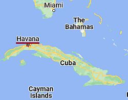 Havana, where is located

The capital, Havana, is located in the north-west of Cuba, on the northern coast. On average, highs range from 27 °C (80.5 °F) in January to 32.5 °C (90.5 °F) in August.
Rainfall amounts to 1,200 mm (48 inches) per year, of which more than 100 mm (4 in) fall per month in the hot and rainy season, from May to October. From December to February, the rains are a little more frequent than in the south-east (see below).

As mentioned, the sea in Cuba is warm enough for swimming all year round: in winter the water temperature near Havana is about 25 °C (77 °F).
South-east
In the south-east, winter is warmer than in the north-west, especially along the south coast (see Marea del Portillo, Santiago de Cuba, Guantánamo Bay, San Antonio del Sur), where there are summer-like temperatures even from December to February.
Santiago de Cuba
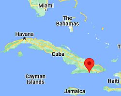 Santiago de Cuba, where is located

Santiago de Cuba is located on the sheltered southern coast. Every now and then, from December to March, there may be some days a bit cool, with low around 16/17 °C (61/63 °F) and highs of 24/25 °C (75/77 °F), and therefore not as low as in the north-west.
In Santiago de Cuba, there is a decrease in rainfall in July (as happens in some Caribbean areas) as well as the dryness in winter (because, as mentioned, this area is sheltered from the winds coming from the United States, which are able to bring rainfall in winter).
On the southern coast, the sea in winter is a little warmer than in the north-west; in fact, the temperature does not drop below 26/27 °C (79/81 °F).
Hurricanes
From June to November, it's the
hurricane season in Cuba and the Caribbean. Tropical storms and cyclones usually come from the east, and affect Cuba especially in the eastern part. The period when they are most likely runs from August to October.
Hurricanes are not frequent, but sometimes they can be destructive, bringing torrential rains and gale force winds, so this period is not recommended for those who want to be on the safe side, but for the rest, in this period the weather, though hot and humid and accompanied by showers and thunderstorms, all in all would be acceptable.
Some hurricanes that caused extensive damage to the island were: the «Cuba Hurricane» of November 1932, Hurricane Flora in October 1963, Georges in September 1998, Gustav in late August 2008, Ike in September 2008, Sandy in late October 2012, and Irma in September 2017.
When to go
If you want to visit cities and to go on excursions in Cuba, the
dry season (late November through mid-April) is a good time to go, while specifically the coolest period (December-February) is preferable.
For a
beach holiday, in the northwest you can prefer the Easter period (late March-April), while in the south-east you can also go in winter.
In winter, sometimes the weather can be cool and cloudy, especially in the western part and on the northern slopes. Because of this, the east is more advisable for a beach holiday, especially the southern coast of the south-east (see Marea del Portillo, Santiago de Cuba, etc). The south-east coast is preferable also in July and August because it's less rainy, yet in this period the heat is intense throughout Cuba, and there's some chance of hurricanes, especially in August.
What to pack
From
November to April, in the north, Havana and inland hills, bring light clothing, but also a sweatshirt or sweater, a jacket and umbrella (or a raincoat). In the south-eastern area (see Santiago de Cuba), bring light clothes, but also a sweatshirt for the evening.
From
May to October, bring lightweight, tropics-friendly clothing, and possibly a light sweatshirt and a light raincoat for thunderstorms.
When going to the reef, you can bring snorkeling equipment, including water shoes or rubber-soled shoes.
Climate data - Cuba
| Camaguey |
|---|
|
| Jan | Feb | Mar | Apr | May | Jun | Jul | Aug | Sep | Oct | Nov | Dec |
|---|
| Min temp. | 19 | 19 | 19 | 21 | 22 | 23 | 24 | 24 | 23 | 23 | 21 | 20 |
|---|
| Max temp. | 28 | 29 | 30 | 31 | 31 | 32 | 33 | 33 | 32 | 31 | 29 | 28 |
|---|
| Precip. | 25 | 40 | 70 | 105 | 215 | 235 | 165 | 195 | 210 | 165 | 55 | 35 |
|---|
| Prec. days | 5 | 3 | 5 | 6 | 11 | 12 | 9 | 11 | 11 | 11 | 7 | 5 |
|---|
|
|
|
|
| Cayo Largo |
|---|
|
| Jan | Feb | Mar | Apr | May | Jun | Jul | Aug | Sep | Oct | Nov | Dec |
|---|
| Min temp. | 22 | 22 | 23 | 24 | 26 | 27 | 27 | 27 | 27 | 26 | 24 | 23 |
|---|
| Max temp. | 26 | 27 | 28 | 29 | 30 | 31 | 31 | 32 | 31 | 30 | 28 | 27 |
|---|
| Precip. | 35 | 40 | 40 | 45 | 145 | 195 | 125 | 165 | 200 | 125 | 55 | 20 |
|---|
| Prec. days | 6 | 6 | 5 | 5 | 10 | 14 | 11 | 13 | 14 | 14 | 9 | 7 |
|---|
|
|
| Sun hours | 8 | 8 | 9 | 9 | 9 | 8 | 8 | 8 | 8 | 8 | 8 | 8 |
|---|
| Sea temp | 26 | 26 | 26 | 27 | 28 | 29 | 30 | 30 | 30 | 29 | 28 | 27 |
|---|
| Cienfuegos |
|---|
|
| Jan | Feb | Mar | Apr | May | Jun | Jul | Aug | Sep | Oct | Nov | Dec |
|---|
| Min temp. | 18 | 18 | 19 | 21 | 22 | 24 | 24 | 24 | 24 | 23 | 20 | 19 |
|---|
| Max temp. | 28 | 29 | 29 | 31 | 31 | 32 | 33 | 33 | 32 | 31 | 29 | 28 |
|---|
| Precip. | 20 | 25 | 35 | 45 | 120 | 150 | 120 | 160 | 175 | 160 | 40 | 25 |
|---|
|
|
|
|
|
| Havana |
|---|
|
| Jan | Feb | Mar | Apr | May | Jun | Jul | Aug | Sep | Oct | Nov | Dec |
|---|
| Min temp. | 19 | 19 | 19 | 21 | 22 | 24 | 24 | 24 | 24 | 23 | 21 | 20 |
|---|
| Max temp. | 27 | 28 | 28 | 30 | 31 | 32 | 32 | 32 | 32 | 30 | 29 | 27 |
|---|
| Precip. | 70 | 45 | 45 | 60 | 120 | 165 | 125 | 135 | 150 | 170 | 80 | 60 |
|---|
| Prec. days | 6 | 4 | 4 | 4 | 7 | 10 | 9 | 10 | 11 | 11 | 7 | 6 |
|---|
|
|
| Sun hours | 7 | 7 | 9 | 9 | 8 | 8 | 9 | 8 | 8 | 6 | 7 | 6 |
|---|
| Sea temp | 25 | 25 | 25 | 26 | 27 | 29 | 29 | 30 | 30 | 28 | 27 | 26 |
|---|
| Santiago |
|---|
|
| Jan | Feb | Mar | Apr | May | Jun | Jul | Aug | Sep | Oct | Nov | Dec |
|---|
| Min temp. | 21 | 20 | 21 | 22 | 23 | 24 | 24 | 24 | 24 | 24 | 23 | 21 |
|---|
| Max temp. | 28 | 29 | 29 | 29 | 30 | 30 | 31 | 31 | 31 | 30 | 30 | 29 |
|---|
| Precip. | 30 | 15 | 40 | 70 | 150 | 130 | 55 | 95 | 150 | 215 | 100 | 30 |
|---|
| Prec. days | 3 | 2 | 4 | 6 | 10 | 11 | 6 | 9 | 11 | 14 | 7 | 3 |
|---|
|
|
| Sun hours | 7 | 7 | 8 | 8 | 6 | 7 | 8 | 7 | 6 | 6 | 6 | 7 |
|---|
| Sea temp | 26 | 26 | 26 | 27 | 28 | 29 | 29 | 29 | 30 | 29 | 28 | 27 |
|---|
| Varadero |
|---|
|
| Jan | Feb | Mar | Apr | May | Jun | Jul | Aug | Sep | Oct | Nov | Dec |
|---|
| Min temp. | 17 | 17 | 18 | 20 | 21 | 23 | 23 | 23 | 23 | 22 | 20 | 18 |
|---|
| Max temp. | 26 | 27 | 28 | 30 | 30 | 31 | 32 | 32 | 31 | 30 | 28 | 27 |
|---|
| Precip. | 40 | 35 | 50 | 70 | 165 | 210 | 155 | 165 | 180 | 170 | 65 | 35 |
|---|
| Prec. days | 7 | 6 | 6 | 5 | 9 | 13 | 13 | 15 | 15 | 12 | 8 | 7 |
|---|
|
|
| Sun hours | 8 | 8 | 9 | 10 | 9 | 8 | 9 | 9 | 9 | 9 | 8 | 7 |
|---|
| Sea temp | 24 | 24 | 24 | 26 | 27 | 28 | 29 | 30 | 30 | 28 | 27 | 26 |
|---|
See also the
temperatures month by month