Select units of measurement for the temperature and rainfall tables (metric or imperial).
Average weather, temperature, rainfall, sunshine
The Solomon Islands, located in the Pacific Ocean south of the Equator and east of Papua New Guinea, have an
equatorial climate, that is, hot, humid and rainy all year round, so much so that they are covered by rainforests.
Temperatures are stable throughout the year: highs are around 31 °C (88 °F) from November to April, when the warmer and wetter winds from the north-west predominate, while they drop slightly from May to October, when the
south-east trade winds, relatively cooler, prevail.
Rainfall is definitely abundant, since it ranges from 3,000 to 3,500 millimeters (118 to 138 inches) per year on the
flat islands, which are the majority, and it's well distributed throughout the year, even though it reaches a peak from January to March, and decreases slightly from May to November, when, however, it remains around 200/250 mm (8/10 in) per month.
The
sea in the Solomon Islands, is warm enough to swim in all year round.

The climate in detail
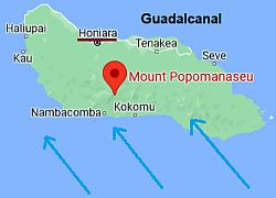
Guadalcanal
On the islands that have some
elevations in the interior, the rainfall is more abundant on the
slopes exposed to the wind and less abundant on the sheltered slopes. In particular, on the island of
Guadalcanal, there are volcanoes such as Mount Popomanaseu, 2,335 meters (7,661 feet) high, which protect the northern slopes from the trade winds during the cooler season. So, in
Honiara, on the north side, less than 150 mm (6 in) of rain fall from May to October; here, precipitation amounts to "only" 2,200 mm (87 in) per year, with a maximum in March, which is typically the wettest month on all the islands.
Another mountainous island is
Kolombangara, where lies Mount Veve, 1,768 meters (5,801 feet) high: here too, there is a difference in the period of the trade winds, between the north side, more sheltered, and the south side, more exposed to the winds that are able to produce rain clouds.
Honiara
 Honiara, where is located

In Honiara, the capital, located at 9 degrees south latitude, the daytime
temperatures are stable, since it is located on the north coast of the island of Guadalcanal, where, as mentioned, there are elevations in the interior, which partly protect it from the south-east trade winds.
On cooler nights, the temperature typically drops to 19/20 °C (66/68 °F) from July to September. In August 1993, it dropped to 16.6 °C (61.9 °F).
On warmer days, the temperature typically reaches 34 °C (93 °F) from October to February. In February 2010, it reached 36 °C (97 °F).
In the austral winter, as mentioned, Honiara is not as
rainy as the south side and the flat islands. On average, 1,970 mm (77.5 in) of rain fall per year, with a minimum of 85/100 mm (3.3/4 in) per month from June to September.
The amount of
sunshine on the Solomons is not great, nor poor; it's fairly uniform throughout the year, with a few hours of sunshine, but also frequent cloud formation, which may lead to showers or thunderstorms. Honiara receives 2,300 hours of sunshine annually.
Other islands
On the flat islands and the southern slopes of the mountainous islands, the temperature drops slightly in the
austral winter due to the southeast trade winds.
Munda

In
Munda, a village located on the island of New Georgia, at 8 degrees south latitude, highs drop to around 30 °C (86 °F) from June to September.
In Munda, the rains are
abundant all year round, and they do not decrease even in the austral winter, as usually happens in the flat islands, which as mentioned are the majority.
Tropical cyclones
The Solomon Islands are located at the north-western boundary of the area where
tropical cyclones of the South Pacific form; therefore, they are affected with a lower frequency than other areas of the South Pacific.
In particular, the least affected provinces are usually the north-western ones (Choiseul, Western Province, Isabel), while the most affected are the south-eastern ones (Makira-Ulawa, Rennell and Bellona, Temotu).
Cyclones are generally formed from November to mid-May, but since the sea is always warm, they have sometimes formed outside of this period, as happened for example with Cyclone Raquel in late July 2015, or with Cyclone Xavier, which affected the southeastern province of Temotu (in the group of the Santa Cruz Islands) in late October 2006.
When to go
The best time to visit the Solomon Islands is from
June to October, since it is the least muggy and rainy, bearing in mind, however, that showers are frequent even in this period, and they may even be abundant on the south-facing slopes, especially on the mountainous islands.
In
July, the rains often increase compared with the other months of this period, except on the northern slopes of mountainous islands such as Guadalcanal.
In the period from June to October, the
north side of Guadalcanal, where Honiara is located, is by far the most sheltered area of the whole archipelago.
What to pack
All year round, bring
tropics-friendly, loose-fitting clothing, a sun hat, a scarf for the breeze, a light sweatshirt for the evening, and a light raincoat or umbrella. When going to Mount Veve and Popomanaseu, bring spring/autumn clothes, a sweatshirt, a jacket, a raincoat, and hiking shoes.
When going to the reef, you can bring snorkeling equipment, including water shoes or rubber-soled shoes.
Climate data - Solomon Islands
| Honiara |
|---|
|
| Jan | Feb | Mar | Apr | May | Jun | Jul | Aug | Sep | Oct | Nov | Dec |
|---|
| Min temp. | 24 | 23 | 23 | 23 | 23 | 22 | 22 | 22 | 22 | 22 | 23 | 23 |
|---|
| Max temp. | 32 | 32 | 31 | 32 | 32 | 31 | 31 | 31 | 32 | 32 | 32 | 32 |
|---|
| Precip. | 240 | 290 | 285 | 190 | 110 | 85 | 100 | 95 | 90 | 120 | 145 | 210 |
|---|
| Prec. days | 14 | 14 | 15 | 11 | 10 | 9 | 9 | 10 | 8 | 9 | 10 | 12 |
|---|
|
|
| Sun hours | 6 | 6 | 6 | 6 | 7 | 7 | 6 | 7 | 6 | 7 | 7 | 5 |
|---|
| Sea temp | 30 | 30 | 30 | 30 | 29 | 29 | 29 | 28 | 28 | 29 | 29 | 30 |
|---|
| Munda |
|---|
|
| Jan | Feb | Mar | Apr | May | Jun | Jul | Aug | Sep | Oct | Nov | Dec |
|---|
| Min temp. | 24 | 24 | 24 | 24 | 24 | 24 | 24 | 24 | 24 | 24 | 24 | 24 |
|---|
| Max temp. | 31 | 31 | 31 | 31 | 31 | 30 | 30 | 30 | 30 | 31 | 31 | 32 |
|---|
| Precip. | 410 | 430 | 350 | 290 | 275 | 290 | 355 | 270 | 245 | 270 | 225 | 265 |
|---|
| Prec. days | 18 | 18 | 19 | 18 | 18 | 18 | 20 | 18 | 17 | 16 | 15 | 16 |
|---|
|
|
|
| Sea temp | 30 | 30 | 30 | 30 | 30 | 29 | 29 | 28 | 28 | 29 | 30 | 30 |
|---|