Select units of measurement for the temperature and rainfall tables (metric or imperial).
Average weather, temperature, rainfall, sunshine hours

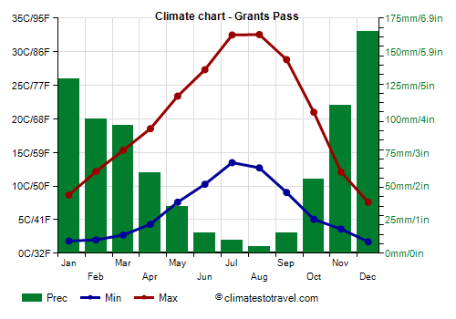
The climate of Grants Pass can be defined as
almost Mediterranean, since the winters are quite mild, but are colder than in the Mediterranean climate, while the summers are hot and sunny, but with significant differences in temperature between night and day.
The city is located in southwestern
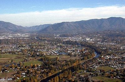
Oregon, 300 meters (1,000 ft) above sea level, in the Rogue River Valley. The Klamath Mountains to the west reduce the influence of the Pacific Ocean, making the climate more continental than on the coast.
Due to its position, isolated from the sea and at low altitude, in the
summer, Grants Pass is one of the hottest cities in Oregon. On the hottest days of the year, the temperature can reach, and sometimes exceed 40 °C (104 °F).
The
winter is generally not very cold, indeed the days can be mild, even though the temperature can drop below freezing at night. However, there can be foggy periods, in which the temperature remains low even during the day. In addition, occasionally there may be cold waves, in which the temperature can drop below -10 °C (14 °F). In December 1990, it reached -19.4 °C (-3 °F). Snowfalls are rare.

Best Time
To visit Grants Pass, you can choose the months of May and September. It is true that it rains a little more often than in summer (especially in May), and that it gets colder at night, but in this way, you can avoid the heat that can occur in summer. September is probably the best month.
Grants Pass - Climate data
In Grants Pass, the
average temperature of the coldest month (December) is of
4,7 °C, that of the warmest month (July) is of
23 °C. Here are the average temperatures.
Grants Pass - Average temperatures (1991-2020) |
| Month | Min | Max | Mean |
|---|
| January | 1,8 | 8,7 | 5,2 |
|---|
| February | 2 | 12,2 | 7,1 |
|---|
| March | 2,7 | 15,3 | 9 |
|---|
| April | 4,3 | 18,6 | 11,4 |
|---|
| May | 7,6 | 23,4 | 15,5 |
|---|
| June | 10,3 | 27,3 | 18,8 |
|---|
| July | 13,5 | 32,5 | 23 |
|---|
| August | 12,7 | 32,6 | 22,6 |
|---|
| September | 9,1 | 28,8 | 18,9 |
|---|
| October | 5,1 | 21 | 13 |
|---|
| November | 3,6 | 12,1 | 7,9 |
|---|
| December | 1,7 | 7,6 | 4,7 |
|---|
| Year | 6,2 | 20,1 | 13,1 |
|---|
amounts to
795 millimeters per year: so, it is at an intermediate level. It ranges from
5 millimeters in the driest month (August) to
165 millimeters in the wettest one (December). Here is the average precipitation.
Grants Pass - Average precipitation| Month | Days |
|---|
| January | 130 | 17 |
|---|
| February | 100 | 14 |
|---|
| March | 95 | 16 |
|---|
| April | 60 | 13 |
|---|
| May | 35 | 9 |
|---|
| June | 15 | 4 |
|---|
| July | 10 | 2 |
|---|
| August | 5 | 2 |
|---|
| September | 15 | 3 |
|---|
| October | 55 | 8 |
|---|
| November | 110 | 16 |
|---|
| December | 165 | 17 |
|---|
| Year | 795 | 121 |
|---|