Select units of measurement for the temperature and rainfall tables (metric or imperial).
Average weather, temperature, rainfall, sunshine hours
In much of Yellowstone Park the climate is
subarctic, with long, freezing, snowy winters and mild summers.
Yellowstone National Park, a UNESCO World Heritage Site, home to a diverse wildlife including bison and bears, is located in the northwestern United States, mostly in the northwestern corner of the state of
Wyoming, but also in the neighboring states of Montana and Idaho. The northern boundary of the park is at the 45th parallel.
The climate of Yellowstone National Park is particularly cold due to the
altitude.
Most of the park is occupied by a
plateau that exceeds 2,000 meters (6,500 feet) above sea level.
The lowest part of the park is found at the North Entrance (in the southernmost part of the valley called Reese Creek), at 1,600 meters (5,250 ft) above sea level. In the few areas below 2,000 meters (6,500 feet), the climate is
continental.
In the park there are also some
mountain ranges, belonging to the Rocky Mountains. In the northwest we find the Gallatin Range, which exceeds 3,000 meters (9,800 ft), while in the center we find Mount Washburn, of 3,122 meters (10,243 ft). But the area richest in mountains is the eastern one, where we find the highest peak of the park,
Eagle Peak, belonging to the Absaroka Range, of 3,462 meters (11,358 ft).

In
winter, there can be
cold waves, during which the temperature can drop to -40 °C (-40 °F) or below.
Summer, from June to August or early September, is the driest and sunniest season of the year, however, thunderstorms can break out in the afternoon, especially in June. In this season, there can be
hot periods, during which the temperature exceeds 30 °C (86 °F), and sometimes reaches 35/36 °C (95/97 °F). Even in these cases, however, the temperature drops significantly at night.
Precipitation in Yellowstone Park is usually not heavy, however, it varies depending on the altitude. In the lowest area of the park, it is lower than 400 millimeters (15.5 inches) per year, while it exceeds 700 mm (27.5 in) above 2,500 meters (8,200 ft).
Snow generally falls from October to early May, although it depends on the altitude and the situation. From November to April, heavy snowfall can occur in much of the park.
In summer, below 2,500 meters (8,200 ft), snow is very rare, however, it can snow occasionally in June. Above this altitude, it can snow occasionally even in July and August. On the mountain peaks, above 3,000 meters (9,800 ft), in summer you can still find some snowfields preserved from the previous months.
In June 2022, the park was closed and evacuated due to heavy rains, which caused widespread flooding, rivers overflowing, and bridges being destroyed.
Climate data
Let's start from the lower part of the park. As mentioned, the climate here is continental, not subarctic, because there are more than three months a year with an average temperature above 10 °C (50 °F).
Here are the average temperatures of
Mammoth, near the north entrance of the park, at 1,900 meters (6,235 ft) above sea level.
Mammoth_Wyoming - Average temperatures (1991-2020) |
| Month | Min | Max | Mean |
|---|
| January | -11.2 | -0.3 | -5.8 |
|---|
| February | -10.9 | 1.2 | -4.9 |
|---|
| March | -7.2 | 5.5 | -0.8 |
|---|
| April | -3.2 | 9.8 | 3.3 |
|---|
| May | 1.4 | 15.3 | 8.4 |
|---|
| June | 5.6 | 20.8 | 13.2 |
|---|
| July | 9.1 | 27.1 | 18.1 |
|---|
| August | 8.1 | 26.6 | 17.4 |
|---|
| September | 3.9 | 20.4 | 12.1 |
|---|
| October | -1.7 | 12 | 5.2 |
|---|
| November | -7.1 | 4.1 | -1.5 |
|---|
| December | -11.2 | -0.9 | -6 |
|---|
| Year | -2 | 11.9 | 4.95 |
|---|
As mentioned, precipitation is related to altitude, so this is also the least rainy (and snowy) part of the park. On average, 182 cm (71.5 inches) of snow fall per year. Here is the average precipitation.
Mammoth_Wyoming - Average precipitation| Month | Days |
|---|
| January | 23 | 11 |
|---|
| February | 20 | 11 |
|---|
| March | 28 | 10 |
|---|
| April | 36 | 11 |
|---|
| May | 46 | 13 |
|---|
| June | 47 | 12 |
|---|
| July | 32 | 9 |
|---|
| August | 27 | 8 |
|---|
| September | 31 | 9 |
|---|
| October | 34 | 10 |
|---|
| November | 29 | 10 |
|---|
| December | 23 | 12 |
|---|
| Year | 375 | 127 |
|---|
As mentioned, most of the park is located above 2,000 meters (9,800 ft) above sea level. In summer, the days are mild, but at night the temperature drops significantly, often near freezing, and sometimes even below.
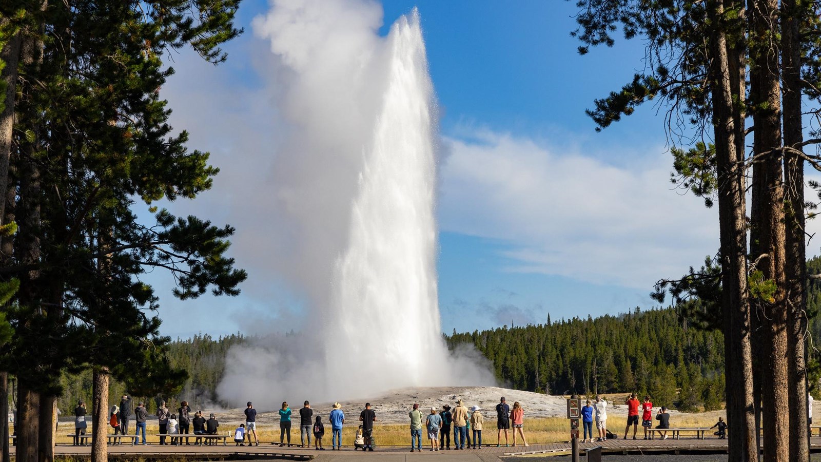
 Old Faithful
, the most famous of the park's approximately 500 geysers, which emits steam at regular intervals, is located at 2,240 meters (7,349 ft). Here are the average temperatures.
Old Faithful - Average temperatures (1991-2020) |
| Month | Min | Max | Mean |
|---|
| January | -17.2 | -2.1 | -9.6 |
|---|
| February | -16.7 | -0.5 | -8.6 |
|---|
| March | -12.3 | 3.7 | -4.3 |
|---|
| April | -7.2 | 7.5 | 0.1 |
|---|
| May | -1.8 | 12.9 | 5.6 |
|---|
| June | 1.5 | 18.4 | 10 |
|---|
| July | 4 | 24.4 | 14.2 |
|---|
| August | 2.7 | 23.9 | 13.3 |
|---|
| September | -1.2 | 18.2 | 8.5 |
|---|
| October | -5.6 | 9.9 | 2.2 |
|---|
| November | -12.3 | 1.8 | -5.2 |
|---|
| December | -17.3 | -3.1 | -10.2 |
|---|
| Year | -6.9 | 9.6 | 1.35 |
|---|
Here, precipitation amounts to 650 mm (25.5 in) per year. On average, 5 meters (197 in) of snow fall per year. Here is the average precipitation.
Old Faithful - Average precipitation| Month | Days |
|---|
| January | 53 | 14 |
|---|
| February | 54 | 13 |
|---|
| March | 57 | 12 |
|---|
| April | 61 | 12 |
|---|
| May | 68 | 13 |
|---|
| June | 61 | 13 |
|---|
| July | 32 | 9 |
|---|
| August | 36 | 9 |
|---|
| September | 43 | 10 |
|---|
| October | 58 | 10 |
|---|
| November | 56 | 12 |
|---|
| December | 71 | 15 |
|---|
| Year | 650 | 142 |
|---|

The shores of
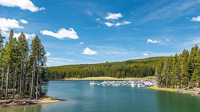
Yellowstone Lake, the largest high-altitude lake in North America, are located at 2,357 meters (7,733 ft). In summer, the lake's waters, which remain frozen until spring, temper the climate, making hot days unlikely. Here are the average temperatures.
Yellowstone Lake - Average temperatures (1991-2020) |
| Month | Min | Max | Mean |
|---|
| January | -17.2 | -5 | -11.1 |
|---|
| February | -17.3 | -3.3 | -10.3 |
|---|
| March | -13.5 | 1.5 | -6 |
|---|
| April | -8.6 | 4.9 | -1.8 |
|---|
| May | -3.2 | 10.3 | 3.6 |
|---|
| June | 0.6 | 16.2 | 8.4 |
|---|
| July | 3.7 | 22.3 | 13 |
|---|
| August | 2.8 | 21.5 | 12.1 |
|---|
| September | -0.9 | 15.8 | 7.4 |
|---|
| October | -5.7 | 7.5 | 0.9 |
|---|
| November | -11.7 | 0 | -5.8 |
|---|
| December | -16.3 | -4.8 | -10.6 |
|---|
| Year | -7.2 | 7.3 | 0.05 |
|---|
Near Yellowstone Lake, precipitation amounts to 575 mm (22.5 in) per year. Snowfall is just over 5 meters per year, namely 507 cm (199 in).
Yellowstone Lake - Average precipitation| Month | Days |
|---|
| January | 45 | 16 |
|---|
| February | 45 | 14 |
|---|
| March | 50 | 16 |
|---|
| April | 60 | 16 |
|---|
| May | 60 | 15 |
|---|
| June | 60 | 12 |
|---|
| July | 40 | 10 |
|---|
| August | 35 | 9 |
|---|
| September | 40 | 9 |
|---|
| October | 45 | 13 |
|---|
| November | 50 | 13 |
|---|
| December | 60 | 16 |
|---|
| Year | 585 | 160 |
|---|
When to go
The
best time to visit Yellowstone National Park is
summer, from June to August, since it is the mildest time of year, although it is clearly the one most crowded with tourists. Some activities such as rafting and guided trekking begin in mid or late June. July and August are the mildest months of all.
Considering that temperatures vary depending on the altitude and time of day, it is advisable to
dress in layers, bringing warm clothes for the night cold, with gloves, fleece and jacket, and to be equipped for the sun (which in summer is very strong, especially at high altitude), with a hat, sunglasses and sunscreen, but also for thunderstorms, with a raincoat.

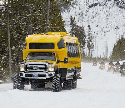
In
winter, most roads are closed, but guided tours are available using vehicles operated by the park that are capable of moving on snow-covered terrain. The only road open to private vehicles is the one that connects the north and northeast entrances, from Gardiner, Montana (near Mammoth), to Cooke City.